
MyTopo
Cibecue Peak Arizona US Topo Map
Couldn't load pickup availability
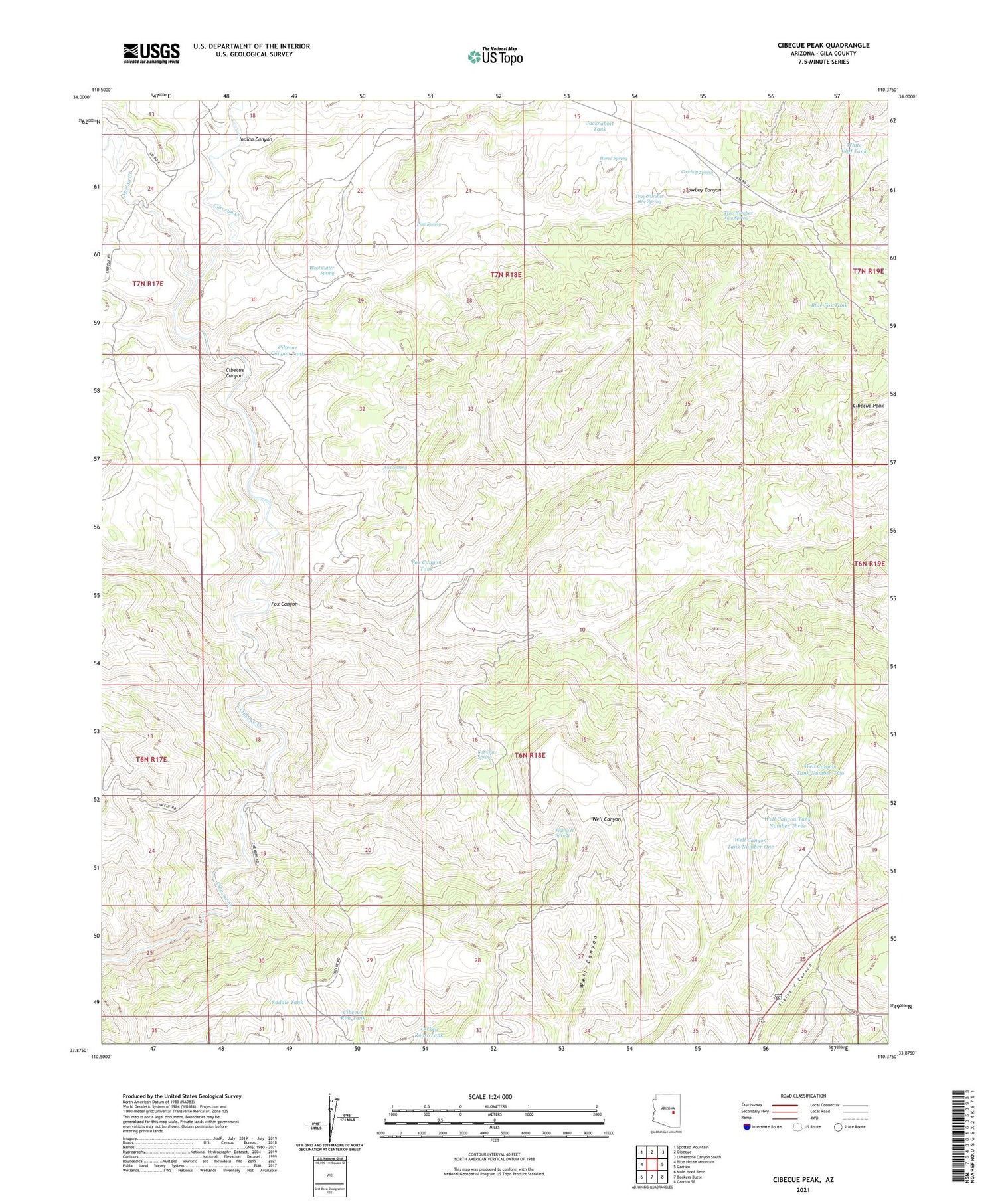
2021 topographic map quadrangle Cibecue Peak in the state of Arizona. Scale: 1:24000. Based on the newly updated USGS 7.5' US Topo map series, this map is in the following counties: Gila. The map contains contour data, water features, and other items you are used to seeing on USGS maps, but also has updated roads and other features. This is the next generation of topographic maps. Printed on high-quality waterproof paper with UV fade-resistant inks.
Quads adjacent to this one:
West: Blue House Mountain
Northwest: Spotted Mountain
North: Cibecue
Northeast: Limestone Canyon South
East: Carrizo
Southeast: Carrizo SE
South: Beckers Butte
Southwest: Mule Hoof Bend
This map covers the same area as the classic USGS quad with code o33110h4.
Contains the following named places: Blue Fox Tank, Bobcat Tank, Cat Claw Spring, Cibecue Canyon, Cibecue Canyon Tank, Cibecue Peak, Cibecue Rim Tank, Cowboy Canyon, Cowboy Spring, Flying H Spring, Fox Canyon, Fox Canyon Tank, Fox Spring, Horse Spring, Indian Canyon, Jackrabbit Tank, Pine Spring, Saddle Tank, Spring Creek, Trap Number One Spring, Trap Number Two Spring, Turkey Roost Tank, Well Canyon Tank Number One, Well Canyon Tank Number Three, Well Canyon Tank Number Two, White Cliff Tank, Wool Cutter Spring


