
MyTopo
Carrizo Arizona US Topo Map
Couldn't load pickup availability
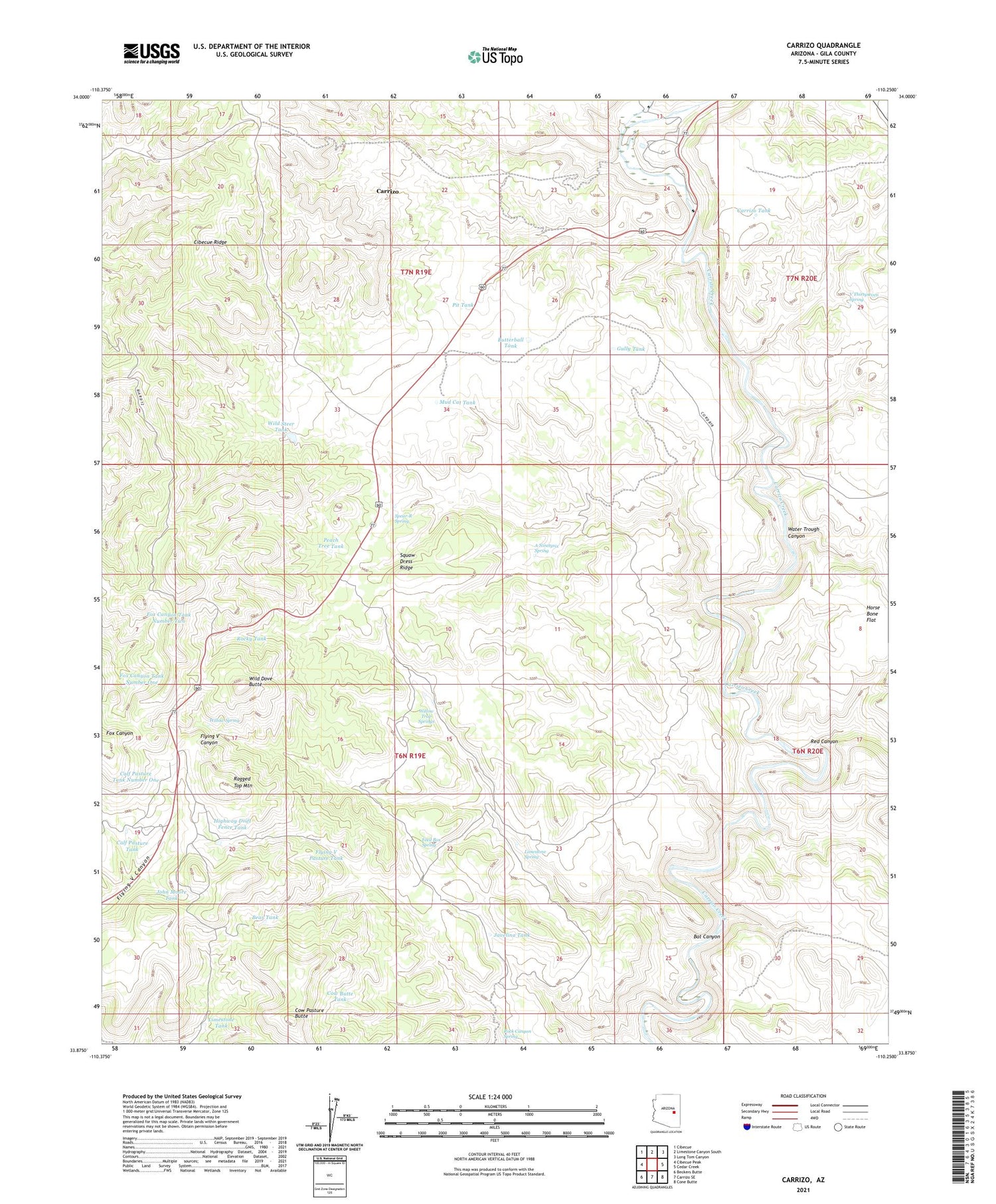
2023 topographic map quadrangle Carrizo in the state of Arizona. Scale: 1:24000. Based on the newly updated USGS 7.5' US Topo map series, this map is in the following counties: Gila. The map contains contour data, water features, and other items you are used to seeing on USGS maps, but also has updated roads and other features. This is the next generation of topographic maps. Printed on high-quality waterproof paper with UV fade-resistant inks.
Quads adjacent to this one:
West: Cibecue Peak
Northwest: Cibecue
North: Limestone Canyon South
Northeast: Long Tom Canyon
East: Cedar Creek
Southeast: Cone Butte
South: Carrizo SE
Southwest: Beckers Butte
This map covers the same area as the classic USGS quad with code o33110h3.
Contains the following named places: A Ninetysix Spring, Bat Canyon, Bear Tank, Butterball Tank, Calf Pasture Tank, Calf Pasture Tank Number One, Carrizo, Carrizo Census Designated Place, Carrizo Tank, Corduroy Creek, Cow Butte Tank, Cow Pasture Butte, Feed Box Spring, Felton Tank, Flying V Maintenance Yard, Flying V Pasture Tank, Fox Canyon Tank Number One, Fox Canyon Tank Number Two, Gully Tank, Highway Drift Fence Tank, Javelina Tank, John Moore Tank, Limestone Spring, Limestone Tank, Mud Cat Tank, Peach Tree Tank, Pit Tank, Ragged Top Mountain, Red Canyon, Rock Canyon Spring, Rocky Tank, Spear-R Spring, Squaw Dress Ridge, V Thirtyseven Spring, Water Trough Canyon, Wild Dove Butte, Wild Steer Dam, Wild Steer Tank, Willow Spring, Willow Trap Springs


