MyTopo
Beckers Butte Arizona US Topo Map
Couldn't load pickup availability
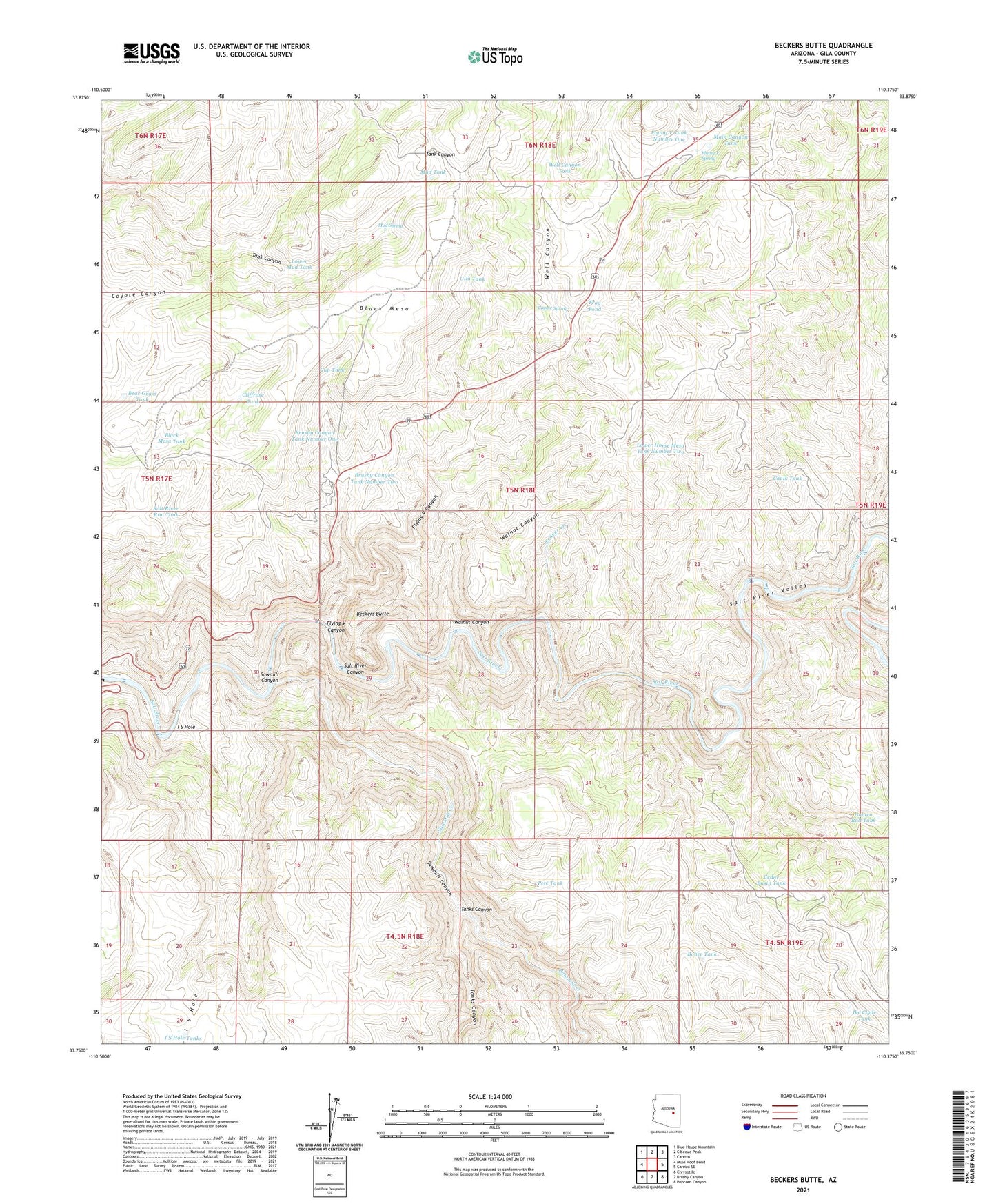
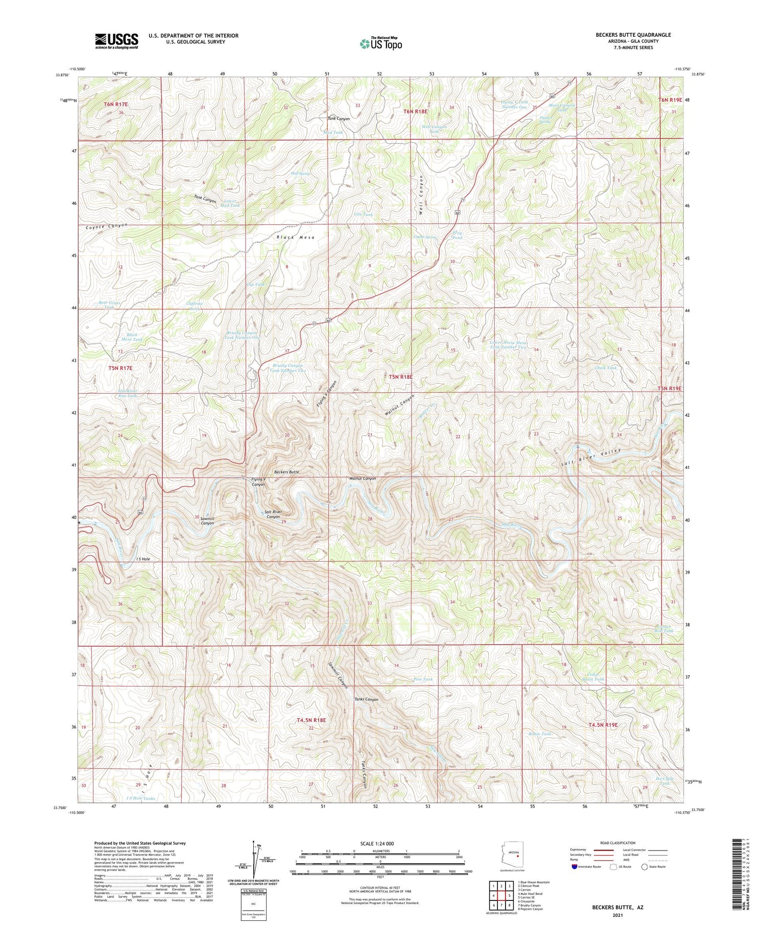
2021 topographic map quadrangle Beckers Butte in the state of Arizona. Scale: 1:24000. Based on the newly updated USGS 7.5' US Topo map series, this map is in the following counties: Gila. The map contains contour data, water features, and other items you are used to seeing on USGS maps, but also has updated roads and other features. This is the next generation of topographic maps. Printed on high-quality waterproof paper with UV fade-resistant inks.
Quads adjacent to this one:
West: Mule Hoof Bend
Northwest: Blue House Mountain
North: Cibecue Peak
Northeast: Carrizo
East: Carrizo SE
Southeast: Popcorn Canyon
South: Brushy Canyon
Southwest: Chrysotile
This map covers the same area as the classic USGS quad with code o33110g4.
Contains the following named places: Bear Grass Tank, Beaver Creek, Beckers Butte, Beckers Butte Roadside Table, Black Mesa, Black Mesa Tank, Bohee Tank, Brushy Canyon Tank Number One, Brushy Canyon Tank Number Two, Cedar Basin Dam, Cedar Basin Tank, Chalk Tank, Cliffrose Tank, Coyote Spring, Cup Tank, Flying V Canyon, Flying V Spring, Flying V Tank Number One, Flying V Well, Frog Pond, Gila Tank, Golden Roll Dam, Golden Roll Tank, Horse Mesa Tank, I S Hole, I S Hole Tanks, Ike Clyde Tank, Lower Horse Mesa Tank Number Two, Lower Limestone Tank, Lower Mud Tank, Main Canyon Tank, Mescal Pit Catchment Basin, Mud Spring, Mud Tank, Pete Tank, Salt River Rim Tank, Sawmill Canyon, Sawmill Creek, Tanks Canyon, Walnut Canyon, Well Canyon, Well Canyon Tank