MyTopo
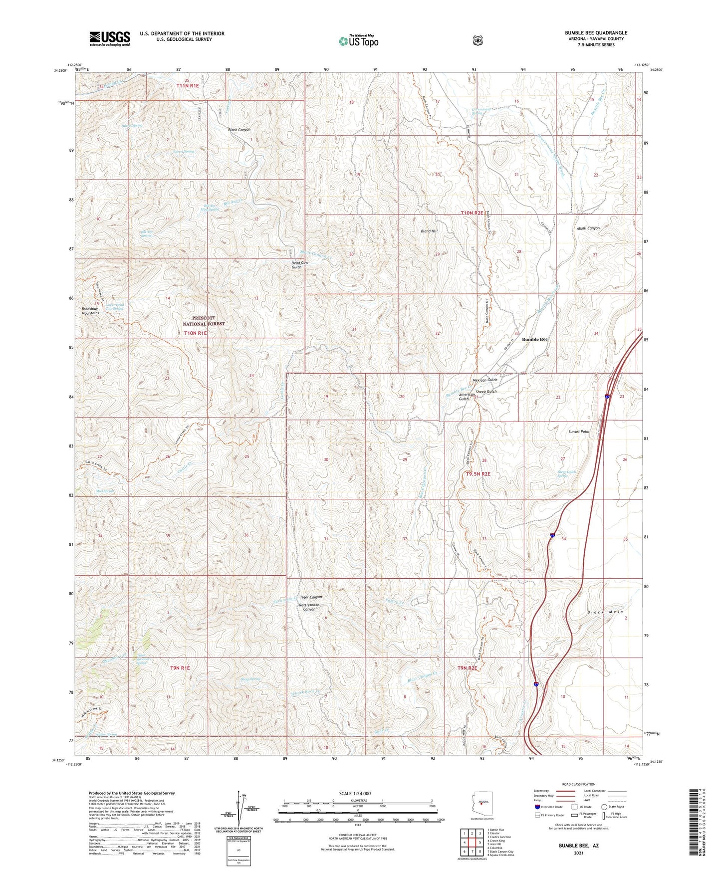
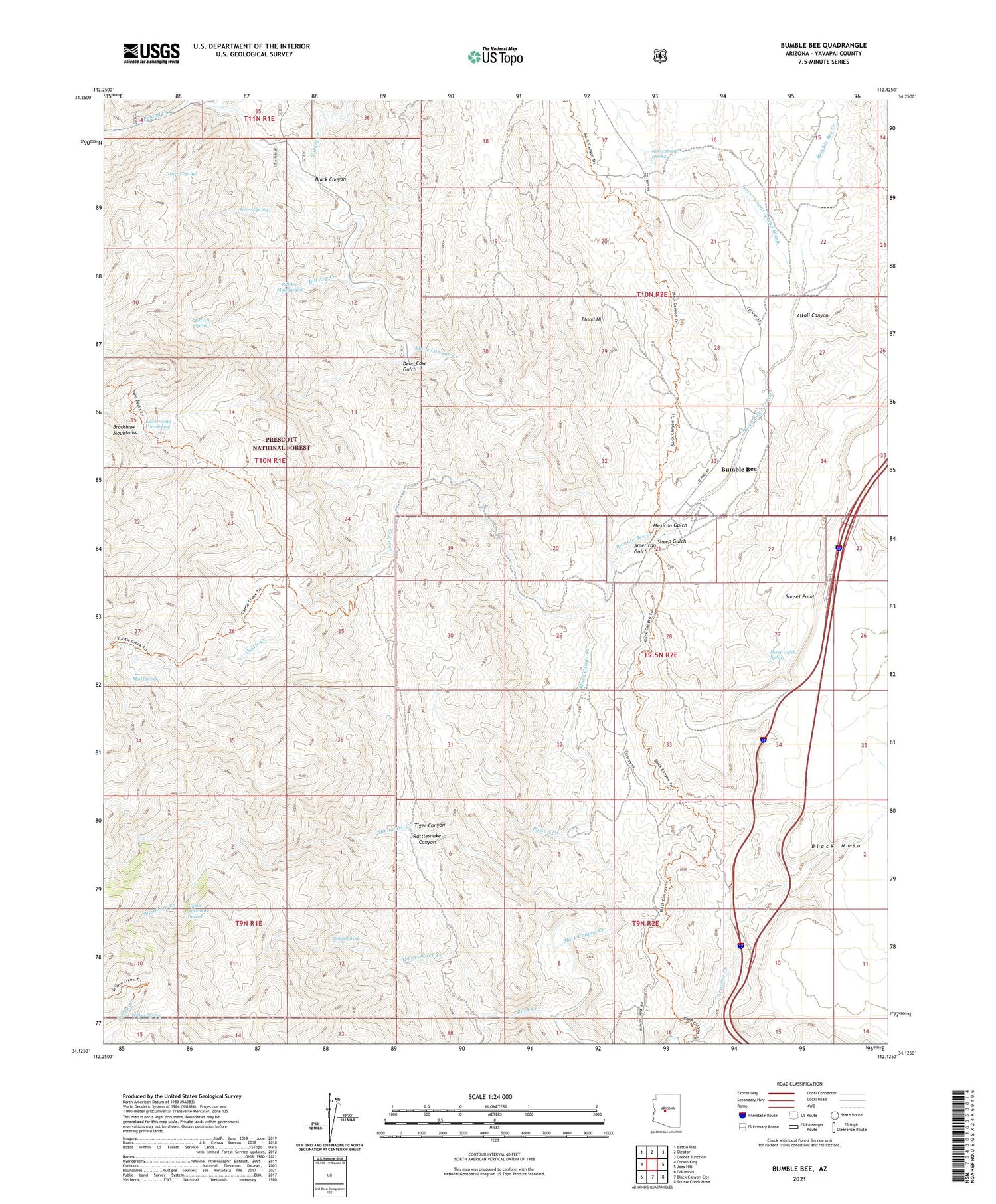
Bumble Bee Arizona US Topo Map
Couldn't load pickup availability
Also explore the Bumble Bee Forest Service Topo of this same quad for updated USFS data
2021 topographic map quadrangle Bumble Bee in the state of Arizona. Scale: 1:24000. Based on the newly updated USGS 7.5' US Topo map series, this map is in the following counties: Yavapai. The map contains contour data, water features, and other items you are used to seeing on USGS maps, but also has updated roads and other features. This is the next generation of topographic maps. Printed on high-quality waterproof paper with UV fade-resistant inks.
Quads adjacent to this one:
West: Crown King
Northwest: Battle Flat
North: Cleator
Northeast: Cordes Junction
East: Joes Hill
Southeast: Squaw Creek Mesa
South: Black Canyon City
Southwest: Columbia
This map covers the same area as the classic USGS quad with code o34112b2.
Contains the following named places: Alkali Canyon, American Gulch, Barrel Spring, Bench Well, Bill Arp Creek, Bill Arp Mine, Bill Arp Mine Spring, Bill Arp Spring, Bimetals Mine, Bland Hill, Bland Mine, Bumble Bee, Bumble Bee Creek, Castle Creek, Castle Creek Cabin, Castle Creek Trail, Crazy Basin Creek, Dead Cow Gulch, East Boulder Creek, Eightyeight Mine, Government Spring, Government Spring Wash, Harris Spring, Howard Copper Mine, Howard Silver Mine, Last Chance Mine, Lower Dead Cow Spring, Mexican Gulch, Mud Spring, North Fork Rock Creek, Poison Creek, Poland Creek, R and H Mine, Rattlesnake Canyon, Rock Creek, Roosevelt Mine, Sheep Gulch, Sheep Gulch Spring, Sheep Spring, South Fork Rock Creek, Sunset Point, Sunset Point Rest Area, Sycamore Creek, Thunderbolt Mine, Tiger Canyon, Turkey Creek, Upper Sycamore Spring, Willow Spring