MyTopo
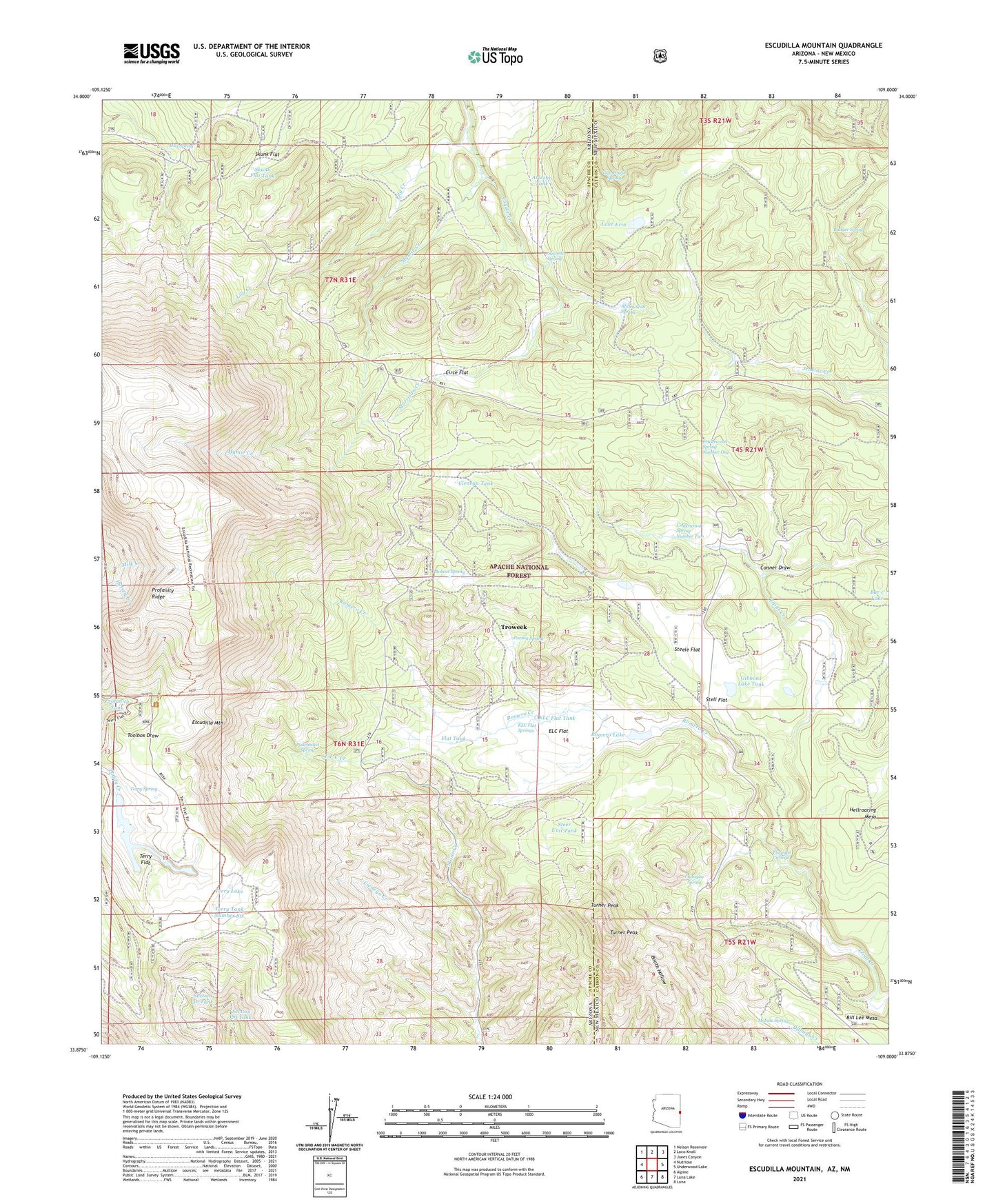
Escudilla Mountain Arizona US Topo Map
Couldn't load pickup availability
Also explore the Escudilla Mountain Forest Service Topo of this same quad for updated USFS data
2021 topographic map quadrangle Escudilla Mountain in the states of Arizona, New Mexico. Scale: 1:24000. Based on the newly updated USGS 7.5' US Topo map series, this map is in the following counties: Apache, Catron. The map contains contour data, water features, and other items you are used to seeing on USGS maps, but also has updated roads and other features. This is the next generation of topographic maps. Printed on high-quality waterproof paper with UV fade-resistant inks.
Quads adjacent to this one:
West: Nutrioso
Northwest: Nelson Reservoir
North: Loco Knoll
Northeast: Jones Canyon
East: Underwood Lake
Southeast: Luna
South: Luna Lake
Southwest: Alpine
Contains the following named places: Arizona Tank, Badger Spring, Bobcat Spring, Cienega Creek, Cienega Tank, Circe Flat, Conner Draw, E L C Creek, ELC Flat, ELC Flat Springs, ELC Flat Tank, ELC Tank, Escudilla Lookout, Escudilla Mountain Tank, Escudilla Mountain Wilderness, Escudilla National Recreation Trail, Escudilla Wilderness, Escundilla Trailhead, Flanigan Cienega, Flanigan Spring, Flat Tank, Gap Pough Spring, Gibbons Lake Tank, Hellroaring Mesa, Lake Erin, Lily Creek, Mamie Creek, McFate Spring, Mesa Tank, Miller Scott Spring, Morrison Creek, Mud Spring, Parson Spring, Profanity Ridge, Profanity Tank, Punchbowl, Punchbowl Spring, Romero Creek, Romero Lake, Sawmill Spring, Section 29 Tank, Section 30 Tank, Skunk Flat, Skunk Flat Tank, Steele Flat, Steer Unit Tank, Stell Flat, Terry Flat, Terry Lake, Terry Number One Tank, Terry Number Three Tank, Terry Number Two Tank, Terry Spring, Terry Tank Number Six, Troweek, Turner Peak, Turner Tank, Underwood Spring Number One, Underwood Spring Number Two