MyTopo
Luna New Mexico US Topo Map
Couldn't load pickup availability
Also explore the Luna Forest Service Topo of this same quad for updated USFS data
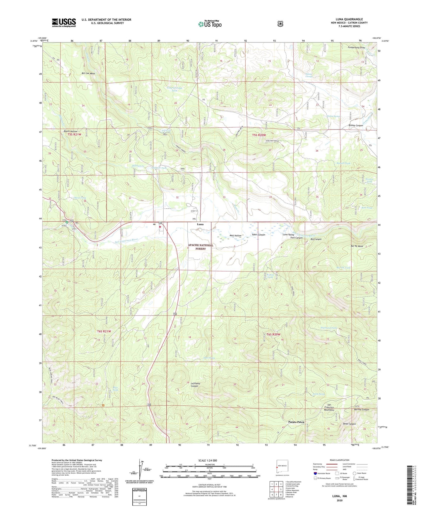
2023 topographic map quadrangle Luna in the state of New Mexico. Scale: 1:24000. Based on the newly updated USGS 7.5' US Topo map series, this map is in the following counties: Catron. The map contains contour data, water features, and other items you are used to seeing on USGS maps, but also has updated roads and other features. This is the next generation of topographic maps. Printed on high-quality waterproof paper with UV fade-resistant inks.
Quads adjacent to this one:
West: Luna Lake
Northwest: Escudilla Mountain
North: Underwood Lake
Northeast: Centerfire Bog
East: Dillon Mountain
Southeast: Reserve
South: Bull Basin
Southwest: Maness Peak
This map covers the same area as the classic USGS quad with code o33108g8.
Contains the following named places: Adair Canyon, Adair Spring, Bar NL Mesa, Bar NL Tank, Big Canyon, Bishop Canyon, Blue Tank, Booth Hollow, Dillman Creek, Dillman Tank, Foxy Grandpa Tank, Funderburg Draw, Head of the Ditch Campground, Highland Tank, Hulsey Cienega, Hulsey Spring, Hulsey Tank, Kiehne Tank, Kiehne Well, Laney Corral, Laney Spring, Lefthand Canyon, Luna, Luna Cemetery, Luna Census Designated Place, Luna District Ranger Office, Luna Fire Department and Ambulance Service, Luna Post Office, Luna Ranger Station, Luna Valley, Luna Weather Station, Mail Hollow, Mesa Tank, Monkey Tank, Old Campbell Place, Potato Patch, Rim Tank, Russell Tank, Russell Well, Ruyle Place, S A Creek, San Francisco Electronic Site, Section Tank, Swapp Tank, Swapp Well, Trail Canyon, Trout Creek, ZIP Code: 87824