MyTopo
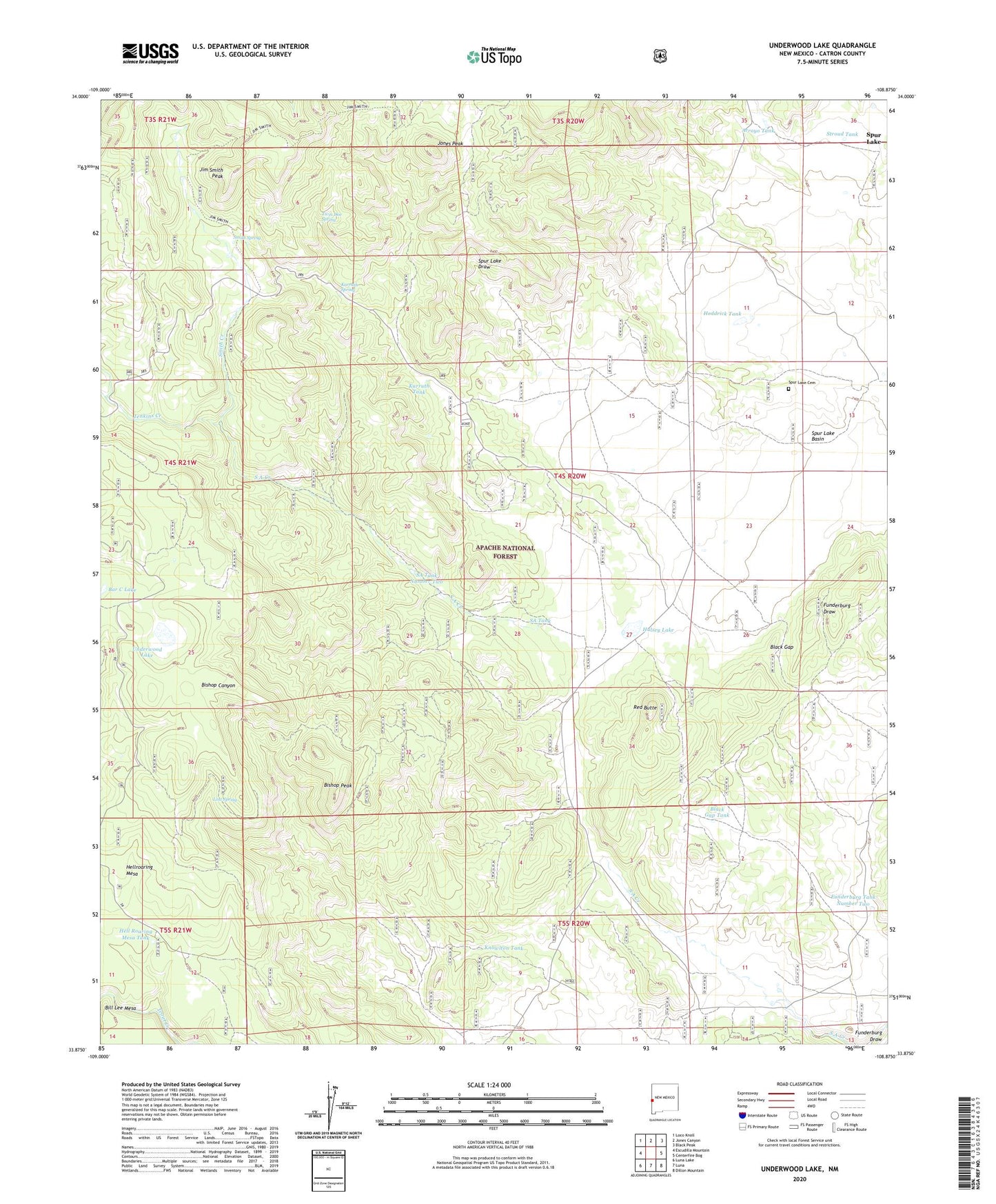
Underwood Lake New Mexico US Topo Map
Couldn't load pickup availability
Also explore the Underwood Lake Forest Service Topo of this same quad for updated USFS data
2023 topographic map quadrangle Underwood Lake in the state of New Mexico. Scale: 1:24000. Based on the newly updated USGS 7.5' US Topo map series, this map is in the following counties: Catron. The map contains contour data, water features, and other items you are used to seeing on USGS maps, but also has updated roads and other features. This is the next generation of topographic maps. Printed on high-quality waterproof paper with UV fade-resistant inks.
Quads adjacent to this one:
West: Escudilla Mountain
Northwest: Loco Knoll
North: Jones Canyon
Northeast: Black Peak
East: Centerfire Bog
Southeast: Dillon Mountain
South: Luna
Southwest: Luna Lake
This map covers the same area as the classic USGS quad with code o33108h8.
Contains the following named places: Arroyo Tank, Bar C Lake, Bastion Ranch, Big Tank, Bill Lee Mesa, Bishop Peak, Black Gap, Black Gap Tank, Boswell Well, Frank Tank, Funderburg Tank Number Two, Gribble Place, Heddrick Tank, Hell Roaring Mesa Tank, Hulsey Lake, Jenkins Creek, Jim Smith Peak, Jones Peak, Karruth Creek, Karruth Spring, Karruth Tank, Karruth Tank Number Two, Knowlton Tank, Lost Spring, Morrison Tank, Red Butte, SA Tank, SA Tank Number Two, Sand Creek, Smith Creek, Smith Spring, Smith Tank, Spur Lake, Spur Lake Cemetery, Spur Lake Post Office, Spur Lake Well, Stroud Tank, Tipton Well, Todilto Park, Twin Doe Spring, Underwood Lake