
MyTopo
Faught Ridge Arizona US Topo Map
Couldn't load pickup availability
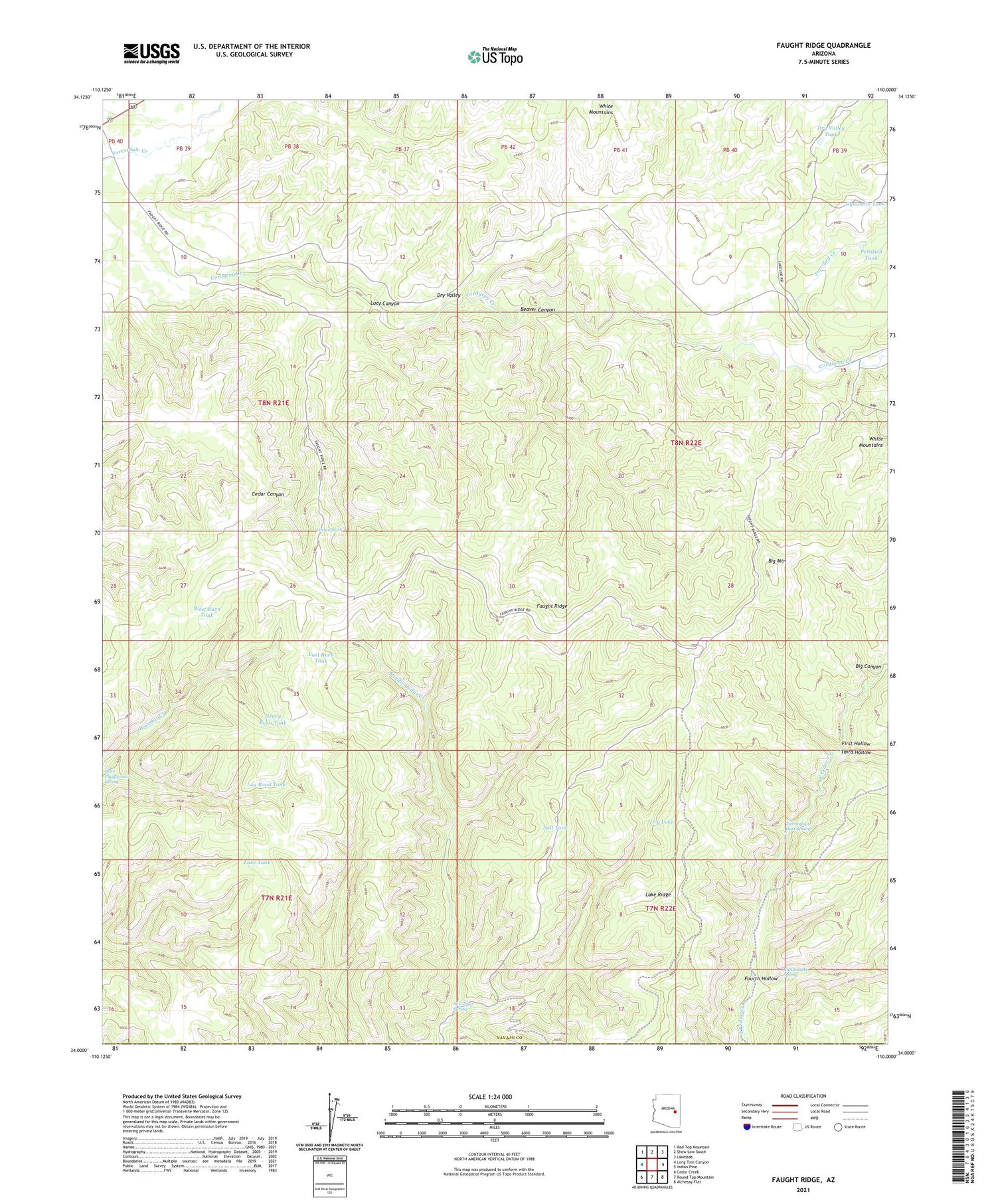
2021 topographic map quadrangle Faught Ridge in the state of Arizona. Scale: 1:24000. Based on the newly updated USGS 7.5' US Topo map series, this map is in the following counties: Navajo, Gila. The map contains contour data, water features, and other items you are used to seeing on USGS maps, but also has updated roads and other features. This is the next generation of topographic maps. Printed on high-quality waterproof paper with UV fade-resistant inks.
Quads adjacent to this one:
West: Long Tom Canyon
Northwest: Red Top Mountain
North: Show Low South
Northeast: Lakeside
East: Indian Pine
Southeast: Alchesay Flat
South: Round Top Mountain
Southwest: Cedar Creek
This map covers the same area as the classic USGS quad with code o34110a1.
Contains the following named places: Beaver Canyon, Big Mountain, Cattail Rush, Dry Lake, Dry Valley, Dry Valley Tank, East Burn Tank, Faught Ridge, Faught Ridge Lookout, First Hollow, Fourth Hollow, Heavy Burn Tank, Lake Ridge, Lake Tank, Log Road Tank, Lucy Canyon, Petrified Creek, Petrified Tank, Rattlesnake Spring, Salt Tank, Salt Trap Spring, Third Hollow, Twentyfour-Dart Spring, West Burn Tank, West Ranch


