MyTopo
Canyon Day Arizona US Topo Map
Couldn't load pickup availability
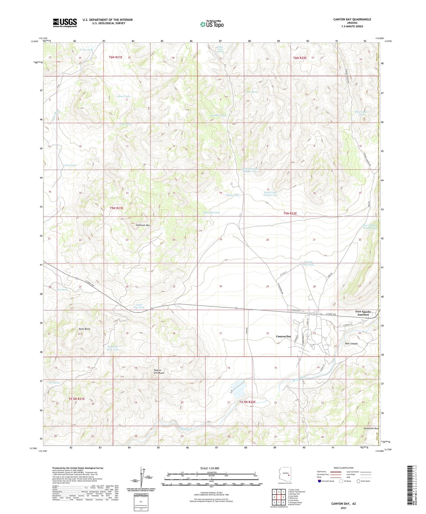
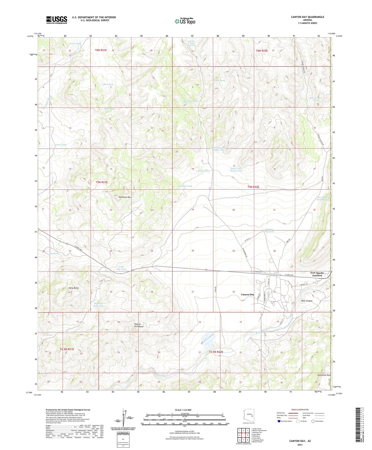
2021 topographic map quadrangle Canyon Day in the state of Arizona. Scale: 1:24000. Based on the newly updated USGS 7.5' US Topo map series, this map is in the following counties: Gila, Navajo. The map contains contour data, water features, and other items you are used to seeing on USGS maps, but also has updated roads and other features. This is the next generation of topographic maps. Printed on high-quality waterproof paper with UV fade-resistant inks.
Quads adjacent to this one:
West: Cone Butte
Northwest: Cedar Creek
North: Round Top Mountain
Northeast: Alchesay Flat
East: Whiteriver
Southeast: Bonito Prairie
South: Velasquez Butte
Southwest: Forks Butte
This map covers the same area as the classic USGS quad with code o33110g1.
Contains the following named places: Amos Spring, Amos Tank, Bear Canyon, Bear Canyon Number One, Bear Canyon Tank, Canyon Day, Canyon Day Census Designated Place, Canyon Day Junior High School, Canyon Day Tank, Cedar Gap Tank, Coyote Spring, D-five Spring, D-five Tank, Fort Apache Junction, Ghost Tank, G-one Well, Kelly Butte, Kinishba Tank, Kinishba Well, Macklin Well, Ruins Tank, Ruins Tank Number Two, Sawtooth Mountain, Sawtooth Tank, Sawtooth Tank Number Two, Sore Spring, Standing Rock Tank, Stockman Station, Tsay-se-zhin Butte, Yellow Jacket Spring