MyTopo
Cone Butte Arizona US Topo Map
Couldn't load pickup availability
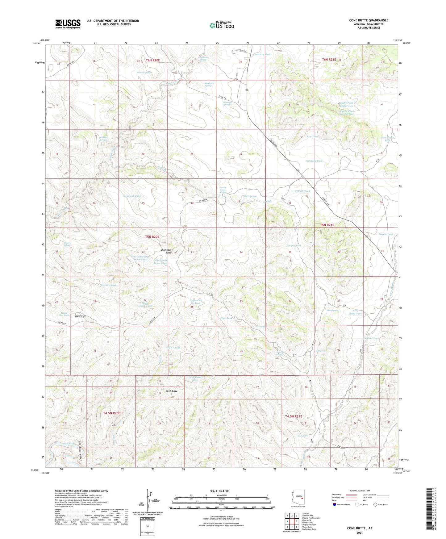
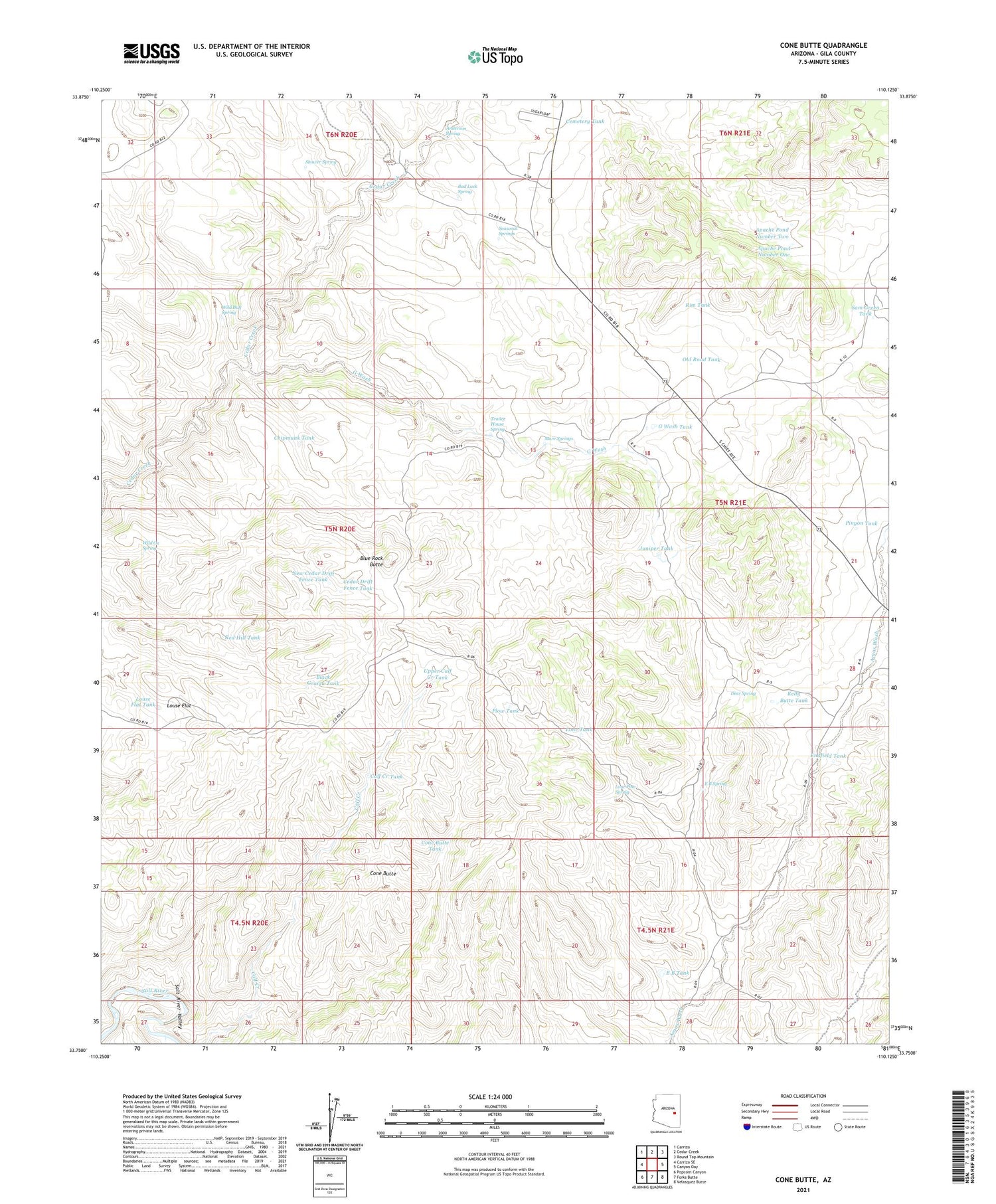
2021 topographic map quadrangle Cone Butte in the state of Arizona. Scale: 1:24000. Based on the newly updated USGS 7.5' US Topo map series, this map is in the following counties: Gila. The map contains contour data, water features, and other items you are used to seeing on USGS maps, but also has updated roads and other features. This is the next generation of topographic maps. Printed on high-quality waterproof paper with UV fade-resistant inks.
Quads adjacent to this one:
West: Carrizo SE
Northwest: Carrizo
North: Cedar Creek
Northeast: Round Top Mountain
East: Canyon Day
Southeast: Velasquez Butte
South: Forks Butte
Southwest: Popcorn Canyon
This map covers the same area as the classic USGS quad with code o33110g2.
Contains the following named places: Anderson Spring, Apache Pond Dam Number One, Apache Pond Dam Number Two, Apache Pond Number One, Apache Pond Number Two, Bad Luck Spring, Black Grama Tank, Blue Rock Butte, Calf Creek Tank, Cave Creek, Cedar Creek Crossing, Cedar Drift Fence Tank, Cemetery Tank, Chipmunk Tank, Cone Butte, Cone Butte Tank, Dead Cow Tank, Deer Spring, E B Spring, E B Tank, Endfield Tank, G Wash, G Wash Tank, Juniper Tank, Kelly Butte Tank, Lone Pine Spring, Lone Tank, Louse Flat, Louse Flat Tank, Mare Springs, New Cedar Drift Fence Tank, Old Road Tank, Pinyon Tank, Plow Tank, Red Hill Tank, R-fourteen Ranch, Rim Tank, Roadside Table Milepost Three Hundred Twentyseven, Sam Green Tank, Seasonal Springs, Shower Spring, Trailer House Spring, Upper Calf Creek Tank, Wild Bull Spring, Wild Ox Spring