MyTopo
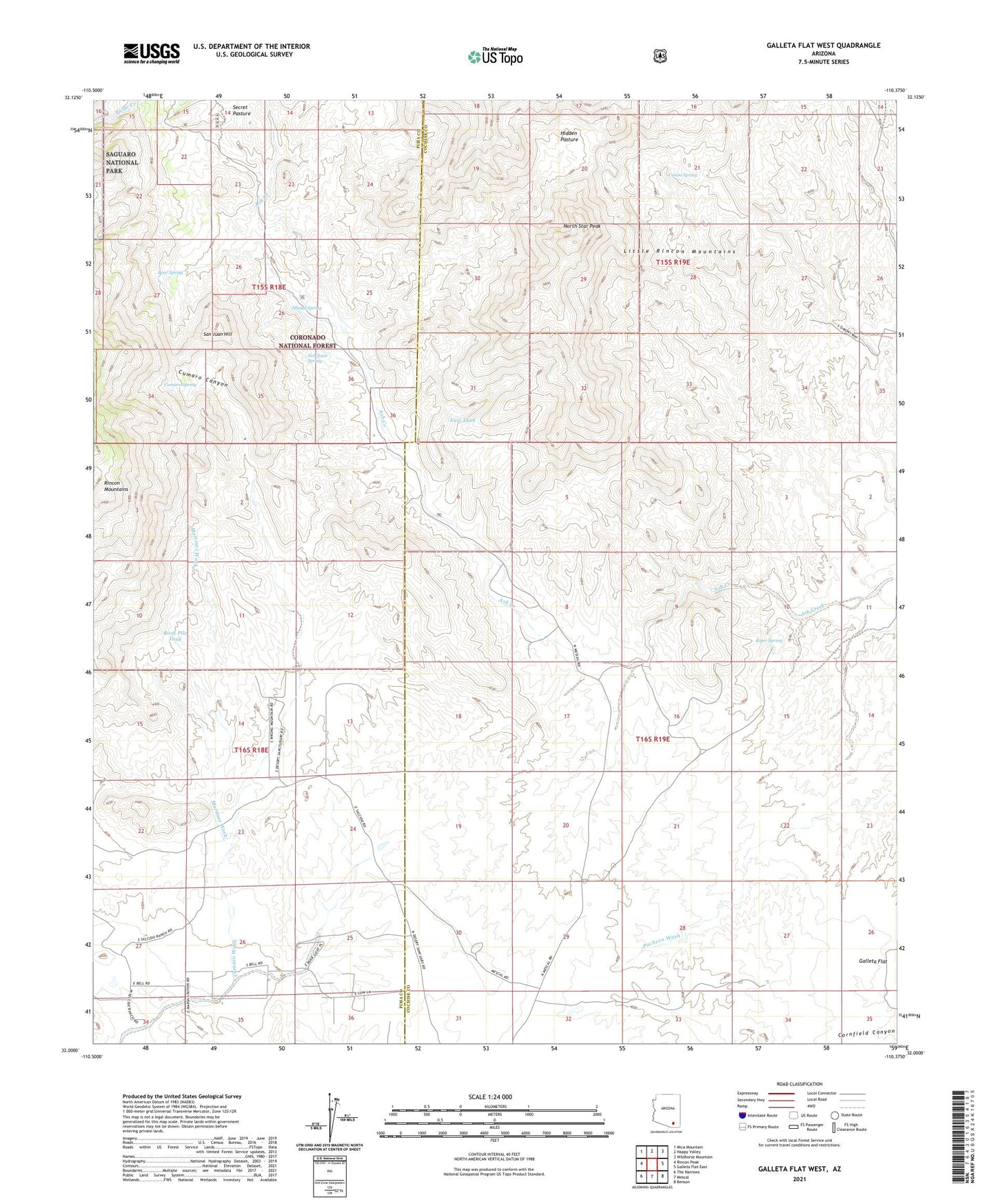
Galleta Flat West Arizona US Topo Map
Couldn't load pickup availability
Also explore the Galleta Flat West Forest Service Topo of this same quad for updated USFS data
2021 topographic map quadrangle Galleta Flat West in the state of Arizona. Scale: 1:24000. Based on the newly updated USGS 7.5' US Topo map series, this map is in the following counties: Cochise, Pima. The map contains contour data, water features, and other items you are used to seeing on USGS maps, but also has updated roads and other features. This is the next generation of topographic maps. Printed on high-quality waterproof paper with UV fade-resistant inks.
Quads adjacent to this one:
West: Rincon Peak
Northwest: Mica Mountain
North: Happy Valley
Northeast: Wildhorse Mountain
East: Galleta Flat East
Southeast: Benson
South: Mescal
Southwest: The Narrows
This map covers the same area as the classic USGS quad with code o32110a4.
Contains the following named places: Alboyd Spring, Ashrama Ranch, Bear Spring, Canoa Spring, Cumaro Canyon, Cumaro Spring, East Tank, Galleta Flat, Hidden Pasture, Kiper Spring, Mackenzie Ranch, Martinez Ranch, Martinez Wash, North Star Peak, Rock Pile Tank, San Juan Hill, San Juan Spring, Stansbury Ranch, White Cross Cemetery, World University