MyTopo
Tusayan East Arizona US Topo Map
Couldn't load pickup availability
Also explore the Tusayan East Forest Service Topo of this same quad for updated USFS data
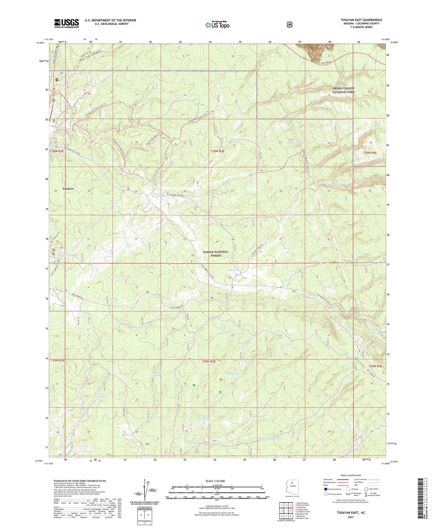
2021 topographic map quadrangle Tusayan East in the state of Arizona. Scale: 1:24000. Based on the newly updated USGS 7.5' US Topo map series, this map is in the following counties: Coconino. The map contains contour data, water features, and other items you are used to seeing on USGS maps, but also has updated roads and other features. This is the next generation of topographic maps. Printed on high-quality waterproof paper with UV fade-resistant inks.
Quads adjacent to this one:
West: Tusayan West
Northwest: Grand Canyon
North: Phantom Ranch
Northeast: Cape Royal
East: Grandview Point
Southeast: Harbison Tank
South: Red Butte
Southwest: Red Butte SW
This map covers the same area as the classic USGS quad with code o35112h1.
Contains the following named places: Canyon Mine, Charley Tank, Charlie I Trick Tank, Gallo Tank, Halfway Tank, Halfway Trick Tank, Hualapa Tank, Indian Tank, Long Jim Trick Tank, Lost Tank, Maybe Tank, McRae Tank, Mejor Tank, Miller Seep Tank, Moqui Camp, Moqui Lodge, Reed Tank, Seventeen Tank, Shale Tank, Skinner Ridge, Ten X Tank, Town of Tusayan, Trail Tank, Tusayan Ranger Station, Twin Tank, Upper Ten X Tank, Upper Ten X Trick Tank, Watson Tank, West Skinner Tank