
MyTopo
Holbrook Arizona US Topo Map
Couldn't load pickup availability
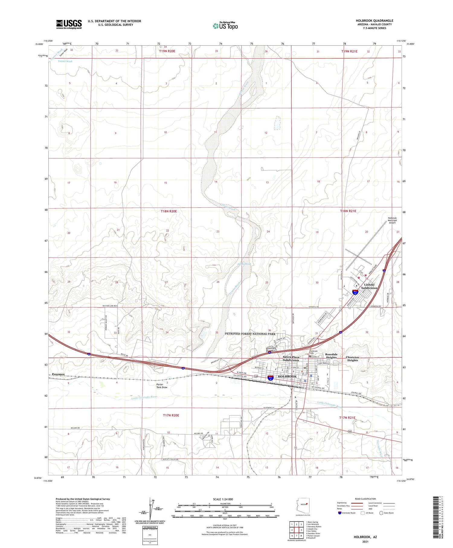
2021 topographic map quadrangle Holbrook in the state of Arizona. Scale: 1:24000. Based on the newly updated USGS 7.5' US Topo map series, this map is in the following counties: Navajo. The map contains contour data, water features, and other items you are used to seeing on USGS maps, but also has updated roads and other features. This is the next generation of topographic maps. Printed on high-quality waterproof paper with UV fade-resistant inks.
Quads adjacent to this one:
West: Joseph City
Northwest: Blairs Spring
North: Lee Mountain
Northeast: Hennessy Buttes
East: Sun Valley
Southeast: Woodruff
South: Porter Canyon
Southwest: Saunders Draw
This map covers the same area as the classic USGS quad with code o34110h2.
Contains the following named places: Arizona State Highway Patrol Holbrook District 3, Berean Baptist Church, Bureau of Indian Affairs Dormitory School, Buzzard Gulch Trailer Park, Calvary Chapel of Holbrook, City of Holbrook, City of Holbrook Painted Mesa Water Reclamation Facility, Clearview Heights, Cozy Canyon Mobile Home Park, First Assembly of God, Fivemile Wash, Hidden Cove Golf Course, Hillcrest Mobile Home Park, Holbrook, Holbrook Cemetery, Holbrook City Hall, Holbrook First Baptist Church, Holbrook High School, Holbrook Hospital, Holbrook Indian School, Holbrook Junior High School, Holbrook Municipal Airport, Holbrook Pentecostal Church of God, Holbrook Petrified Forest Kampgrounds of America, Holbrook Plaza Shopping Center, Holbrook Police Department, Holbrook Post Office, Holbrook Public Library, Holbrook Railroad Station, Holbrook Senior Citizen Center, Holbrook United Methodist Church, Holbrook Volunteer Fire Department, Hulet Elementary School, Hunt Park, Jacobs Wash, Kargas Mobile Home Park, KDJI-AM (Holbrook), Lerous Substation, Leroux Wash, Lisitzky Subdivision, Navajo County Fairgrounds, Navajo County Historic Courthouse Museum, Navajo County Historic Courthouse Visitor Center, Navajo County Instruction for Success High School, Navajo County Public Health Holbrook Office, Navajo County Sheriff's Office District 1, Navajo Mission School, Northland Pioneer College Painted Desert Campus Nizhoni Learning Center, Northland Pioneer College Painted Desert Campus Tawa Center, Northland Pioneer College Painted Desert Campus Tiponi Community Center, Our Lady of Guadalupe, Park Elementary School, Peace Lutheran Church, Phenix School, Pittman Elementary School, Porter Tank Draw, Rosedale Heights, Saint Johns Baptist Church, Saints Home Church of God in Christ, Sheldon Elementary School, Sierra Plaza Subdivision, Yahta Indian School


