MyTopo
Joseph City Arizona US Topo Map
Couldn't load pickup availability
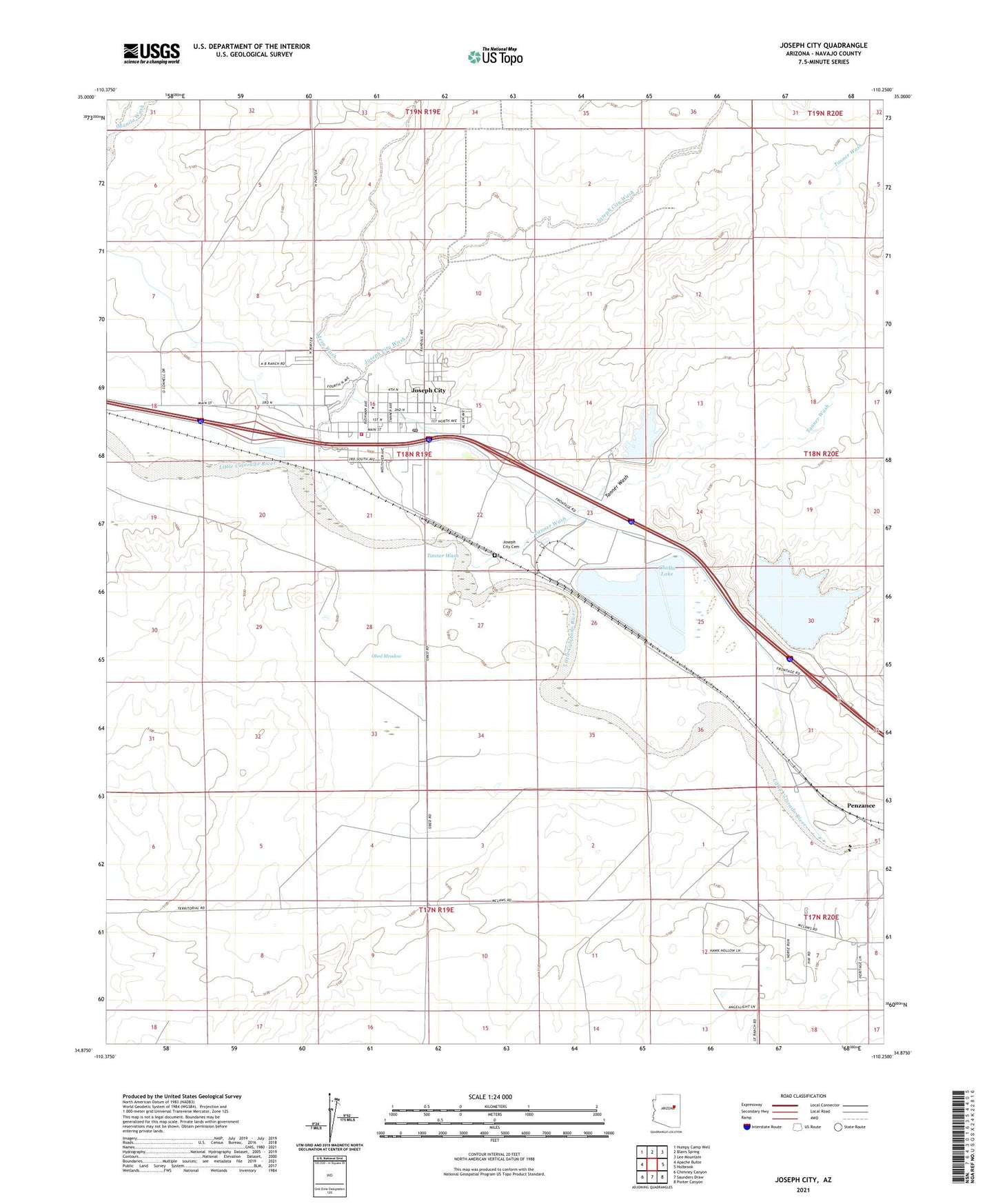
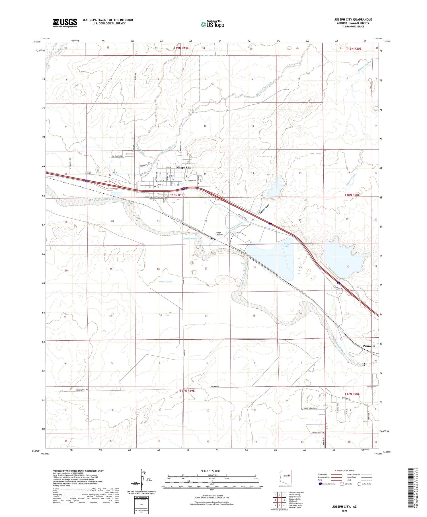
2021 topographic map quadrangle Joseph City in the state of Arizona. Scale: 1:24000. Based on the newly updated USGS 7.5' US Topo map series, this map is in the following counties: Navajo. The map contains contour data, water features, and other items you are used to seeing on USGS maps, but also has updated roads and other features. This is the next generation of topographic maps. Printed on high-quality waterproof paper with UV fade-resistant inks.
Quads adjacent to this one:
West: Apache Butte
Northwest: Humpy Camp Well
North: Blairs Spring
Northeast: Lee Mountain
East: Holbrook
Southeast: Porter Canyon
South: Saunders Draw
Southwest: Chimney Canyon
This map covers the same area as the classic USGS quad with code o34110h3.
Contains the following named places: Cholla Bottom Ash Pond, Cholla Bottom Ash Pond Dam, Cholla Cooling Pond Dam, Cholla Fly Ash Pond, Cholla Fly Ash Pond Dam, Cholla Lake, Cholla Mobile Home Park, Cholla Power Generating Plant, Joseph City, Joseph City Cemetery, Joseph City Census Designated Place, Joseph City Elementary School, Joseph City Fire District, Joseph City Junior / Senior High School, Joseph City Post Office, Joseph City Wash, Mesa Wash, Obed Meadow, Penzance, Tanner Wash, The Old Fort Historical Monument, Winslow-Holbrook Division