
MyTopo
Sun Valley Arizona US Topo Map
Couldn't load pickup availability
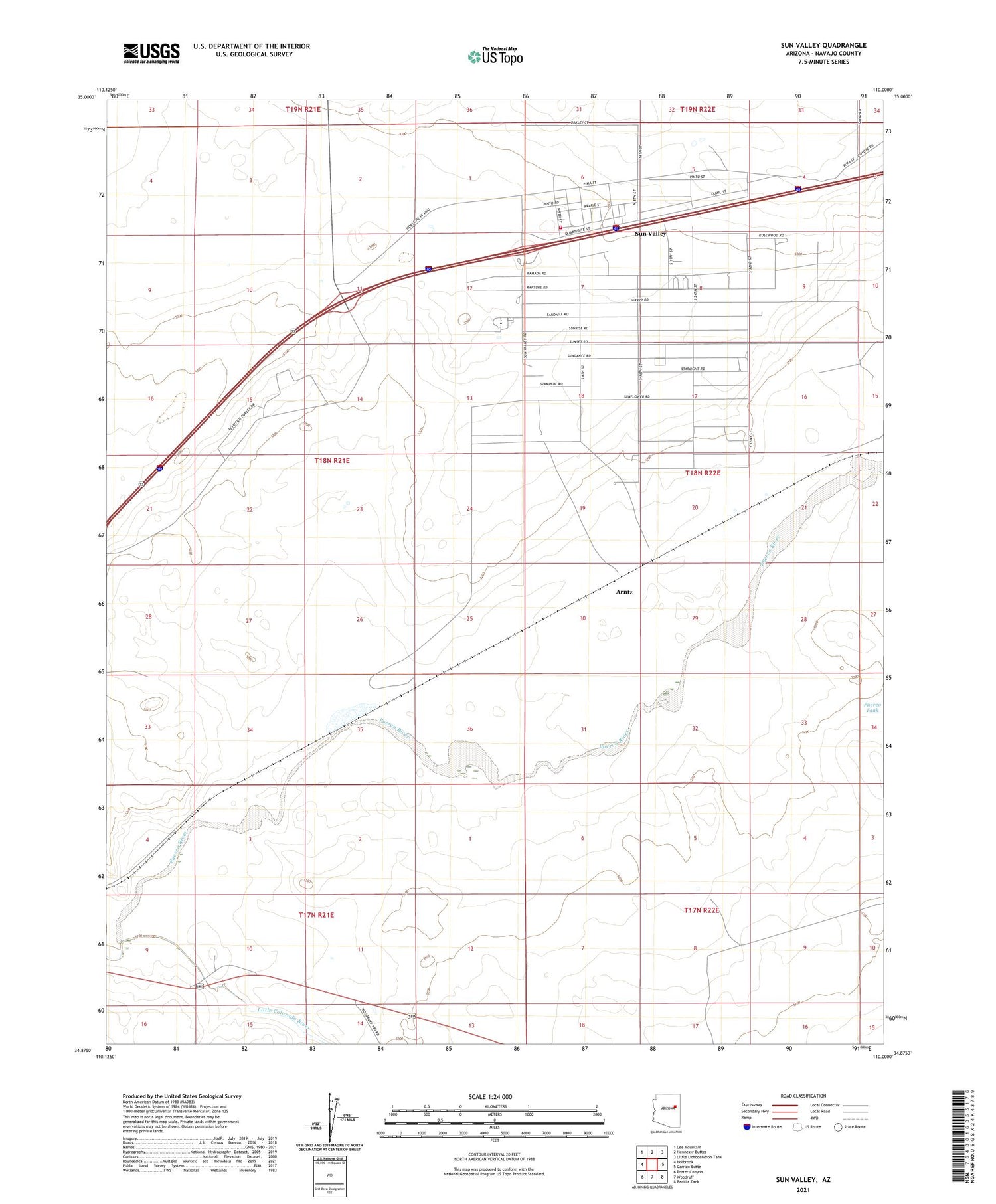
2021 topographic map quadrangle Sun Valley in the state of Arizona. Scale: 1:24000. Based on the newly updated USGS 7.5' US Topo map series, this map is in the following counties: Navajo. The map contains contour data, water features, and other items you are used to seeing on USGS maps, but also has updated roads and other features. This is the next generation of topographic maps. Printed on high-quality waterproof paper with UV fade-resistant inks.
Quads adjacent to this one:
West: Holbrook
Northwest: Lee Mountain
North: Hennessy Buttes
Northeast: Little Lithodendron Tank
East: Carrizo Butte
Southeast: Padilla Tank
South: Woodruff
Southwest: Porter Canyon
This map covers the same area as the classic USGS quad with code o34110h1.
Contains the following named places: Arntz, Native American Christian Academy, Puerco River, Sun Valley, Sun Valley Census Designated Place, Sun Valley Church of the Nazarene, Sun Valley Fire and Rescue, ZIP Code: 86025


