MyTopo
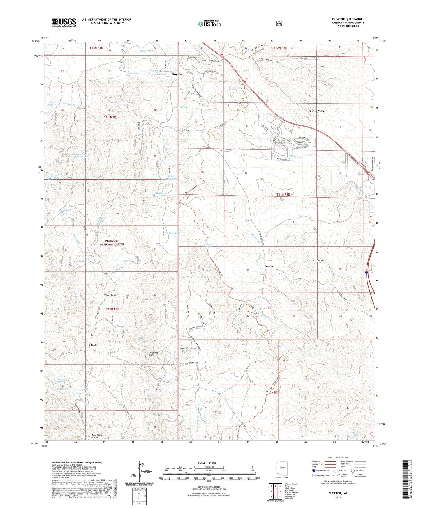
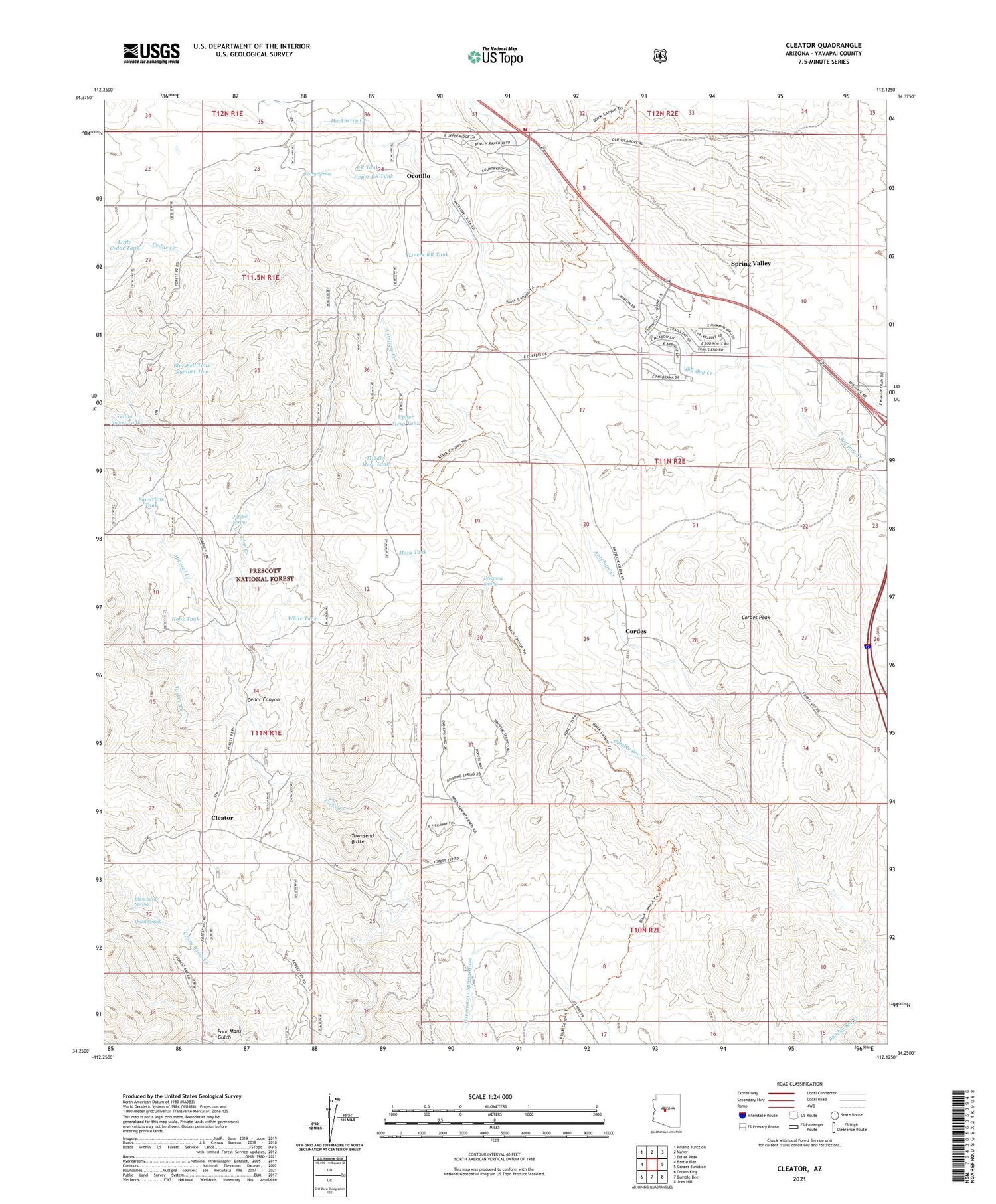
Cleator Arizona US Topo Map
Couldn't load pickup availability
Also explore the Cleator Forest Service Topo of this same quad for updated USFS data
2021 topographic map quadrangle Cleator in the state of Arizona. Scale: 1:24000. Based on the newly updated USGS 7.5' US Topo map series, this map is in the following counties: Yavapai. The map contains contour data, water features, and other items you are used to seeing on USGS maps, but also has updated roads and other features. This is the next generation of topographic maps. Printed on high-quality waterproof paper with UV fade-resistant inks.
Quads adjacent to this one:
West: Battle Flat
Northwest: Poland Junction
North: Mayer
Northeast: Estler Peak
East: Cordes Junction
Southeast: Joes Hill
South: Bumble Bee
Southwest: Crown King
This map covers the same area as the classic USGS quad with code o34112c2.
Contains the following named places: Antelope Creek, Blanchard Spring, Blue Bell, Blue Bell Mine, Blue Bell Tank Number Two, Blue Bell Trick Tank, Blue Bell Well, Cedar Canyon, Cedar Creek, Cedar Well, Cleator, Cordes, Cordes Airport, Cordes Peak, Dripping Spring, French Lilly Mine, Geary Spring, Golden Belt Mine, Golden Turkey Mine, Gray Goose Mine, Hackberry Creek, Hidden Treasure Mine, Hook Tank, Jubilee Mine, Jubilee Spring, Little Cedar Tank, Lower RR Tank, Mayer Fire Department Fire Station 22, Mayer Fire Department Fire Station 24, Mayer Junior Senior High School, Mesa Tank, Middle Mesa Tank, Mineral Creek, Ocotillo, Poor Mans Gulch, Powerline Tank, Quail Spring, RR Tank, Saint Johns Mine, Silver Cord Mine, Spring Valley, Spring Valley Census Designated Place, Spring Valley Community Church, Susie Hendrick Place, Swiettendick Place, Swiettendick Place Well, Townsend Butte, Upper Mesa Tank, Upper RR Tank, White Tank, Yellow Jacket Tank