MyTopo
Moccasin Arizona US Topo Map
Couldn't load pickup availability
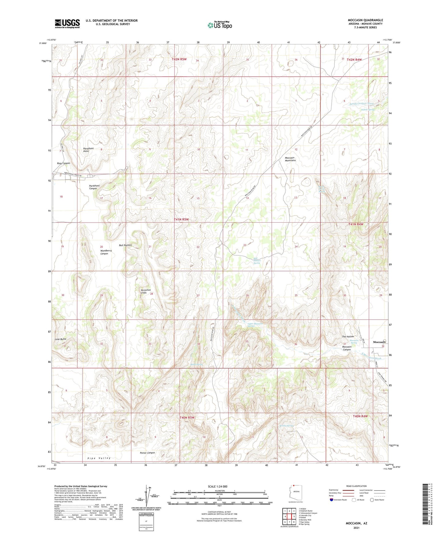
2021 topographic map quadrangle Moccasin in the state of Arizona. Scale: 1:24000. Based on the newly updated USGS 7.5' US Topo map series, this map is in the following counties: Mohave. The map contains contour data, water features, and other items you are used to seeing on USGS maps, but also has updated roads and other features. This is the next generation of topographic maps. Printed on high-quality waterproof paper with UV fade-resistant inks.
Quads adjacent to this one:
West: Colorado City
Northwest: Hildale
North: Elephant Butte
Northeast: Yellowjacket Canyon
East: Kaibab
Southeast: Pipe Spring
South: Pipe Valley
Southwest: Maroney Well
This map covers the same area as the classic USGS quad with code o36112h7.
Contains the following named places: Bee Cistern, Bull Pasture, Bull Pasture Spring, Burnt Corral Spring, Meeks Spring, Mocassin Post Office, Moccasin, Moccasin Canyon, Moccasin Census Designated Place, Moccasin Elementary School, Moccasin Mountains, Moccasin Spring, Parashont Canyon, Parashont Point, Potter Canyon, Rosy Canyon, Seman Cistern, The Hollow, Upper Moccasin Springs, Vermilion Cliffs, Willow Spring, Woodberry Canyon, Wooley Spring