MyTopo
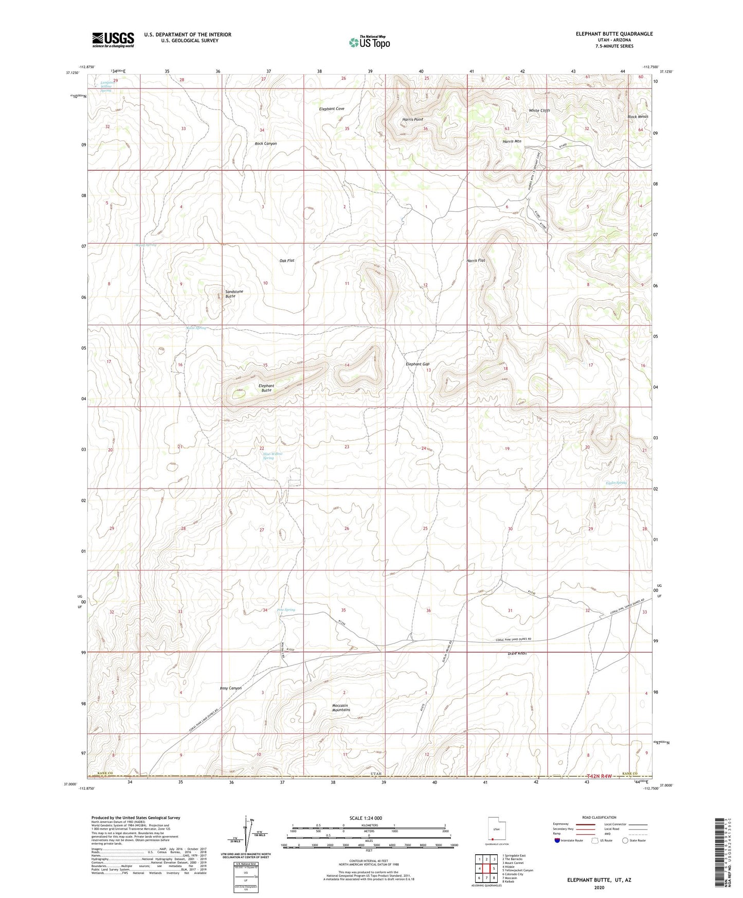
Elephant Butte Utah US Topo Map
Couldn't load pickup availability
2023 topographic map quadrangle Elephant Butte in the state of Utah. Scale: 1:24000. Based on the newly updated USGS 7.5' US Topo map series, this map is in the following counties: Kane, Mohave. The map contains contour data, water features, and other items you are used to seeing on USGS maps, but also has updated roads and other features. This is the next generation of topographic maps. Printed on high-quality waterproof paper with UV fade-resistant inks.
Quads adjacent to this one:
West: Hildale
Northwest: Springdale East
North: The Barracks
Northeast: Mount Carmel
East: Yellowjacket Canyon
Southeast: Kaibab
South: Moccasin
Southwest: Colorado City
This map covers the same area as the classic USGS quad with code o37112a7.
Contains the following named places: Block Mesas, Dixie Knoll, Elephant Butte, Elephant Gap, Esplin Spring, Harris Flat, Harris Mountain, Harris Point, Hise-Willow Spring, Kane Spring, Langston Willow Spring, Moccasin Mountains, Oak Flat, Pine Spring, Rosy Canyon, Sandstone Butte, Shunesburg Mail Trail, Wyatt Spring