MyTopo
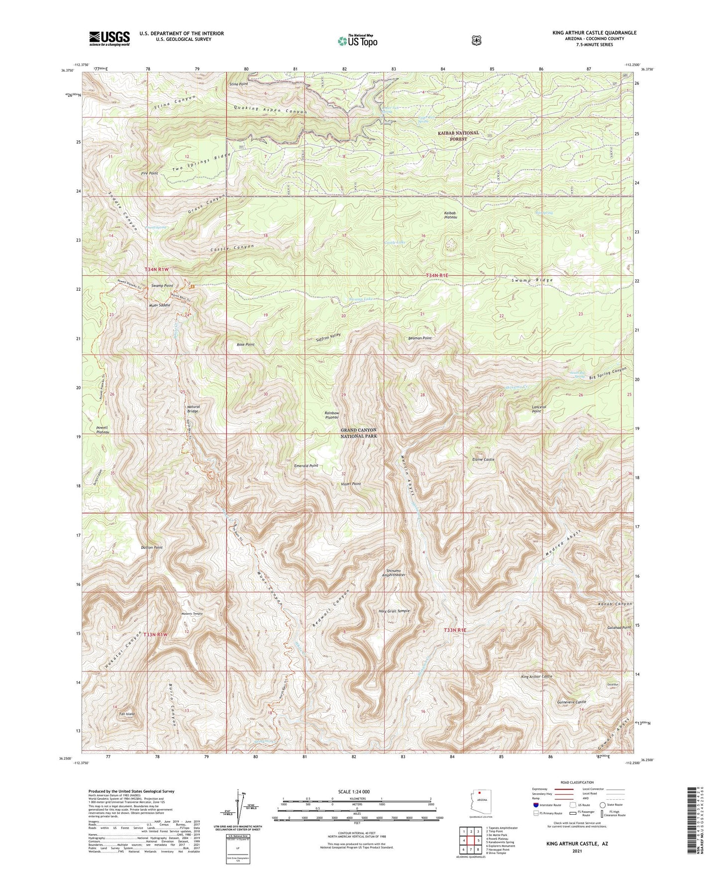
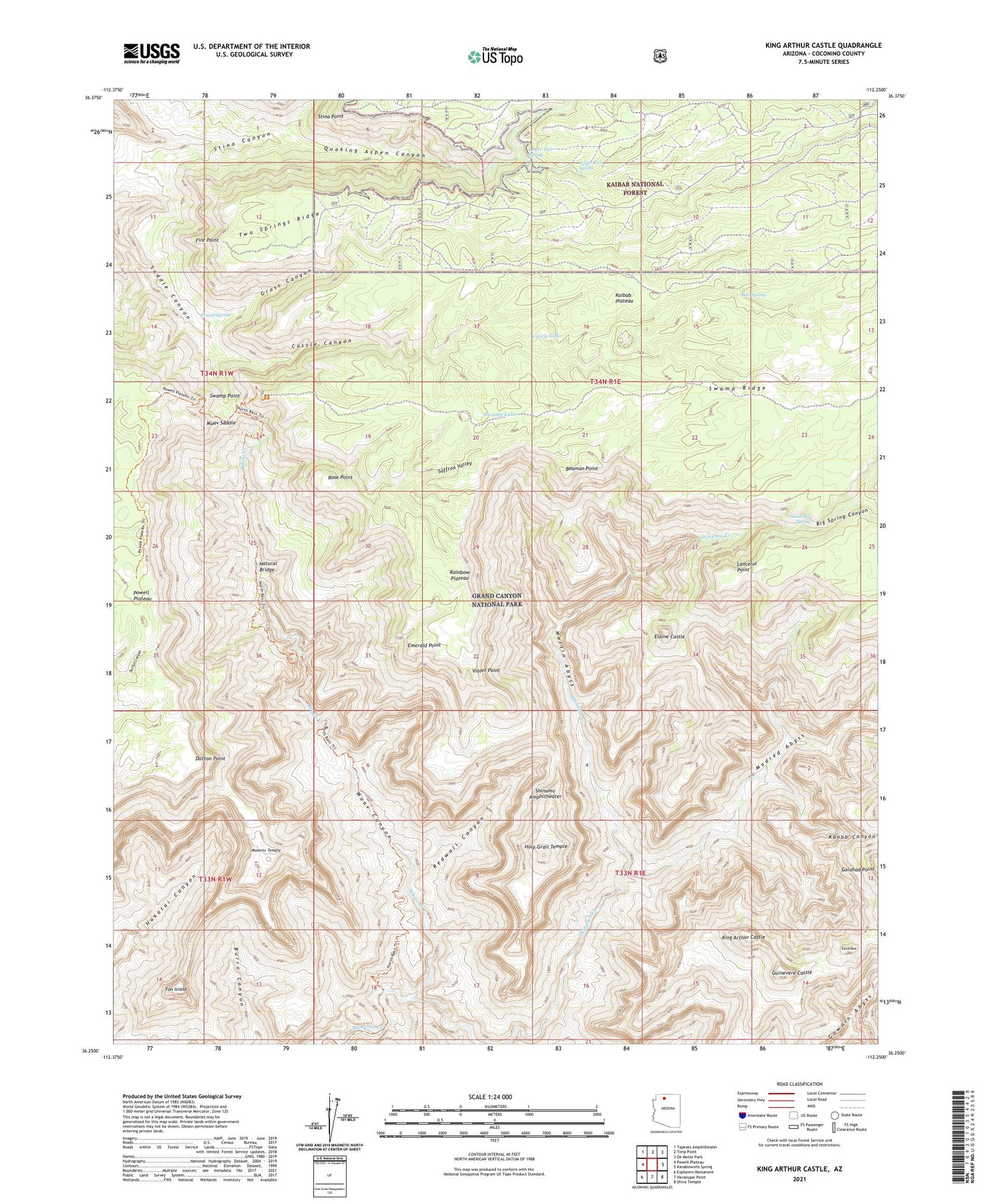
King Arthur Castle Arizona US Topo Map
Couldn't load pickup availability
Also explore the King Arthur Castle Forest Service Topo of this same quad for updated USFS data
2021 topographic map quadrangle King Arthur Castle in the state of Arizona. Scale: 1:24000. Based on the newly updated USGS 7.5' US Topo map series, this map is in the following counties: Coconino. The map contains contour data, water features, and other items you are used to seeing on USGS maps, but also has updated roads and other features. This is the next generation of topographic maps. Printed on high-quality waterproof paper with UV fade-resistant inks.
Quads adjacent to this one:
West: Powell Plateau
Northwest: Tapeats Amphitheater
North: Timp Point
Northeast: De Motte Park
East: Kanabownits Spring
Southeast: Shiva Temple
South: Havasupai Point
Southwest: Explorers Monument
This map covers the same area as the classic USGS quad with code o36112c3.
Contains the following named places: Bass Trail, Beaman Point, Big Spring Canyon, Castle Canyon, Castle Lake, Dutton Point, Elaine Castle, Emerald Point, Excalibur, Fan Island, Fire Point, Galahad Point, Grass Canyon, Guinevere Castle, Holy Grail Temple, Ikes Spring, Kanab Canyon, King Arthur Castle, Lancelot Point, Lower Two Spring, Masonic Temple, Merlin Abyss, Modred Abyss, Muav Canyon, Muav Saddle, Natural Bridge, Powell Spring, Quaking Aspen Canyon, Rainbow Plateau, Redwall Canyon, Rose Point, Saffron Valley, Shinumo Camp, South Big Spring, Stina Point, Swamp Lake, Swamp Point, Upper Two Spring, Violet Point, White Creek