MyTopo
Las Guijas Arizona US Topo Map
Couldn't load pickup availability
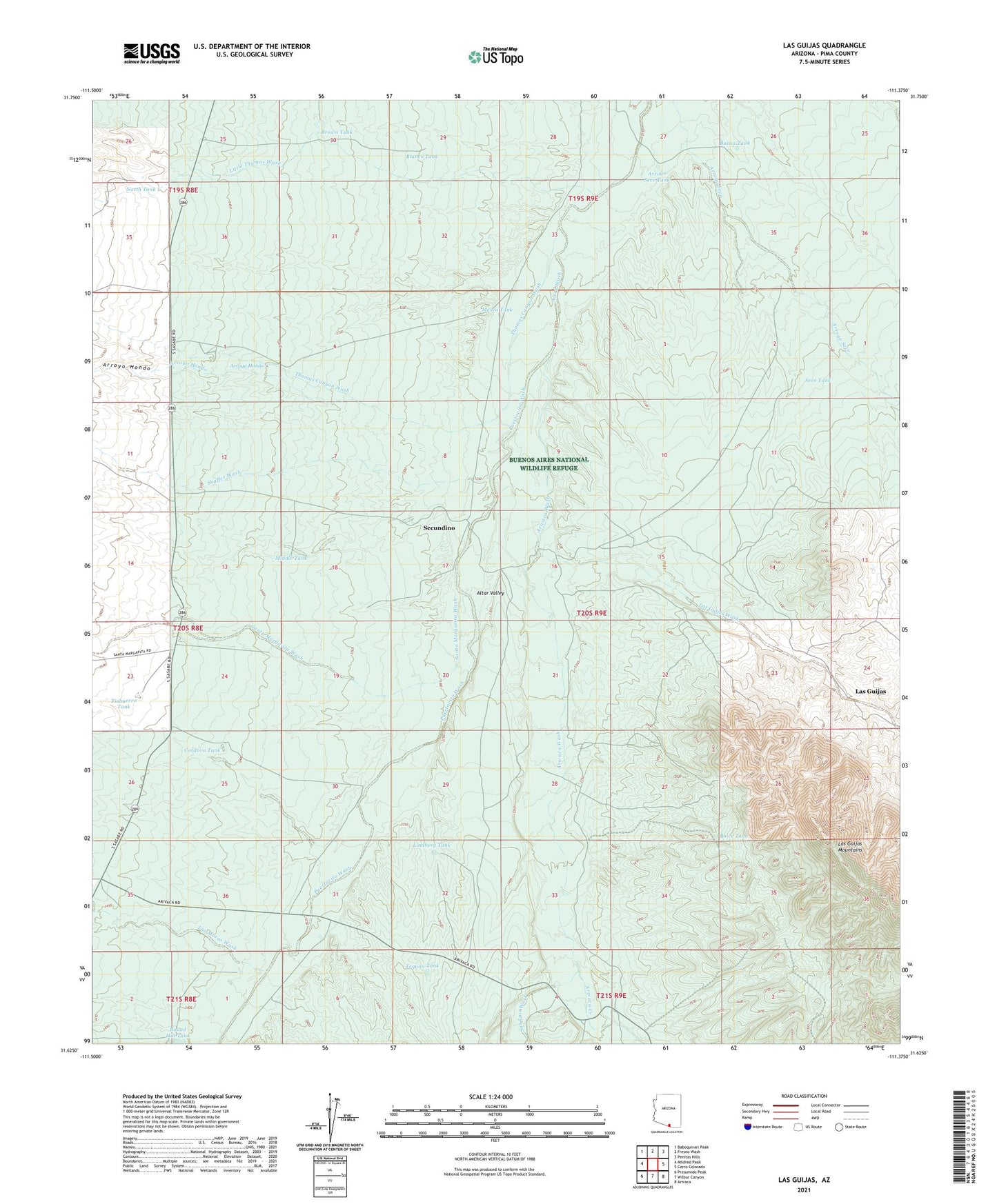
2021 topographic map quadrangle Las Guijas in the state of Arizona. Scale: 1:24000. Based on the newly updated USGS 7.5' US Topo map series, this map is in the following counties: Pima. The map contains contour data, water features, and other items you are used to seeing on USGS maps, but also has updated roads and other features. This is the next generation of topographic maps. Printed on high-quality waterproof paper with UV fade-resistant inks.
Quads adjacent to this one:
West: Mildred Peak
Northwest: Baboquivari Peak
North: Fresno Wash
Northeast: Penitas Hills
East: Cerro Colorado
Southeast: Arivaca
South: Wilbur Canyon
Southwest: Presumido Peak
This map covers the same area as the classic USGS quad with code o31111f4.
Contains the following named places: Arivaca Creek, Arivaca Wash, Arroyo Hondo, Arroyo Seco Tank, Blanco Tank, Boice Tank, Brown Tank, Buena Tank, Buenos Aires National Wildlife Refuge, Cordova Tank, Figueroa Ranch, Las Guijas, Las Guijas Mine, Las Guijas Wash, Las Guijas Well, Las Moras Wash, Lindberg Tank, Little Thomas Wash, Martinez Well, Middle Tank, Mosca Tank, North Tank, Puertocito Wash, San Luis Wash, Santa Margarita Wash, Seco Tank, Secundino, Secundino Well, Shaffer Wash, Tequila Tank, Thomas Canyon Wash, Tiohuerro Tank