MyTopo
Cerro Colorado Arizona US Topo Map
Couldn't load pickup availability
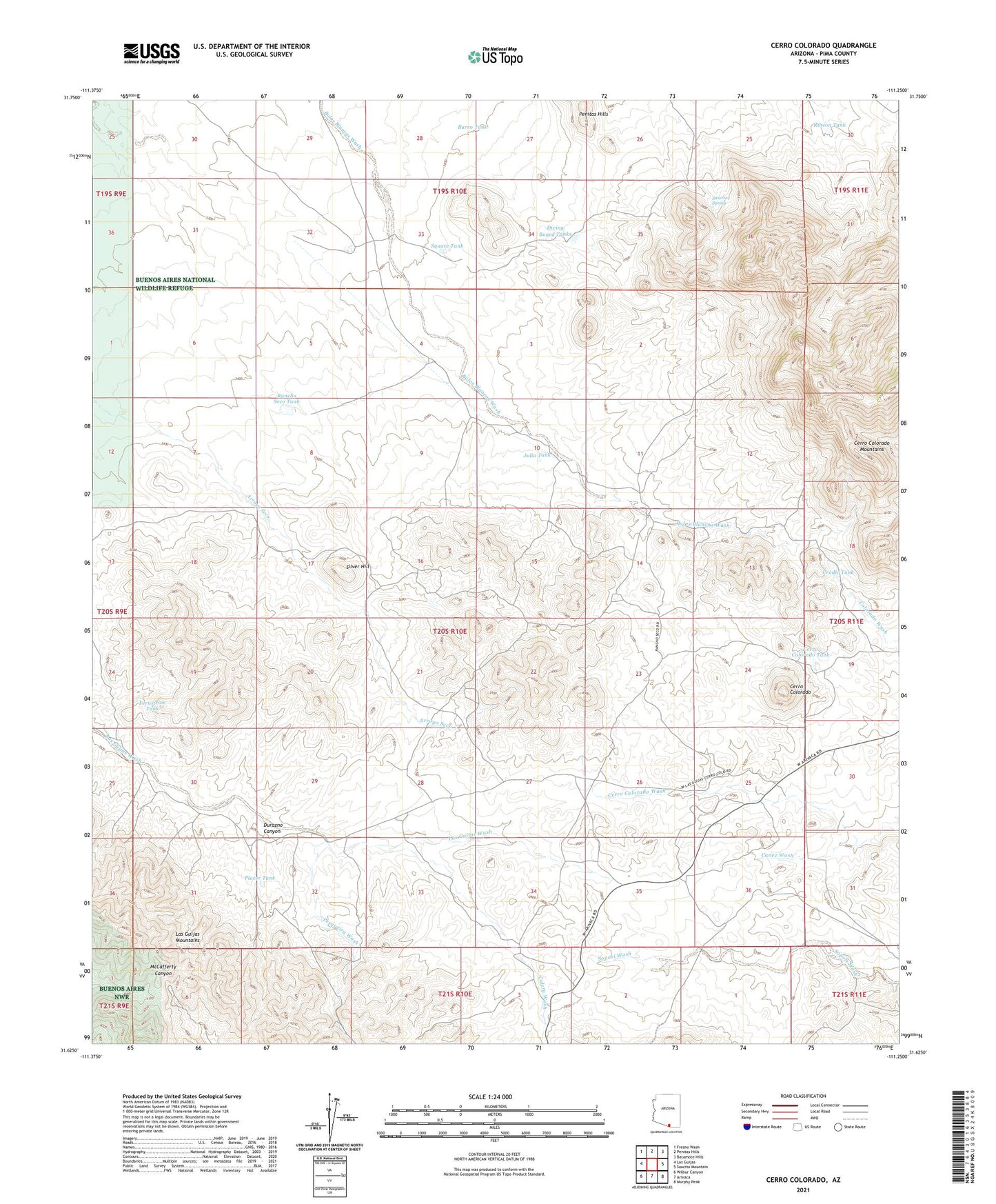
2021 topographic map quadrangle Cerro Colorado in the state of Arizona. Scale: 1:24000. Based on the newly updated USGS 7.5' US Topo map series, this map is in the following counties: Pima. The map contains contour data, water features, and other items you are used to seeing on USGS maps, but also has updated roads and other features. This is the next generation of topographic maps. Printed on high-quality waterproof paper with UV fade-resistant inks.
Quads adjacent to this one:
West: Las Guijas
Northwest: Fresno Wash
North: Penitas Hills
Northeast: Batamote Hills
East: Saucito Mountain
Southeast: Murphy Peak
South: Arivaca
Southwest: Wilbur Canyon
This map covers the same area as the classic USGS quad with code o31111f3.
Contains the following named places: Amado Well, Arivaca King Mine, Black Princess Mine, Burro Tank, Calera Wash, Cerro Colorado, Cerro Colorado Mine, Cerro Colorado Mountains, Cerro Colorado Tank, Cerro Colorado Wash, Charles Mine, Colorado Clark Mine, Cradle Tank, Diving Board Tanks, Durazno Canyon, Fernstrom Tank, Golden Star Mine, Good Enough Mine, Heintzelman Mine, Julia Tank, Las Guijas Mountains, Liberty Mine, Mary G Mine, Mitchell Well, Montano Ranch, New Colorado Mine, Oros Well, Pesqueira Wash, Placer Tank, Rancho Seco, Rancho Seco Tank, Rincon Tank, Saucito Spring, Shirley Well, Silver Coin Mine, Silver Hill, Silver Hill Mine, Silver Shield Mine, Square Tank