MyTopo
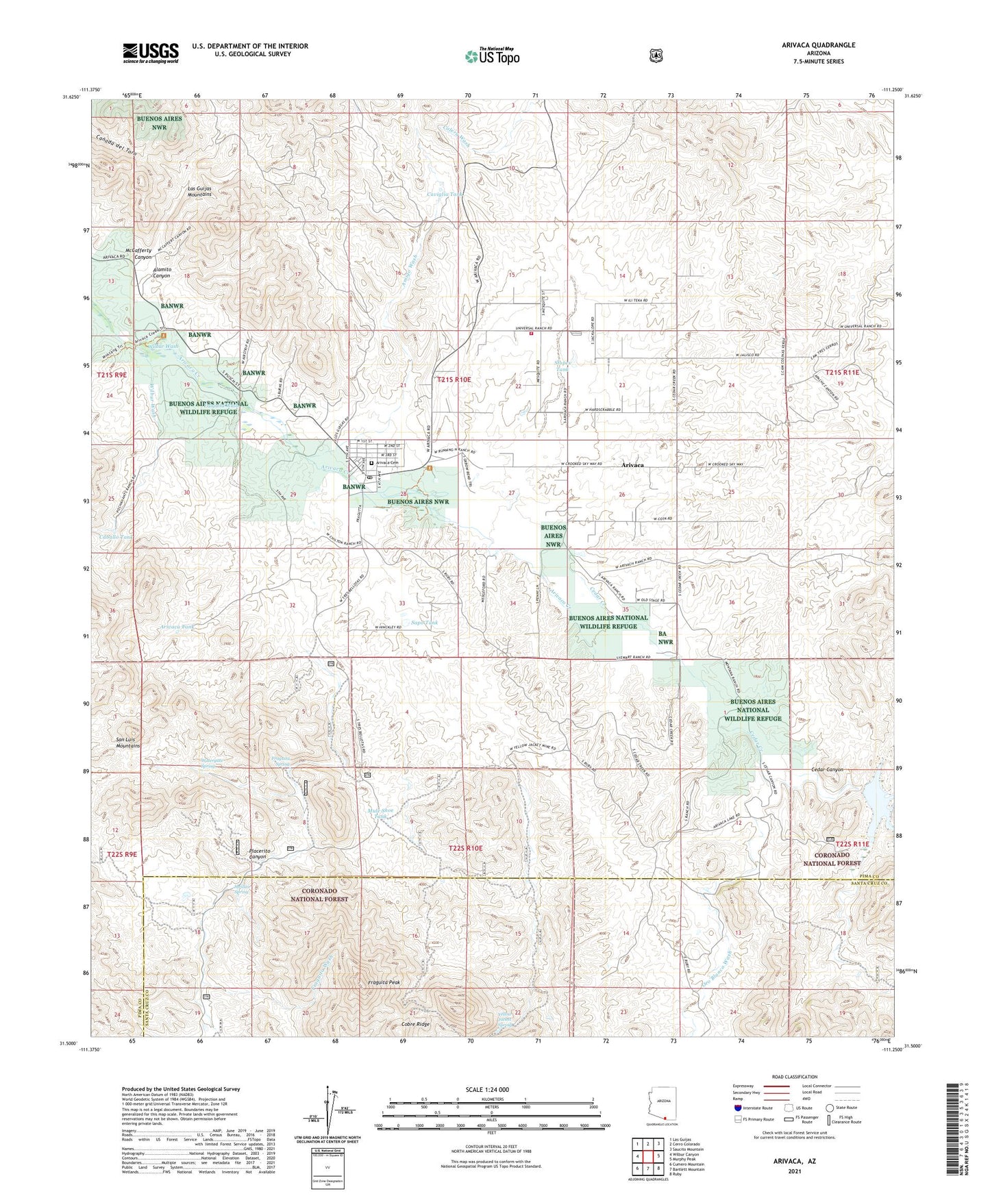
Arivaca Arizona US Topo Map
Couldn't load pickup availability
Also explore the Arivaca Forest Service Topo of this same quad for updated USFS data
2021 topographic map quadrangle Arivaca in the state of Arizona. Scale: 1:24000. Based on the newly updated USGS 7.5' US Topo map series, this map is in the following counties: Pima, Santa Cruz. The map contains contour data, water features, and other items you are used to seeing on USGS maps, but also has updated roads and other features. This is the next generation of topographic maps. Printed on high-quality waterproof paper with UV fade-resistant inks.
Quads adjacent to this one:
West: Wilbur Canyon
Northwest: Las Guijas
North: Cerro Colorado
Northeast: Saucito Mountain
East: Murphy Peak
Southeast: Ruby
South: Bartlett Mountain
Southwest: Cumero Mountain
This map covers the same area as the classic USGS quad with code o31111e3.
Contains the following named places: Ajax Mine, Alamito Canyon, Albatross Mine, Amado Mine, Amigo Wash, Arivaca, Arivaca Cemetery, Arivaca Census Designated Place, Arivaca Coop Water Wells, Arivaca Dam, Arivaca Lake, Arivaca Post Office, Arivaca Ranch, Arivaca Tank, Arivaca Volunteer Fire Department, Backbone Mine, Caballo Tank, Campos Ranch, Carrizo Well, Caviglia Tank, Cedar Canyon, Cedar Creek, Chimney Canyon, Clark Ranch, Edwards Mine, Fraguita Peak, Fraguita Spring, Fraguita Wash, Honnas Ranch, Jarillas Spring, Las Jarillas Ranch, McCafferty Canyon, Montana Ranch, Mule Shoe Tank, Oro Blanco Wash, Pima County Public Library Caviglia Arivaca Branch, Placerito Canyon, Sapo Tank, Stopes Tank, Tonkin Well, Watergate Spring, Wilbur Wash, Yellow Jacket Spring, Yellow Jacket Wash, ZIP Code: 85601