MyTopo
Pima Arizona US Topo Map
Couldn't load pickup availability
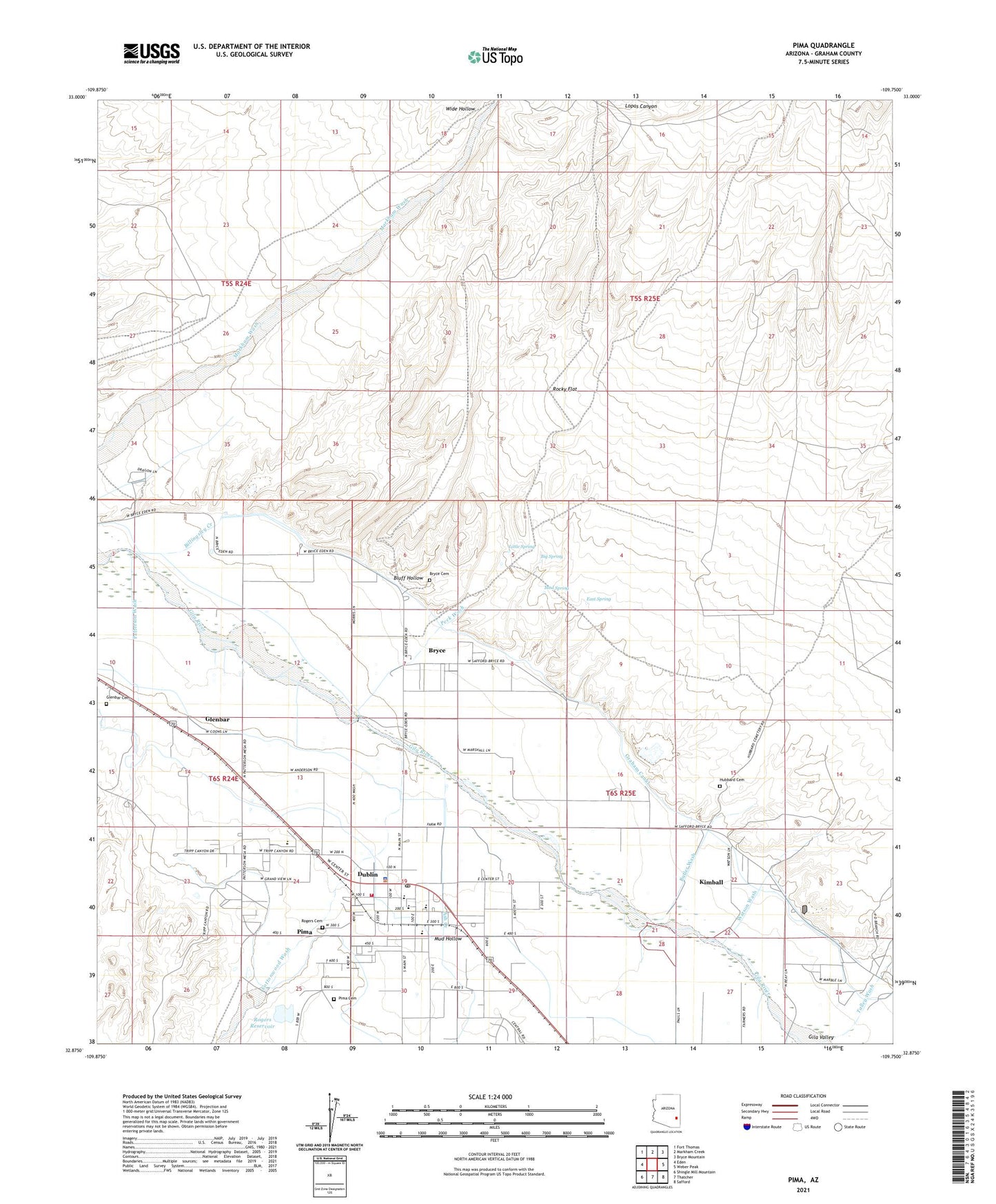
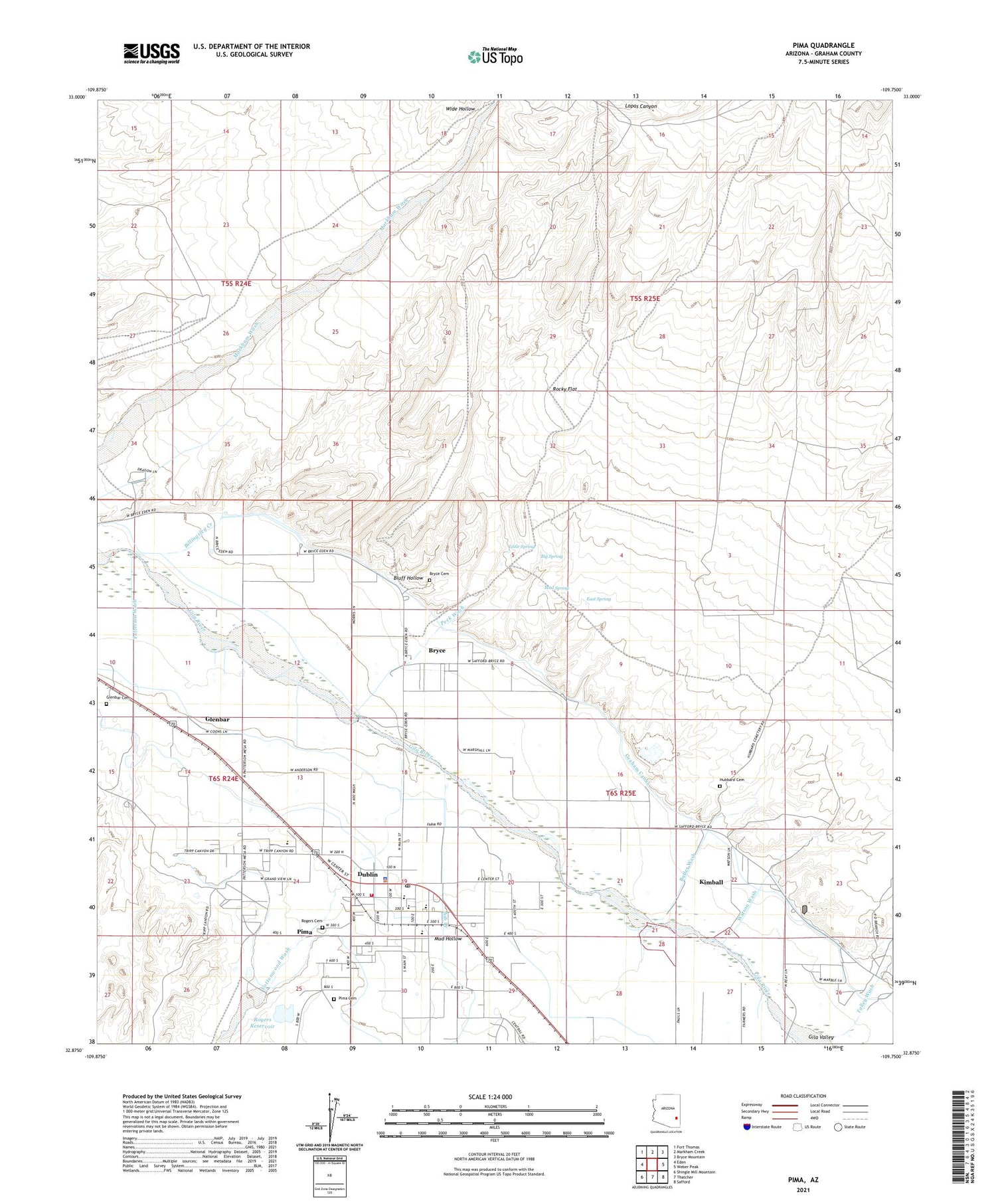
2021 topographic map quadrangle Pima in the state of Arizona. Scale: 1:24000. Based on the newly updated USGS 7.5' US Topo map series, this map is in the following counties: Graham. The map contains contour data, water features, and other items you are used to seeing on USGS maps, but also has updated roads and other features. This is the next generation of topographic maps. Printed on high-quality waterproof paper with UV fade-resistant inks.
Quads adjacent to this one:
West: Eden
Northwest: Fort Thomas
North: Markham Creek
Northeast: Bryce Mountain
East: Weber Peak
Southeast: Safford
South: Thatcher
Southwest: Shingle Mill Mountain
This map covers the same area as the classic USGS quad with code o32109h7.
Contains the following named places: Ash Creek, Big Spring, Big Spring Wash, Billingsley Creek, Billingsley Dam, Bluff Hollow, Bryce, Bryce Cemetery, Bryce Census Designated Place, Butler Wash, Chesley Wash, Chesley-Wamslee Dam, Cottonwood Wash, Coyote Wash, Dan Hinton Accommodation School, Discovery Plus Academy, Dublin, East Spring, Glenbar, Glenbar Cemetery, Graham Canal, Holyoke Wash, Howard Dam, Hubbard Cemetery, Kimball, Lee Dam, Little Spring, Mack Well, Mud Hollow, Mud Spring, Patterson Wash, Peck Wash, Pima, Pima Cemetery, Pima City Hall, Pima Elementary School, Pima High School, Pima Junior High School, Pima Police Office, Pima Post Office, Pima Public Library, Pima Railroad Station, Pima Rural Fire Department, Rocky Flat, Rogers Cemetery, Rogers Reservoir, Rogers Reservoir Dam, Talley Wash, Town of Pima, Watson Wash, ZIP Code: 85531