MyTopo
Eden Arizona US Topo Map
Couldn't load pickup availability
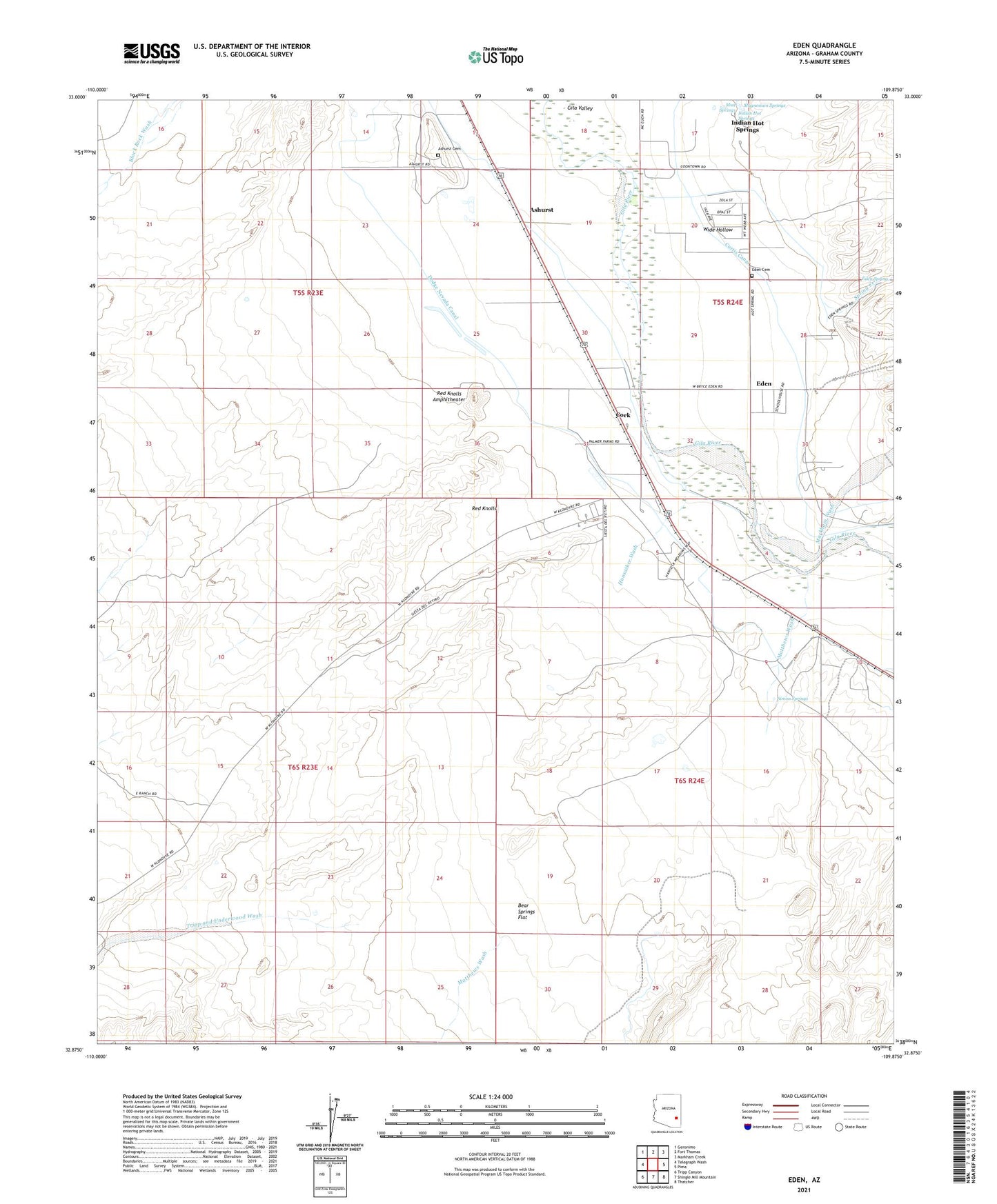
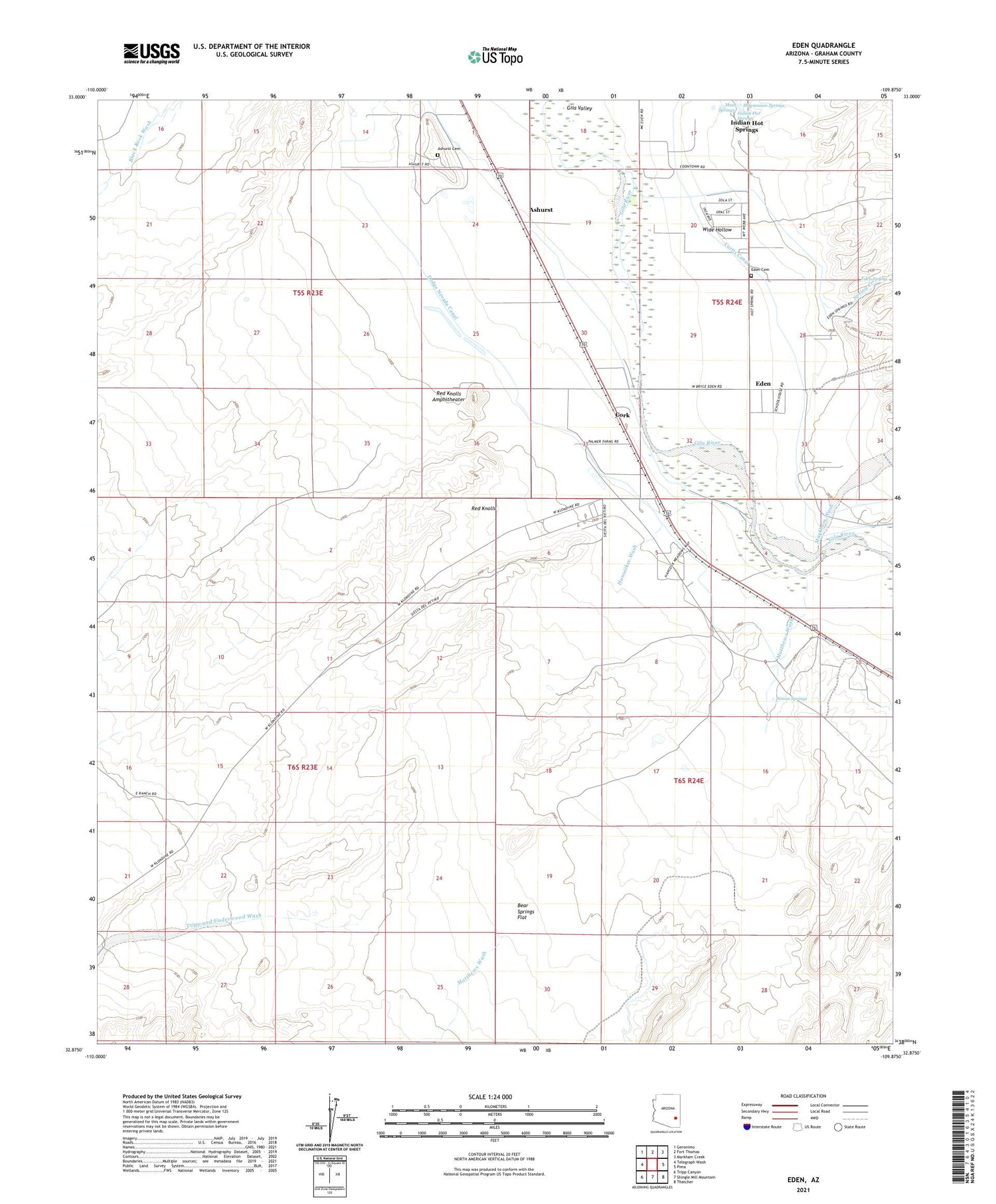
2021 topographic map quadrangle Eden in the state of Arizona. Scale: 1:24000. Based on the newly updated USGS 7.5' US Topo map series, this map is in the following counties: Graham. The map contains contour data, water features, and other items you are used to seeing on USGS maps, but also has updated roads and other features. This is the next generation of topographic maps. Printed on high-quality waterproof paper with UV fade-resistant inks.
Quads adjacent to this one:
West: Telegraph Wash
Northwest: Geronimo
North: Fort Thomas
Northeast: Markham Creek
East: Pima
Southeast: Thatcher
South: Shingle Mill Mountain
Southwest: Tripp Canyon
This map covers the same area as the classic USGS quad with code o32109h8.
Contains the following named places: Ashurst, Ashurst Cemetery, Battle Creek Canal, Bear Springs Flat, Bigler Wash, Biglers Reservoir, Cork, Curtis Canal, Dodge Nevada Canal, Eden, Eden Cemetery, Eden Post Office, Eden Spring, Eldon Palmer Reservoir, Gila Well, Graham County, Hot Springs Wash, Hunsacker Wash, Indian Hot Springs, Iron Springs, Magnesium Springs, Markham Wash, Matthews Wash, Mud Springs, Oso Largo Dike Dam, Pima Division, Quarry Reservoir, Red Knolls, Red Knolls Amphitheater, Simon Springs, Spring Creek, Tripp and Underwood Wash, White House, Wide Hollow, ZIP Codes: 85535, 85543