MyTopo
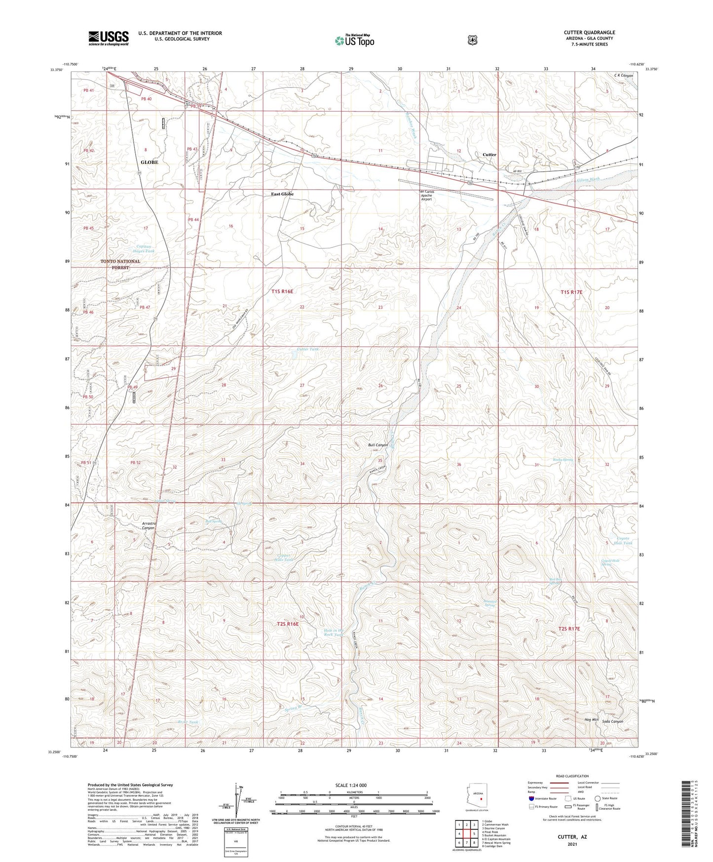
Cutter Arizona US Topo Map
Couldn't load pickup availability
Also explore the Cutter Forest Service Topo of this same quad for updated USFS data
2021 topographic map quadrangle Cutter in the state of Arizona. Scale: 1:24000. Based on the newly updated USGS 7.5' US Topo map series, this map is in the following counties: Gila. The map contains contour data, water features, and other items you are used to seeing on USGS maps, but also has updated roads and other features. This is the next generation of topographic maps. Printed on high-quality waterproof paper with UV fade-resistant inks.
Quads adjacent to this one:
West: Pinal Peak
Northwest: Globe
North: Cammerman Wash
Northeast: Dourine Canyon
East: Bucket Mountain
Southeast: Coolidge Dam
South: Mescal Warm Spring
Southwest: El Capitan Mountain
This map covers the same area as the classic USGS quad with code o33110c6.
Contains the following named places: Apache Stronghold Golf Club, Arrastra Canyon, Bar F Bar Ranch, Branch Creek Dam, Branch Creek Tank, Bull Canyon, Bull Spring, Cactus Well, Capitan Hayes Tank, Copper Hills Tank, Coyote Hold Dam, Coyote Hole Spring, Coyote Hole Tank, Cutter, Cutter Census Designated Place, Cutter Ranch, Cutter Tank, East Globe Census Designated Place, Elk Spring, Elk Trick Tank, Globe City Well, Grantham Well, Haunted Spring, Hensen Tank, Hog Mountain, Hole in the Rock Tank, Indian Spring, Martin Well, Naltazen Dam Number One, Nig Well Number Two, Ramboz Wash, Ranch Creek, Red Box Spring, Rocky Spring, San Carlos Apache Airport, Spring Branch, Twin Tanks