MyTopo
White Hills Utah US Topo Map
Couldn't load pickup availability
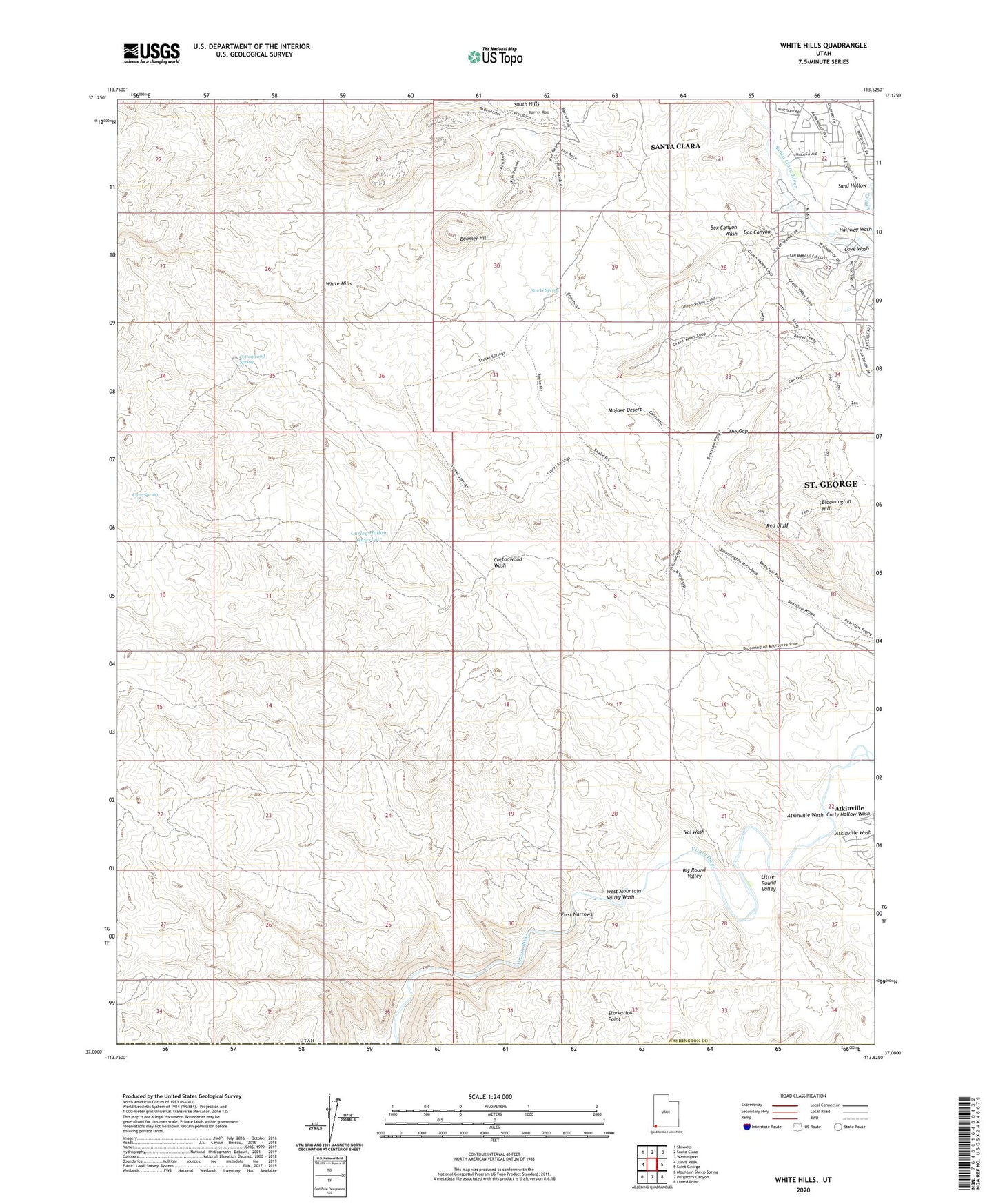
2023 topographic map quadrangle White Hills in the state of Utah. Scale: 1:24000. Based on the newly updated USGS 7.5' US Topo map series, this map is in the following counties: Washington. The map contains contour data, water features, and other items you are used to seeing on USGS maps, but also has updated roads and other features. This is the next generation of topographic maps. Printed on high-quality waterproof paper with UV fade-resistant inks.
Quads adjacent to this one:
West: Jarvis Peak
Northwest: Shivwits
North: Santa Clara
Northeast: Washington
East: Saint George
Southeast: Lizard Point
South: Purgatory Canyon
Southwest: Mountain Sheep Spring
This map covers the same area as the classic USGS quad with code o37113a6.
Contains the following named places: Atkinville, Atkinville Wash, Big Round Valley, Blakes Lambing Grounds, Boomer Hill, Box Canyon, Box Canyon Wash, Cave Spring, Cottonwood Spring, Cottonwood Wash, Cove Wash, Curley Hollow Reservoir, Curly Hollow Wash, First Narrows, Little Round Valley, Red Bluff, Sand Hollow, South Hills, Starvation Point, Stucki Spring, The Gap, Val Wash, West Mountain Valley Wash, White Hills