
MyTopo
Picacho Butte Arizona US Topo Map
Couldn't load pickup availability
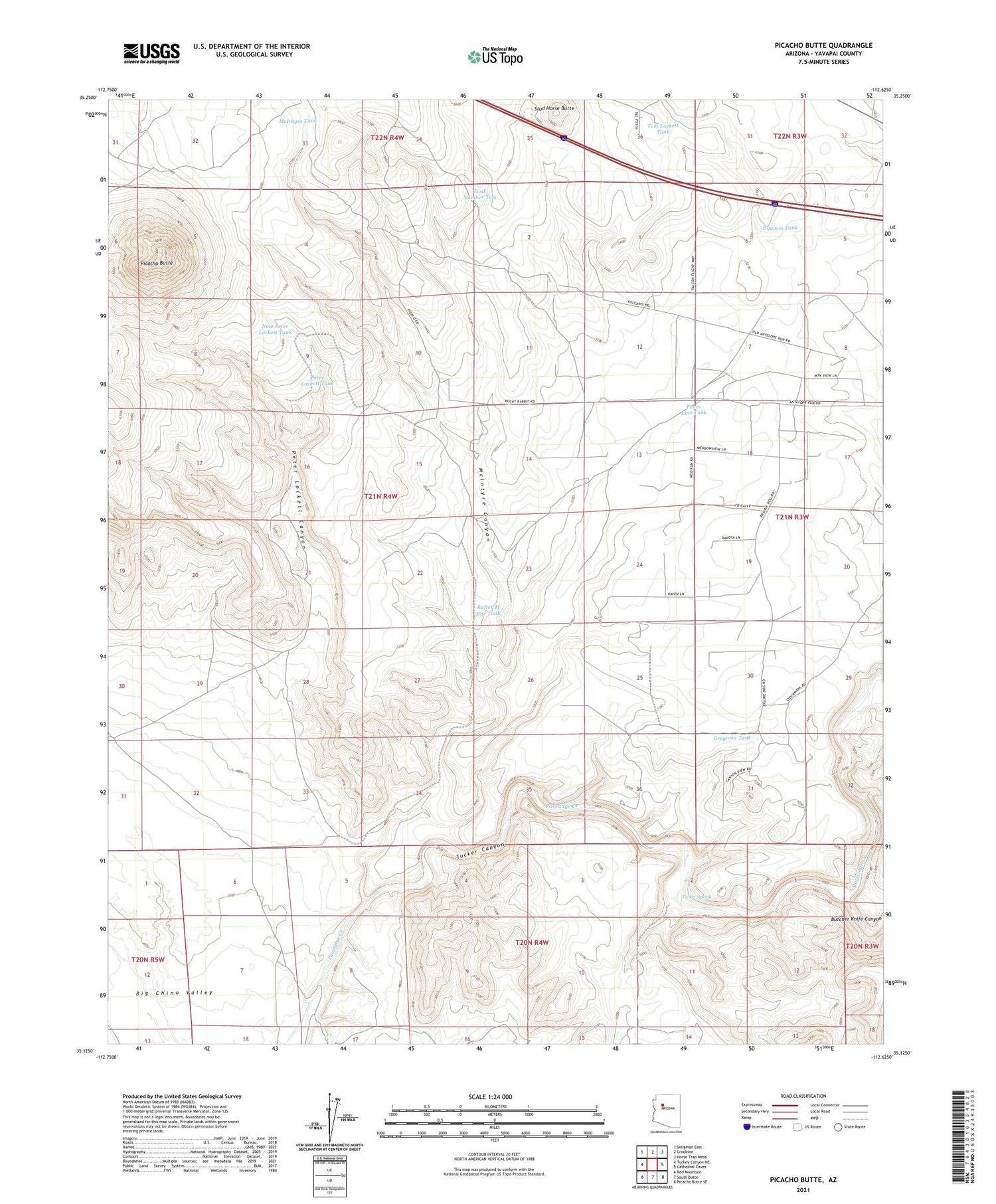
2021 topographic map quadrangle Picacho Butte in the state of Arizona. Scale: 1:24000. Based on the newly updated USGS 7.5' US Topo map series, this map is in the following counties: Yavapai. The map contains contour data, water features, and other items you are used to seeing on USGS maps, but also has updated roads and other features. This is the next generation of topographic maps. Printed on high-quality waterproof paper with UV fade-resistant inks.
Quads adjacent to this one:
West: Turkey Canyon NE
Northwest: Seligman East
North: Crookton
Northeast: Horse Trap Mesa
East: Cathedral Caves
Southeast: Picacho Butte SE
South: South Butte
Southwest: Red Mountain
This map covers the same area as the classic USGS quad with code o35112b6.
Contains the following named places: Butcher Knife Canyon, Dawson Tank, Fence Line Tank, Gregoria Tank, McIntyre Canyon, McIntyre Tank, New Peter Lockett Tank, Peter Lockett Canyon, Peter Lockett Tank, Picacho Butte, Rafter M Bar Tank, Stud Horse Butte, Tank Number Two, Tom Lockett Tank, Tucker Canyon, Tucker Spring


