MyTopo
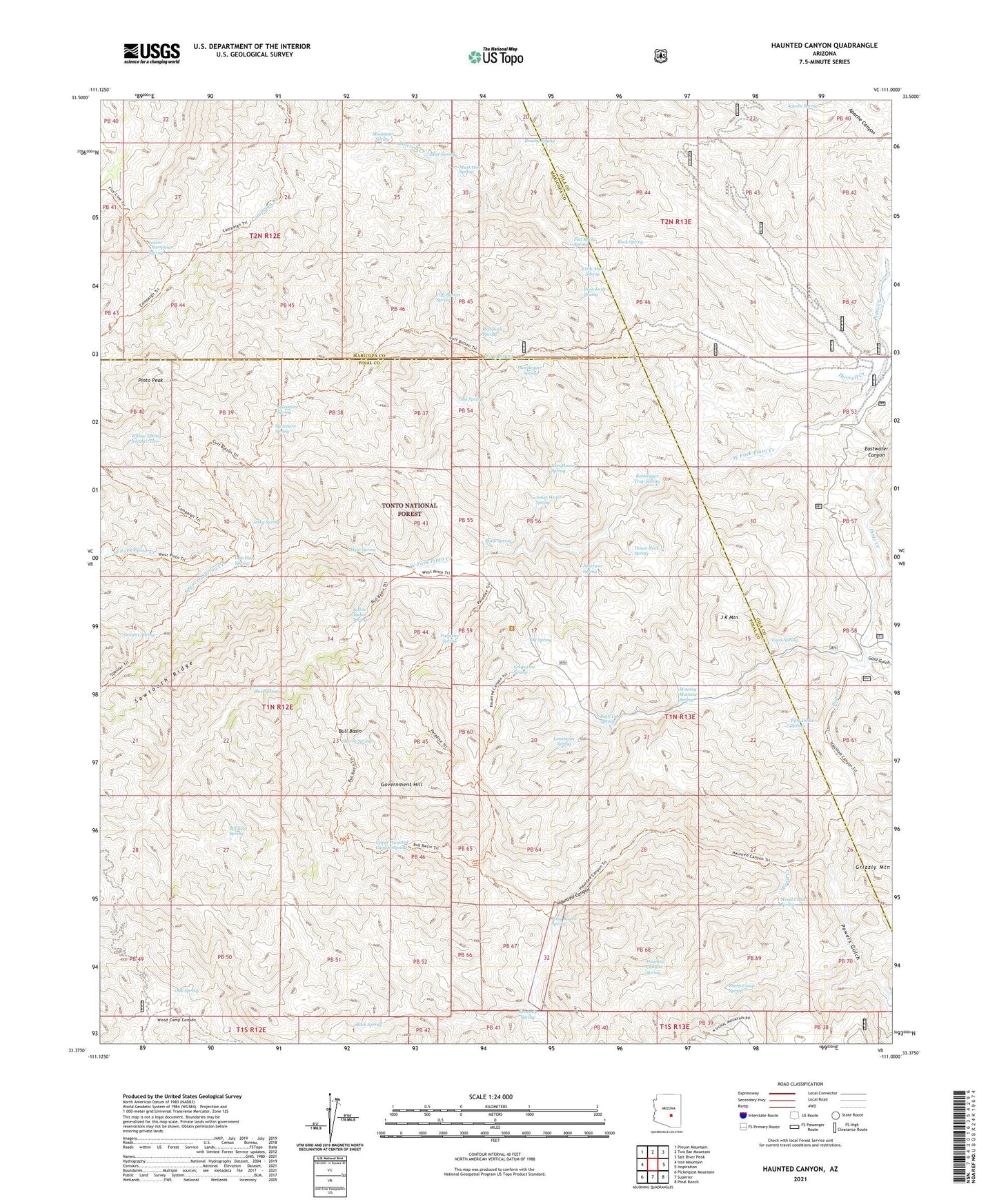
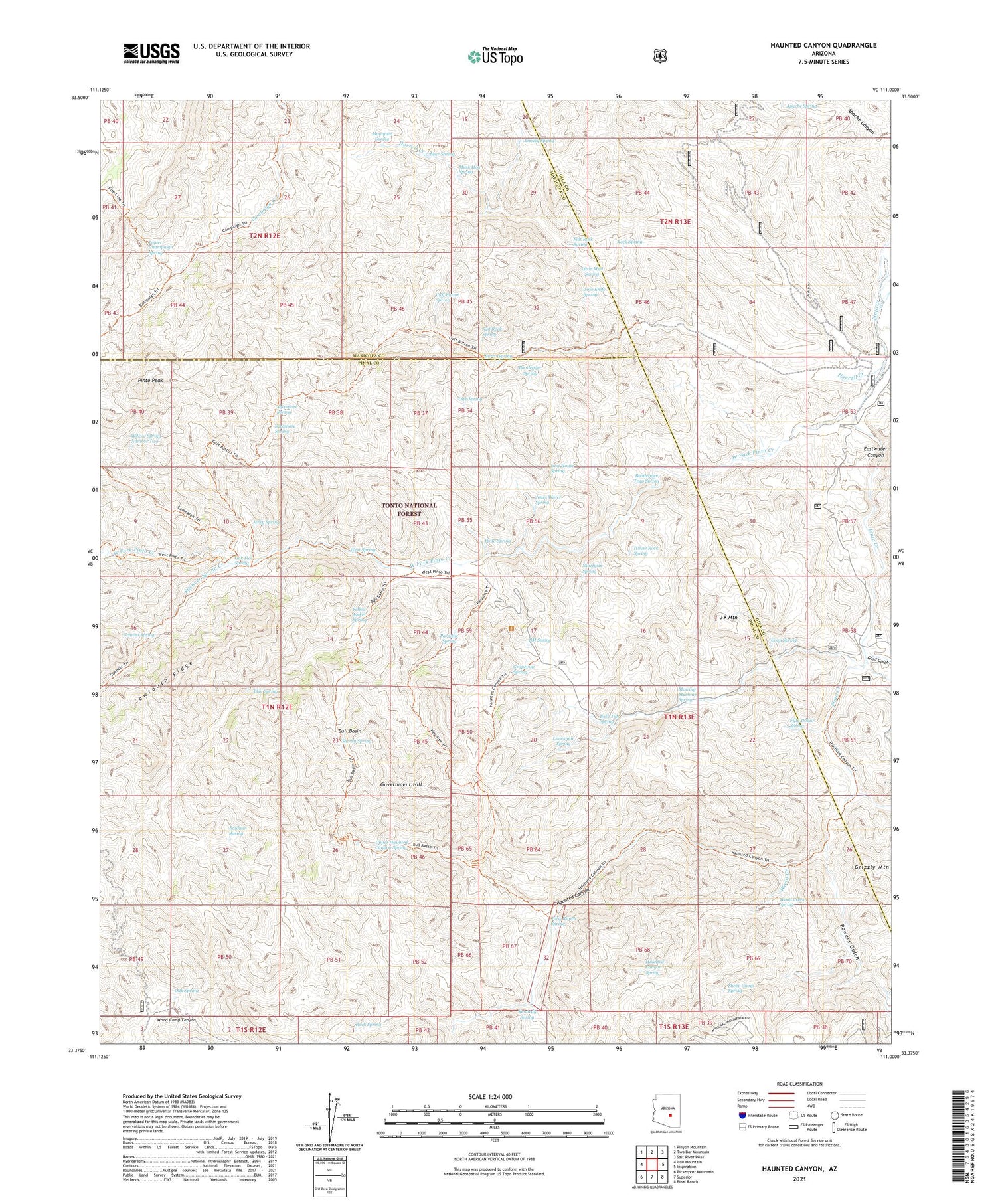
Haunted Canyon Arizona US Topo Map
Couldn't load pickup availability
Also explore the Haunted Canyon Forest Service Topo of this same quad for updated USFS data
2021 topographic map quadrangle Haunted Canyon in the state of Arizona. Scale: 1:24000. Based on the newly updated USGS 7.5' US Topo map series, this map is in the following counties: Pinal, Gila, Maricopa. The map contains contour data, water features, and other items you are used to seeing on USGS maps, but also has updated roads and other features. This is the next generation of topographic maps. Printed on high-quality waterproof paper with UV fade-resistant inks.
Quads adjacent to this one:
West: Iron Mountain
Northwest: Pinyon Mountain
North: Two Bar Mountain
Northeast: Salt River Peak
East: Inspiration
Southeast: Pinal Ranch
South: Superior
Southwest: Picketpost Mountain
This map covers the same area as the classic USGS quad with code o33111d1.
Contains the following named places: Apache Spring, Baldwin Spring, Bath Tub Spring, Bear Spring, Bear Thicket Creek, Blue Spring, BM Spring, Bootlegger Spring, Bootlegger Trap Spring, Brushy Spring, Bull Basin, Burro Spring, Case Knife Spring, Cement Spring, Coon Spring, Cuff Button Spring, Eastwater Canyon, Fifty Dollar Spring, Flat Rock Spring, Gold Gulch, Government Hill, Grapevine Spring, Haunted Canyon, Haunted Canyon Spring, Horrell Creek, House Rock Spring, Iron House Spring, J K Mountain, Jerky Spring, Jones Water Spring, Kennedy Ranch, Kennedy Spring, Limestone Spring, Little Mud Spring, Little Well, Lower Champaign Spring, Miles Ranch Trailhead, Mountain Spring, Mowing Machine Spring, Musk Hog Spring, Ninetysix Spring, Oak Flat Spring, Oak Spring, Paradise Spring, Pinto Peak, Pinto Spring, Powers Gulch, Red Rock Spring, Rock Creek, Rock Spring, Sawtooth Ridge, Sheep Camp Spring, Sherry Spring, Spencer Spring Creek, Sycamore Spring, Tony Ranch, Tony Ranch Spring, Upper Haunted Canyon Spring, West Fork Pinto Creek, West Spring, Willow Spring Number Two, Wood Creek, Wood Creek Spring, Yellow Jacket Spring