
MyTopo
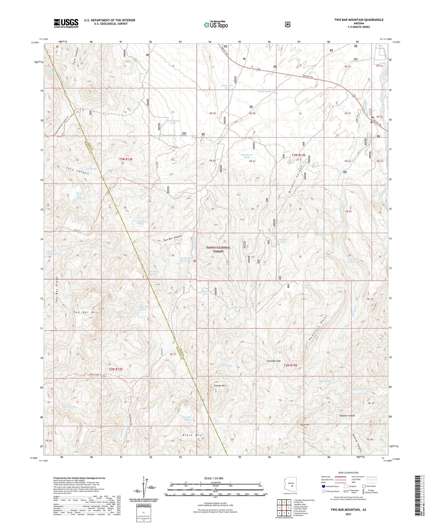
Two Bar Mountain Arizona US Topo Map
Couldn't load pickup availability
Also explore the Two Bar Mountain Forest Service Topo of this same quad for updated USFS data
2021 topographic map quadrangle Two Bar Mountain in the state of Arizona. Scale: 1:24000. Based on the newly updated USGS 7.5' US Topo map series, this map is in the following counties: Gila, Maricopa. The map contains contour data, water features, and other items you are used to seeing on USGS maps, but also has updated roads and other features. This is the next generation of topographic maps. Printed on high-quality waterproof paper with UV fade-resistant inks.
Quads adjacent to this one:
West: Pinyon Mountain
Northwest: Theodore Roosevelt Dam
North: Windy Hill
Northeast: Meddler Wash
East: Salt River Peak
Southeast: Inspiration
South: Haunted Canyon
Southwest: Iron Mountain
This map covers the same area as the classic USGS quad with code o33111e1.
Contains the following named places: Apache Hill, Black Brush Ranch, Black Mountain, Blackberry Spring, Bobcat Tank Number Two, Brushy Basin Spring, Bull Canyon Spring, Campaign Creek, Campaign Well, Cane Spring, Cedar Spring, Centipede Spring, Charlie Tank, Cholla Tank, Cottonwood Spring, Cross P Ranch, Double Corral Trough, East Tank, Gans Hole Spring, Granite Mountain, Granite Tank, Gunsight Gap, Hackberry Spring, Henderson Tank, Horrell Ranch, Horrell Spring, Lily Hole Spring, Lower H N Trough, Monkey Spring, Mud Spring, Nonesuch Rocks, Nonesuch Spring, Reavis Gap, Roosevelt Lake Estates, Roosevelt Post Office, Schoolhouse Tank, Spring Creek, Spring Creek Ranch, Substitute Tank, Swede Spring, Tonto Basin Fire District Station 6, Top Tank, Tule Canyon, Tule Spring, Tule Tank, Two Bar Canyon, Two Bar Mountain, Two Bar Ranch, Upper Horrell, Upper Two Bar Spring, Wildcat Canyon, Willow Spring


