MyTopo
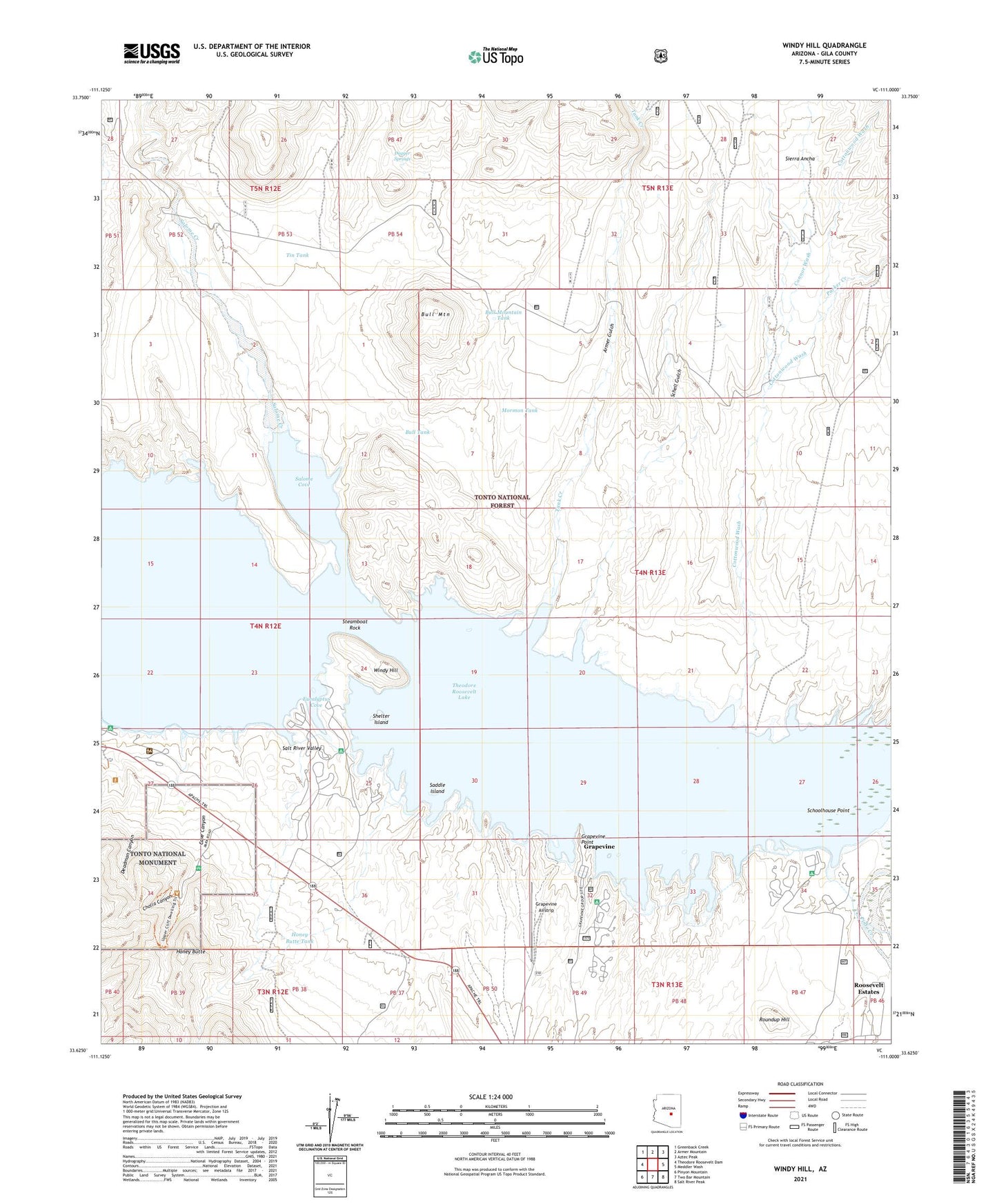
Windy Hill Arizona US Topo Map
Couldn't load pickup availability
Also explore the Windy Hill Forest Service Topo of this same quad for updated USFS data
2021 topographic map quadrangle Windy Hill in the state of Arizona. Scale: 1:24000. Based on the newly updated USGS 7.5' US Topo map series, this map is in the following counties: Gila. The map contains contour data, water features, and other items you are used to seeing on USGS maps, but also has updated roads and other features. This is the next generation of topographic maps. Printed on high-quality waterproof paper with UV fade-resistant inks.
Quads adjacent to this one:
West: Theodore Roosevelt Dam
Northwest: Greenback Creek
North: Armer Mountain
Northeast: Aztec Peak
East: Meddler Wash
Southeast: Salt River Peak
South: Two Bar Mountain
Southwest: Pinyon Mountain
This map covers the same area as the classic USGS quad with code o33111f1.
Contains the following named places: Aconye Ridge, Armer Gulch, Bell Plaza Shopping Center, Black Hills Study Plot, Bull Mountain, Bull Mountain Tank, Bull Tank, Cave Canyon, Cholla Canyon, Connor Wash, Cottonwood Wash, Dagger Springs, Dagger Wash, Deadman Canyon, Eucalyptus Cove, Frazier Substation, Grapevine, Grapevine Airstrip, Grapevine Point, Hat Ranch, Honey Butte, Honey Butte Tank, Honey Butte Well, Jack Shoe Ranch, Mormon Tank, Owlhead, Parker Creek, Porter Spring Recreation Site, Roosevelt Estates, Roundup Hill, Saddle Island, Salome Cove, Salt River Bird Reservation, Schell Gulch, Schoolhouse Campground, Schoolhouse Point, Schoolhouse Recreation Site, Schoolhouse Wash, Shelter Island, Steamboat Rock, Tank Creek, Theodore Roosevelt Lake, Tin Tank, Tonto, Tonto National Monument, Tonto National Monument Headquarters, Tonto Ranger Station Heliport, Windy Hill, Windy Hill Boat Ramp, Windy Hill Camp, Windy Hill Recreation Site