MyTopo
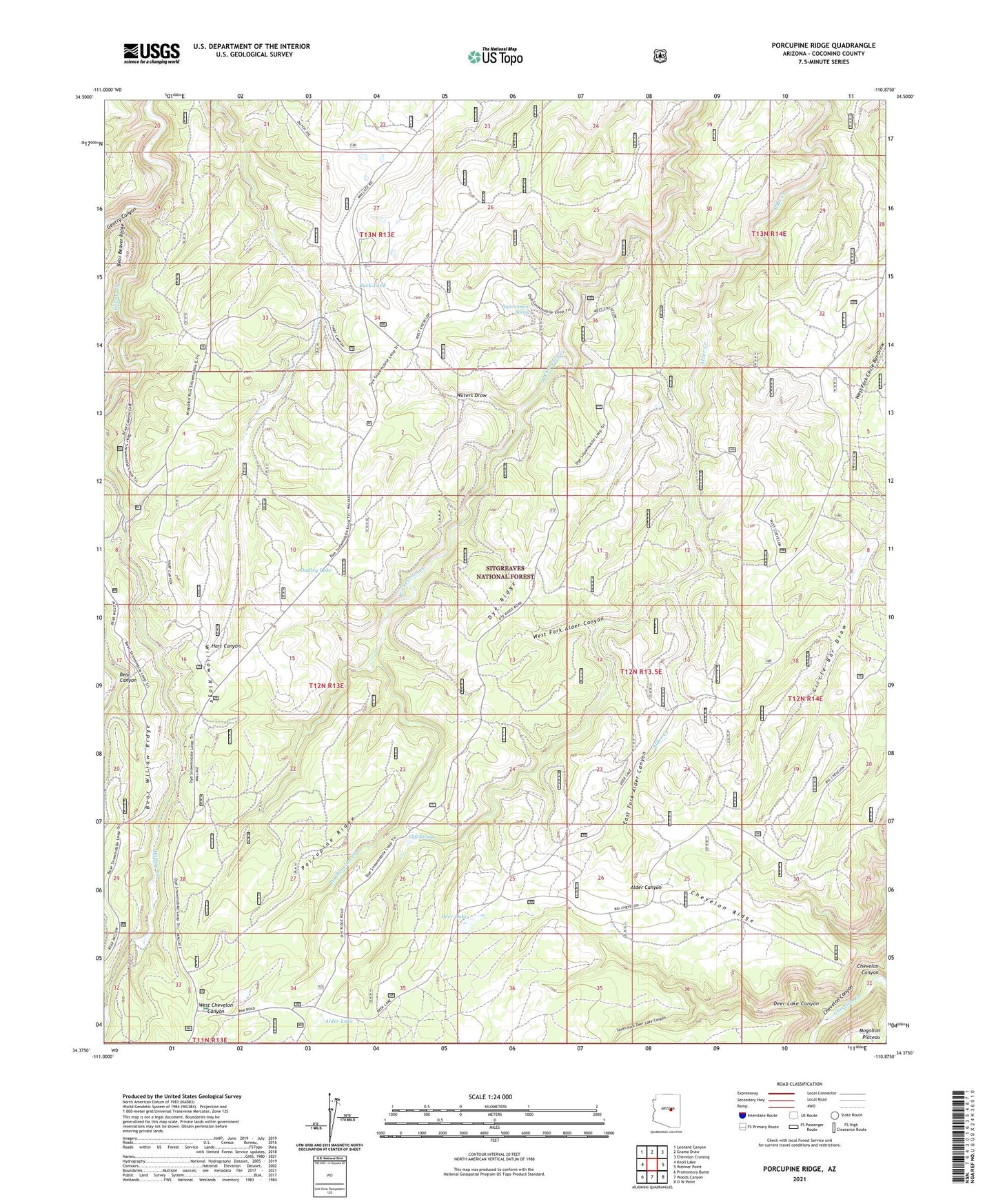
Porcupine Ridge Arizona US Topo Map
Couldn't load pickup availability
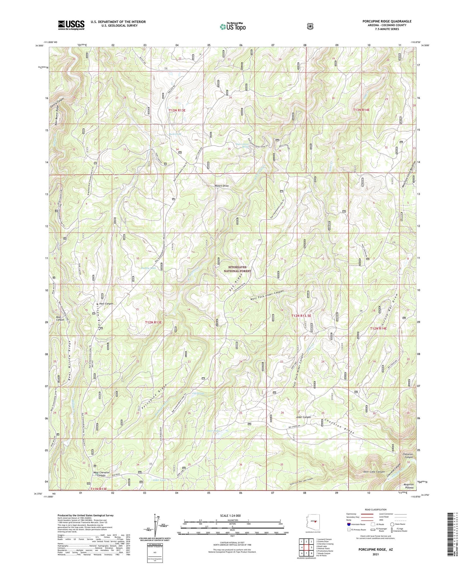
Also explore the Porcupine Ridge Forest Service Topo of this same quad for updated USFS data
2021 topographic map quadrangle Porcupine Ridge in the state of Arizona. Scale: 1:24000. Based on the newly updated USGS 7.5' US Topo map series, this map is in the following counties: Coconino. The map contains contour data, water features, and other items you are used to seeing on USGS maps, but also has updated roads and other features. This is the next generation of topographic maps. Printed on high-quality waterproof paper with UV fade-resistant inks.
Quads adjacent to this one:
West: Knoll Lake
Northwest: Leonard Canyon
North: Grama Draw
Northeast: Chevelon Crossing
East: Weimer Point
Southeast: O W Point
South: Woods Canyon
Southwest: Promontory Butte
This map covers the same area as the classic USGS quad with code o34110d8.
Contains the following named places: Alder Lake, Barts Crossing, Bennett Butler Tank, Buck Tank, Chevelon Ridge, Cliff Springs, Deer Lake, Deer Lake Canyon, Dudley Lake, Duran Ranch, Dutch Joe Lookout, Dutch Joe Ranch, Dye Ranch, Dye Ridge, East Fork Alder Canyon, Fivemile Lake, Gentry Canyon, Horse Tank, Mesa Ives Camp, Nagel Logging Camp, Pauls Crossing, Porcupine Ridge, Rancho Alegro, South Fork Deer Lake Canyon, Vincent Ranch, Waters Draw, Waters Draw Spring, West Fork Alder Canyon, Willow Ridge, Wolfe Ranch