MyTopo
Promontory Butte Arizona US Topo Map
Couldn't load pickup availability
Also explore the Promontory Butte Forest Service Topo of this same quad for updated USFS data
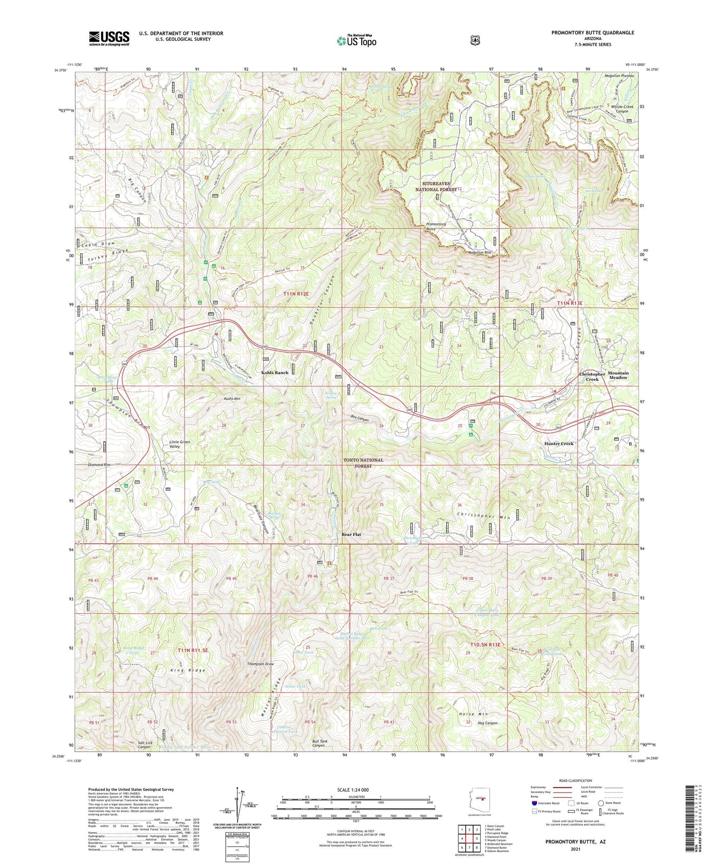
2021 topographic map quadrangle Promontory Butte in the state of Arizona. Scale: 1:24000. Based on the newly updated USGS 7.5' US Topo map series, this map is in the following counties: Gila, Coconino. The map contains contour data, water features, and other items you are used to seeing on USGS maps, but also has updated roads and other features. This is the next generation of topographic maps. Printed on high-quality waterproof paper with UV fade-resistant inks.
Quads adjacent to this one:
West: Diamond Point
Northwest: Dane Canyon
North: Knoll Lake
Northeast: Porcupine Ridge
East: Woods Canyon
Southeast: Oxbow Mountain
South: Diamond Butte
Southwest: McDonald Mountain
This map covers the same area as the classic USGS quad with code o34111c1.
Contains the following named places: Bear Flat, Bear Flat Campground, Bear Flat Census Designated Place, Bear Flat Pleasant Valley Trail, Bear Flat Trail Tank, Bearhide Canyon, Bearhide Spring, Big Canyon, Bootleg Spring, Box Canyon, Boy Scout Camp, Boy Tank, Bull Tank, Bush Cabin, Cabin Draw, Cabin Tank, Camp Tontozona, Christopher Creek, Christopher Creek Campground, Christopher Creek Census Designated Place, Christopher Kohl's Fire Department Christopher Creek Station 51, Christopher Kohl's Fire Department Kohl's Ranch Station 52, Christopher Tank, Derrick Trail, Dick Williams Creek, Doubtful Canyon, East Fork Horton Creek, Herman Spring, Horse Mountain, Horse Pasture Tank, Horton Campground, Horton Creek, Horton Creek Trail, Horton Picnic Area, Horton Spring, Hunter Creek, Hunter Creek Census Designated Place, Hunter Creek Ranch, Indian Gardens Administrative Site, King Ridge, King Ridge Tank, King Tank Number Three, Kohls Ranch, Kohls Ranch Census Designated Place, Kohls Ranch Post Office, Kushs Mountain, Mescal Ridge, Mescal Ridge Tank Number One, Mescal Ridge Tank Number Two, Mountain Meadow, Mountain Meadows, Nappa Spring, Ponderosa Campground, Ponderosa Group Campground, Promontory Butte, Promontory Trailhead, R Bar C Scout Ranch, Schoolhouse Tank, Scout Tank, See Canyon, See Canyon Summer Homes, See Canyon Trailhead, See Spring, Spring Creek, Spring Group Campground, Thompson Draw, Thompson Draw Summer Homes Unit One, Thompson Draw Summer Homes Unit Two, Tonto Creek Campground, Tonto Estate, Twenty Tank, Upper Bull Canyon Tank, Upper Tonto Creek Campground, Winters Ranch, Wipala Wiki Ranch