MyTopo
Diamond Butte Arizona US Topo Map
Couldn't load pickup availability
Also explore the Diamond Butte Forest Service Topo of this same quad for updated USFS data
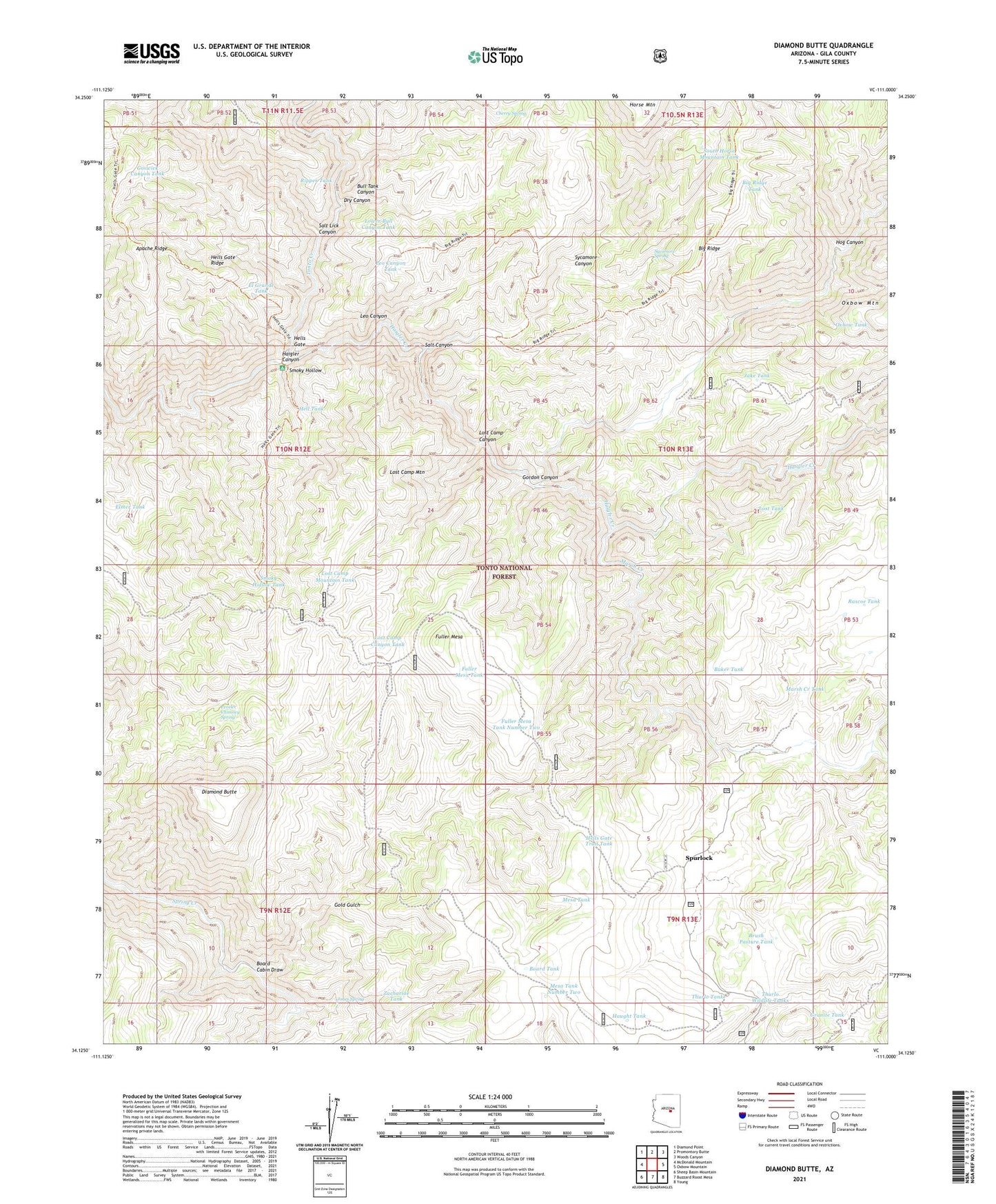
2021 topographic map quadrangle Diamond Butte in the state of Arizona. Scale: 1:24000. Based on the newly updated USGS 7.5' US Topo map series, this map is in the following counties: Gila. The map contains contour data, water features, and other items you are used to seeing on USGS maps, but also has updated roads and other features. This is the next generation of topographic maps. Printed on high-quality waterproof paper with UV fade-resistant inks.
Quads adjacent to this one:
West: McDonald Mountain
Northwest: Diamond Point
North: Promontory Butte
Northeast: Woods Canyon
East: Oxbow Mountain
Southeast: Young
South: Buzzard Roost Mesa
Southwest: Sheep Basin Mountain
This map covers the same area as the classic USGS quad with code o34111b1.
Contains the following named places: Apache Ridge, Baker Tank, Big Ridge, Big Ridge Tank, Board Cabin Draw, Board Tank, Brush Pasture Tank, Bull Tank Canyon, Cherry Spring, Diamond Butte, Dry Canyon, El Grande Tank, Ellinwood Ranch, Ellison Mine, Elmer Tank, Fuller Mesa, Fuller Mesa Tank, Fuller Mesa Tank Number Two, Gold Gulch, Gordon Canyon, Goswick Canyon Tank, Granite Tank, Haigler Canyon, Haigler Creek, Haught Tank, Hell Tank, Hells Gate, Hells Gate Ridge, Hells Gate Trail Tank, Hog Canyon, Jake Tank, Jones Spring, Joy Cabin, Leo Canyon, Leo Canyon Tank, Lost Camp Canyon, Lost Camp Canyon Tank, Lost Camp Mountain, Lost Camp Mountain Tank, Lost Tank, Lower Bull Canyon Tank, Marsh Creek, Marsh Creek Ranch, Marsh Creek Tank, Mesa Tank Number Two, Oxbow Tank, Peveler Chimney Spring, Rascoe Tank, Ripper Tank, Salt Canyon, Salt Lick Canyon, Smoky Hollow, Smoky Hollow Tank, South Horse Mountain Tank, Spurlock, Sycamore Canyon, Sycamore Spring, Thurlo Tank, Thurlo Wildlife Tanks, Winter Camp, Winter Camp Well, Zachariae Tank