
MyTopo
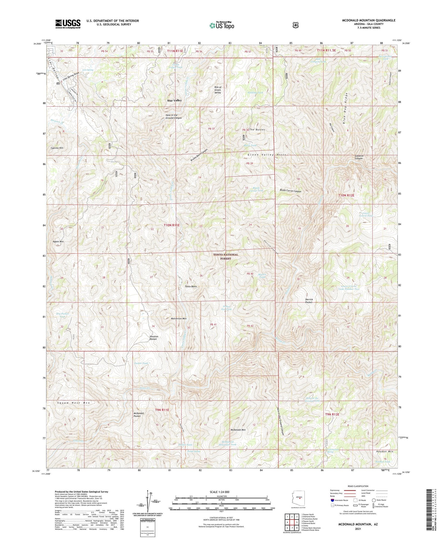
McDonald Mountain Arizona US Topo Map
Couldn't load pickup availability
Also explore the McDonald Mountain Forest Service Topo of this same quad for updated USFS data
2023 topographic map quadrangle McDonald Mountain in the state of Arizona. Scale: 1:24000. Based on the newly updated USGS 7.5' US Topo map series, this map is in the following counties: Gila. The map contains contour data, water features, and other items you are used to seeing on USGS maps, but also has updated roads and other features. This is the next generation of topographic maps. Printed on high-quality waterproof paper with UV fade-resistant inks.
Quads adjacent to this one:
West: Payson South
Northwest: Payson North
North: Diamond Point
Northeast: Promontory Butte
East: Diamond Butte
Southeast: Buzzard Roost Mesa
South: Sheep Basin Mountain
Southwest: Gisela
This map covers the same area as the classic USGS quad with code o34111b2.
Contains the following named places: Agate Mountain, Big Canyon, Blue Dog Ridge, Brush Corral Canyon, Brush Corral Tank, Brushy Basin Canyon, Butte Tank, Cottonwood Spring, Cottonwood Tank, Cypress Hill, Derrick Canyon, Derrick Pocket, Dry Pocket Tank, Dry Pocket Wash, Goswick Canyon, Green Valley Creek, Green Valley Tank, Hellsgate Wilderness, Holding Tank, Hole in the Ground Canyon, Hole in the Ground Tank, Houston Pocket, Lion Spring, Lion Spring Draw, Lower Corral, Lower Corral Tank, Lower Corral Tank Number Two, Martin Tank, McDonald Mountain, McDonald Mountain Tank, McDonald Pocket, Neal Cabin, Needed Tank, Number One Dam, Old Rock House, Picket Pen Tank, Pocket Spring, Pocket Tank, Power Line Tank, Rim of Green Valley, Soldier Camp Creek, Spring Creek, Squaw Nest Mountain, Stewart Creek, Still Canyon Tank, Sweetwater Tank, The Buttes, Wolverton Mountain


