MyTopo
Russell Spring Arizona US Topo Map
Couldn't load pickup availability
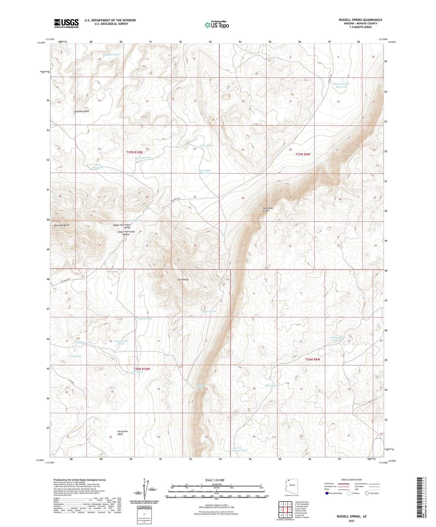
2021 topographic map quadrangle Russell Spring in the state of Arizona. Scale: 1:24000. Based on the newly updated USGS 7.5' US Topo map series, this map is in the following counties: Mohave. The map contains contour data, water features, and other items you are used to seeing on USGS maps, but also has updated roads and other features. This is the next generation of topographic maps. Printed on high-quality waterproof paper with UV fade-resistant inks.
Quads adjacent to this one:
West: Little Tanks
Northwest: Dutchman Draw
North: The Grandstand
Northeast: Antelope Knoll
East: Moriah Knoll
Southeast: Mount Trumbull
South: Jones Hill
Southwest: Poverty Knoll
This map covers the same area as the classic USGS quad with code o36113e3.
Contains the following named places: Big D Reservoir, Carroll Catchment Tank, Chic Pond, Childers Well, Diamond Butte, D-Six Pond, Ferg Pond, Guaranteed Pond, Gyp Reservoir, Hidden Tank, Iverson Detention Dam, J W Spendlove Reservoir, Keller Pond, McCullan Reservoir, Russell Spring, Salt Pond, Sheep Pockets Reservoir, Sheep Pockets Trough, Sugar Pond, Sunshine Tank, Twin Butte, Upper Hurricane Valley, Woody Pond