MyTopo
Sheep Basin Mountain Arizona US Topo Map
Couldn't load pickup availability
Also explore the Sheep Basin Mountain Forest Service Topo of this same quad for updated USFS data
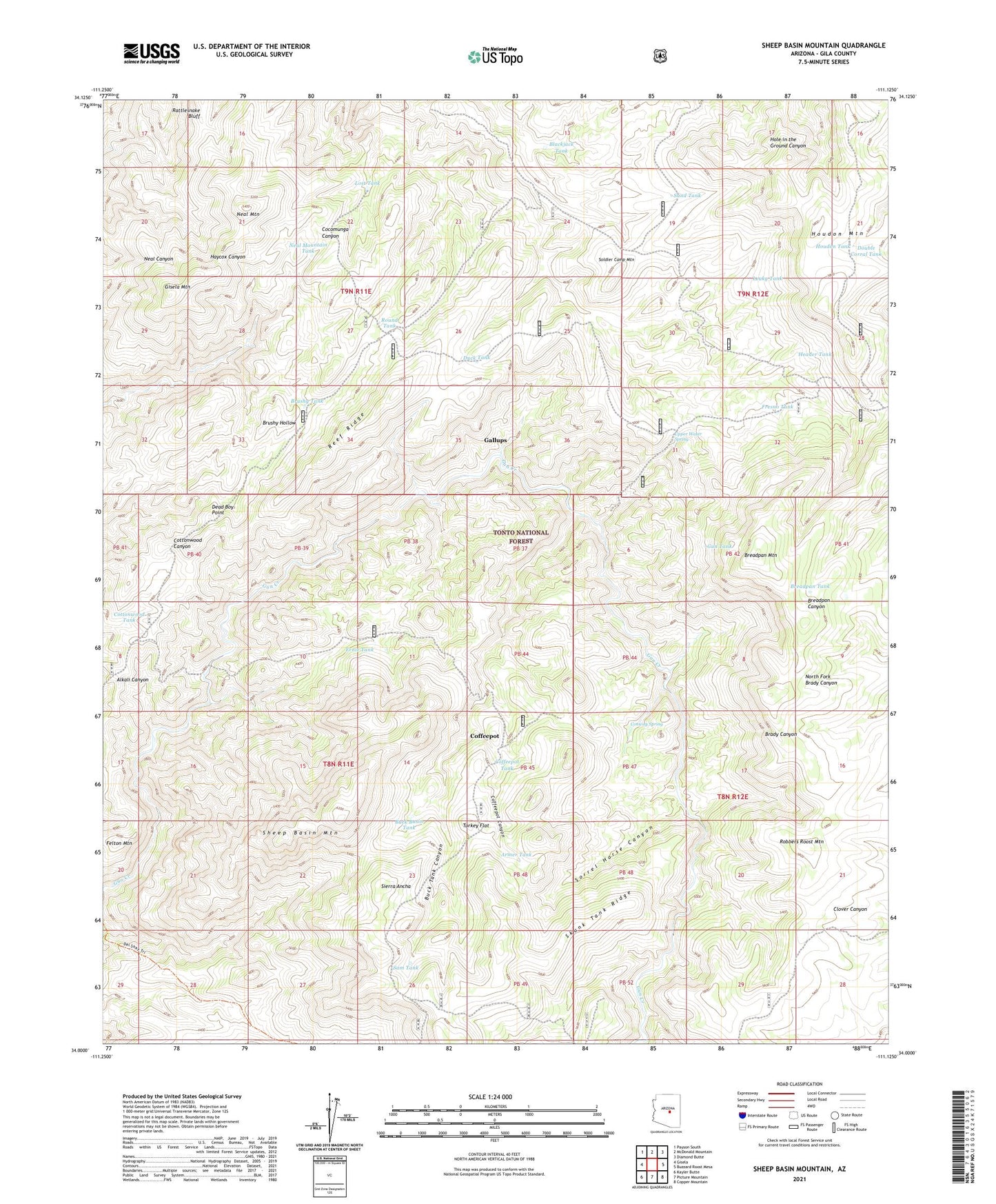
2021 topographic map quadrangle Sheep Basin Mountain in the state of Arizona. Scale: 1:24000. Based on the newly updated USGS 7.5' US Topo map series, this map is in the following counties: Gila. The map contains contour data, water features, and other items you are used to seeing on USGS maps, but also has updated roads and other features. This is the next generation of topographic maps. Printed on high-quality waterproof paper with UV fade-resistant inks.
Quads adjacent to this one:
West: Gisela
Northwest: Payson South
North: McDonald Mountain
Northeast: Diamond Butte
East: Buzzard Roost Mesa
Southeast: Copper Mountain
South: Picture Mountain
Southwest: Kayler Butte
This map covers the same area as the classic USGS quad with code o34111a2.
Contains the following named places: Armer Tank, Blackjack Tank, Breadpan Mountain, Breadpan Tank, Brushy Hollow Tank, Brushy Tank, Buck Basin Tank, Buck Tank Canyon, Coffeepot, Coffeepot Canyon, Coffeepot Tank, Conway Corral, Conway Spring, Cottonwood Tank, Dead Boy Point, Del Shay Trail, Double Corral Tank, Duck Tank, Ernie Tank, Felton Mountain, Fred Pranty Cabin, Fresno Tank, Gallups, Gisela Mountain, Gun Creek Corral, Gun Tank, Header Tank, Houdon Mountain, Houdon Tank, KRMM-FM (Payson), Leaky Tank, Lost Tank, Neal Mountain, Neal Mountain Tank, Neal Tank Number Two, Old Mail Trail, Pigeon Creek, Pigeon Tank, Rattlesnake Bluff, Reef Ridge, Robbers Roost Mountain, Round Tank, Sam Tank, Sand Tank, Sheep Basin Mountain, Skunk Tank Ridge, Soldier Camp, Soldier Camp Mountain, Sorrel Horse Canyon, Turkey Flat, Upper Water Spring