MyTopo
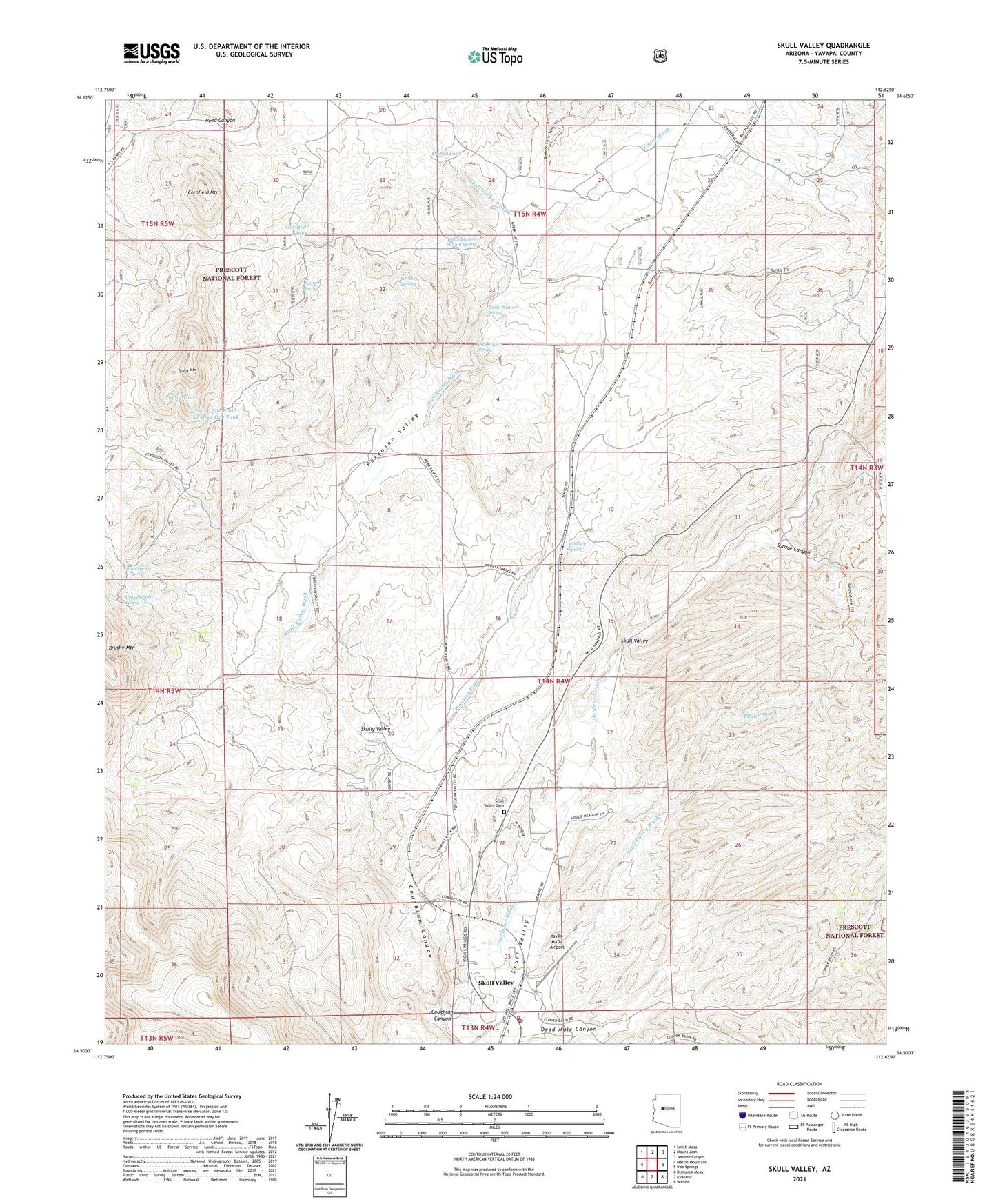
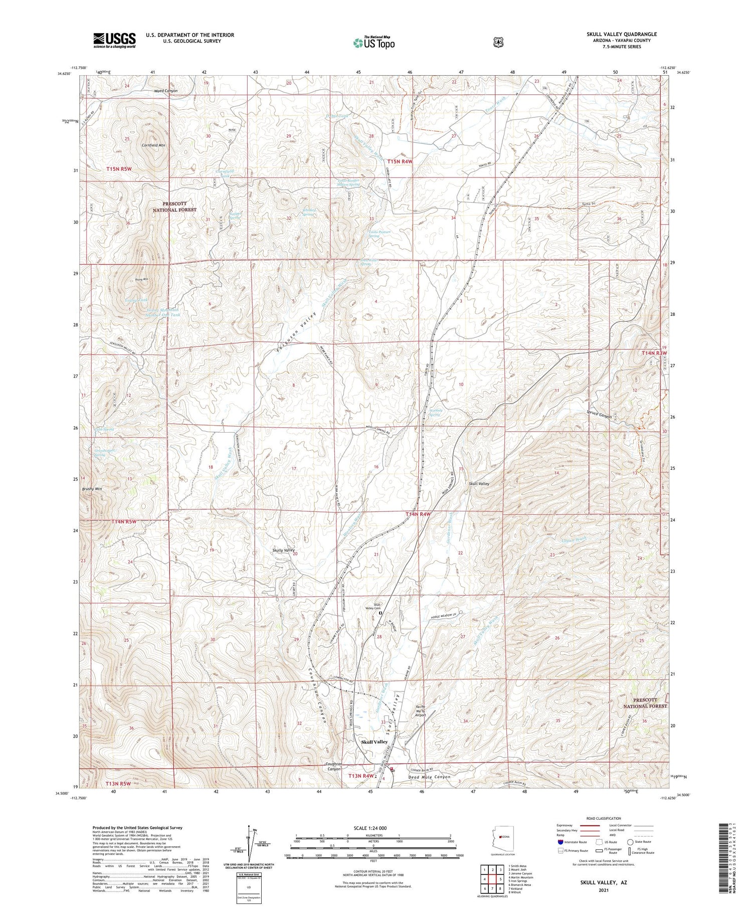
Skull Valley Arizona US Topo Map
Couldn't load pickup availability
Also explore the Skull Valley Forest Service Topo of this same quad for updated USFS data
2021 topographic map quadrangle Skull Valley in the state of Arizona. Scale: 1:24000. Based on the newly updated USGS 7.5' US Topo map series, this map is in the following counties: Yavapai. The map contains contour data, water features, and other items you are used to seeing on USGS maps, but also has updated roads and other features. This is the next generation of topographic maps. Printed on high-quality waterproof paper with UV fade-resistant inks.
Quads adjacent to this one:
West: Martin Mountain
Northwest: Smith Mesa
North: Mount Josh
Northeast: Jerome Canyon
East: Iron Springs
Southeast: Wilhoit
South: Kirkland
Southwest: Bismarck Mesa
This map covers the same area as the classic USGS quad with code o34112e6.
Contains the following named places: Bar U Bar Ranch, Burnt Wash, Contreras Ranch, Cornfield Mountain, Cornfield Tank, Coughran Canyon, D One Tank, Dead Mule Canyon, Ferguson Valley, Gardener Wash, Goat Camp, Gold Star Mine, Grasshopper Spring, Juniper Spring, Logan Wash, Old Poley Ranch, Poley Ranch, Shea Water Spring, Skull Valley, Skull Valley Cemetery, Skull Valley Elementary School, Skull Valley Post Office, Skull Valley Wash, Skully Valley, Spruce Canyon, Tonto Pasture Spring, Tonto Ranger Station Spring, Tonto Springs Ranger Station, Tonto Tank, Tonto Wash, Tubb Spring, Whiskey Spring, Woolsey Spring, Woolsey Wash, Yav'Pe Ma'Ta Airport, Young Mountain, Young Mountain Number One Tank, Young Tank