
MyTopo
Martin Mountain Arizona US Topo Map
Couldn't load pickup availability
Also explore the Martin Mountain Forest Service Topo of this same quad for updated USFS data
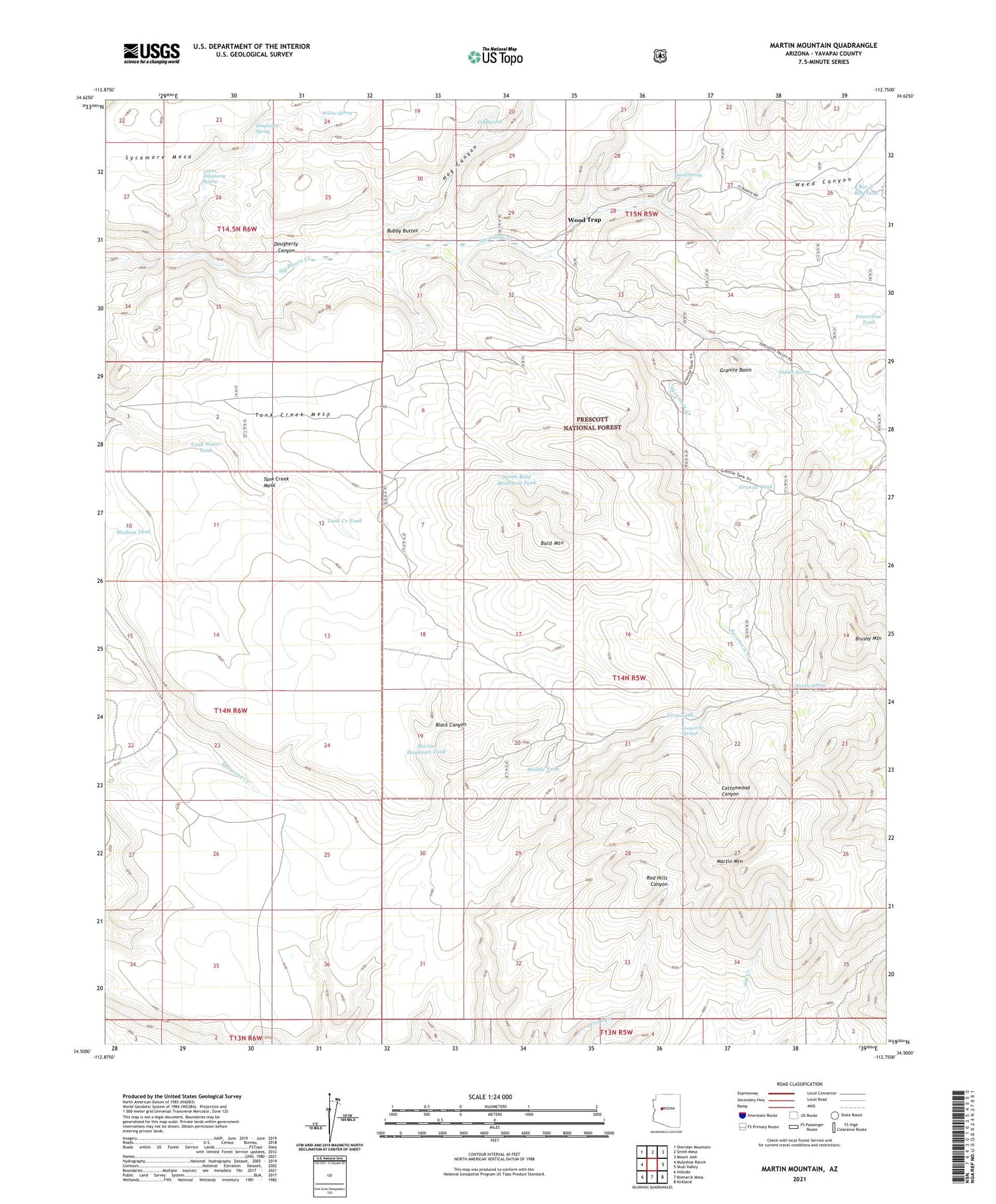
2021 topographic map quadrangle Martin Mountain in the state of Arizona. Scale: 1:24000. Based on the newly updated USGS 7.5' US Topo map series, this map is in the following counties: Yavapai. The map contains contour data, water features, and other items you are used to seeing on USGS maps, but also has updated roads and other features. This is the next generation of topographic maps. Printed on high-quality waterproof paper with UV fade-resistant inks.
Quads adjacent to this one:
West: Muleshoe Ranch
Northwest: Sheridan Mountain
North: Smith Mesa
Northeast: Mount Josh
East: Skull Valley
Southeast: Kirkland
South: Bismarck Mesa
Southwest: Hillside
This map covers the same area as the classic USGS quad with code o34112e7.
Contains the following named places: Bald Mountain, Bar U Bar Ranch, Bar U Bar Tank, Brushy Mountain, Brushy Mountain Number 1 Tank, Brushy Mountain Number 2 Tank, Brushy Spring, Bubby Buttes, Dougherty Canyon, Dougherty Spring, Draper Spring, First Tank, Granite Basin, Granite Tank, Grapevine Springs, Hidden Spring, Hog Canyon, Hog Spring, Hudson Tank, Lower Dougherty Spring, Martin Mountain, Martin Mountain Tank, Middle Tank, North Bald Mountain Tank, Powerline Tank, South Bald Mountain Tank, Stevens Tank, Sycamore Corral, Tank Creek Mesa, Tank Creek Tank, Tank Water Tank, Webb Windmill, Weed Canyon, Willow Spring, Wood Spring, Wood Trap, Young Mountain Number Two Tank, ZIP Code: 86338


