MyTopo
Antelope Point Arizona US Topo Map
Couldn't load pickup availability
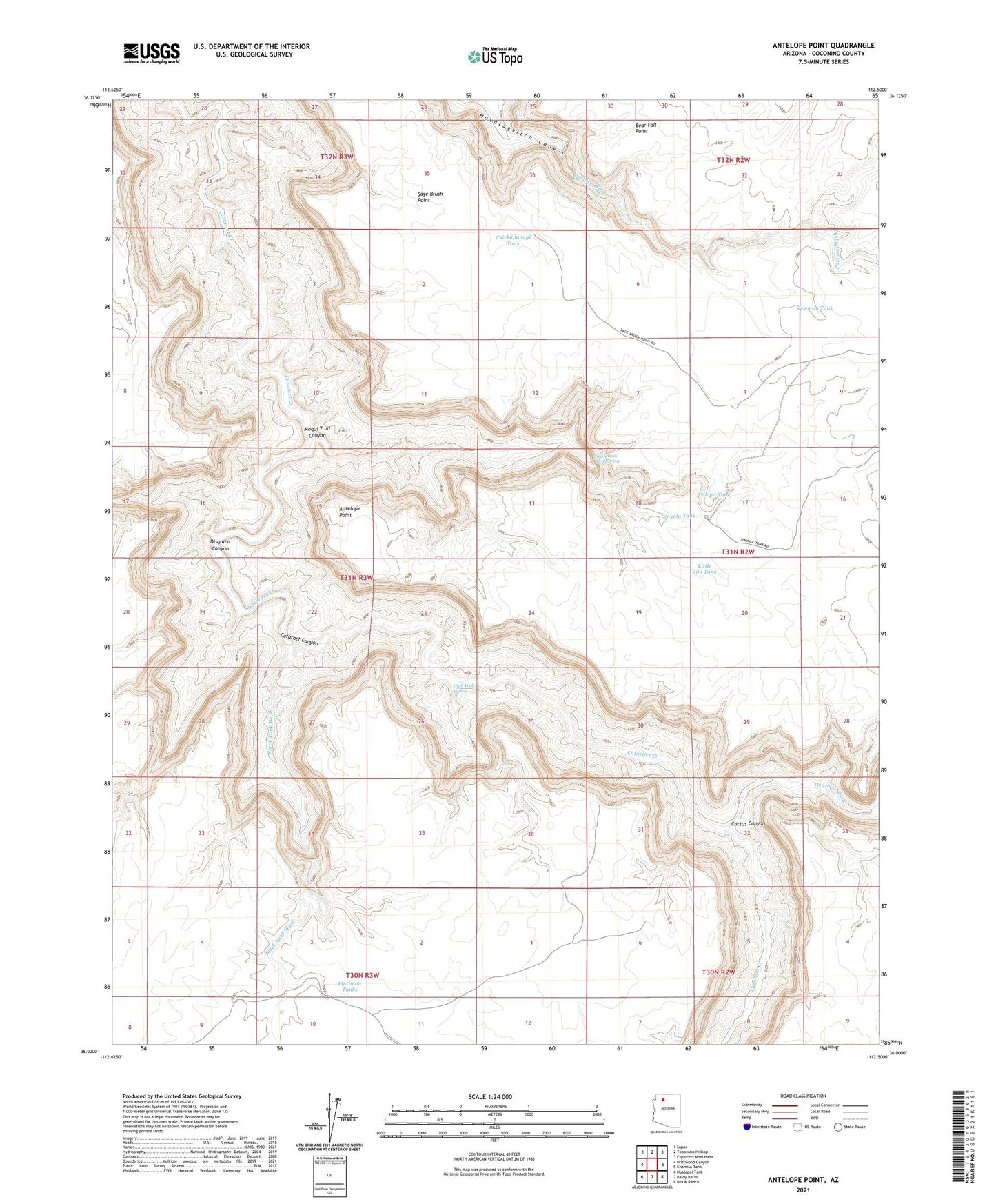
2021 topographic map quadrangle Antelope Point in the state of Arizona. Scale: 1:24000. Based on the newly updated USGS 7.5' US Topo map series, this map is in the following counties: Coconino. The map contains contour data, water features, and other items you are used to seeing on USGS maps, but also has updated roads and other features. This is the next generation of topographic maps. Printed on high-quality waterproof paper with UV fade-resistant inks.
Quads adjacent to this one:
West: Driftwood Canyon
Northwest: Supai
North: Topocoba Hilltop
Northeast: Explorers Monument
East: Chamisa Tank
Southeast: Box K Ranch
South: Baldy Basin
Southwest: Hualapai Tank
This map covers the same area as the classic USGS quad with code o36112a5.
Contains the following named places: Antelope Point, Black Tank Wash, Cactus Canyon, Chickapanagi Tank, Disquiba Canyon, Heather Wash, High Wall Spring, Jwa Qwaw Gwa Spring, Little Jim Tank, Moqui Tank, Moqui Trail Canyon, Newman Tank, Platinum Tanks, Sinyala Tank