MyTopo
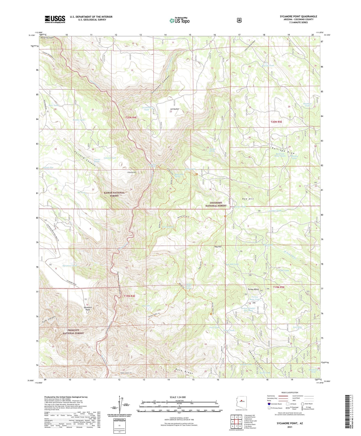
Sycamore Point Arizona US Topo Map
Couldn't load pickup availability
Also explore the Sycamore Point Forest Service Topo of this same quad for updated USFS data
2021 topographic map quadrangle Sycamore Point in the state of Arizona. Scale: 1:24000. Based on the newly updated USGS 7.5' US Topo map series, this map is in the following counties: Coconino. The map contains contour data, water features, and other items you are used to seeing on USGS maps, but also has updated roads and other features. This is the next generation of topographic maps. Printed on high-quality waterproof paper with UV fade-resistant inks.
Quads adjacent to this one:
West: White Horse Lake
Northwest: Davenport Hill
North: Garland Prairie
Northeast: Bellemont
East: Dutton Hill
Southeast: Wilson Mountain
South: Loy Butte
Southwest: Sycamore Basin
This map covers the same area as the classic USGS quad with code o35111a8.
Contains the following named places: Babes Hole Spring, Big Spring Canyon, BT Tank, Buck Ridge, Casner Tank, Colcord Canyon, Colcord Hill, Colcord Spring, Colcord Tank, Corner Tank, Deer Tank, Dorsey Spring, Dorsey Spring Trail, Everett Tank, Flag Tank, Geronimo Spring, Handcock Tank, Hog Hill, Hog Hill Tank, Kelsey Spring, Kelsey Winter Trail, Kennedy Dam, Little L O Spring Canyon, Little Lookout Trail, LO Pocket, LO Pocket Tank, Lost Lake, Mooney Tank, Ott Lake, Power Tank, Railroad Draw, Railroad Draw Tanks, Rankin Tank, Red Hill, Rinehart Tank, Secret Tank, Strahan Spring, Sycamore Point, Sycamore Tank, Taylor Cabin Trail, Thumb Flat, Trail Tank, Tram Tank, Tule Canyon, Turkey Butte, Turkey Butte Tank, Turkey Number Two Tank, Turkey Tank, Volunteer Canyon, Volunteer Wash, Winter Cabin Spring, Winter Cabin Trail