
MyTopo
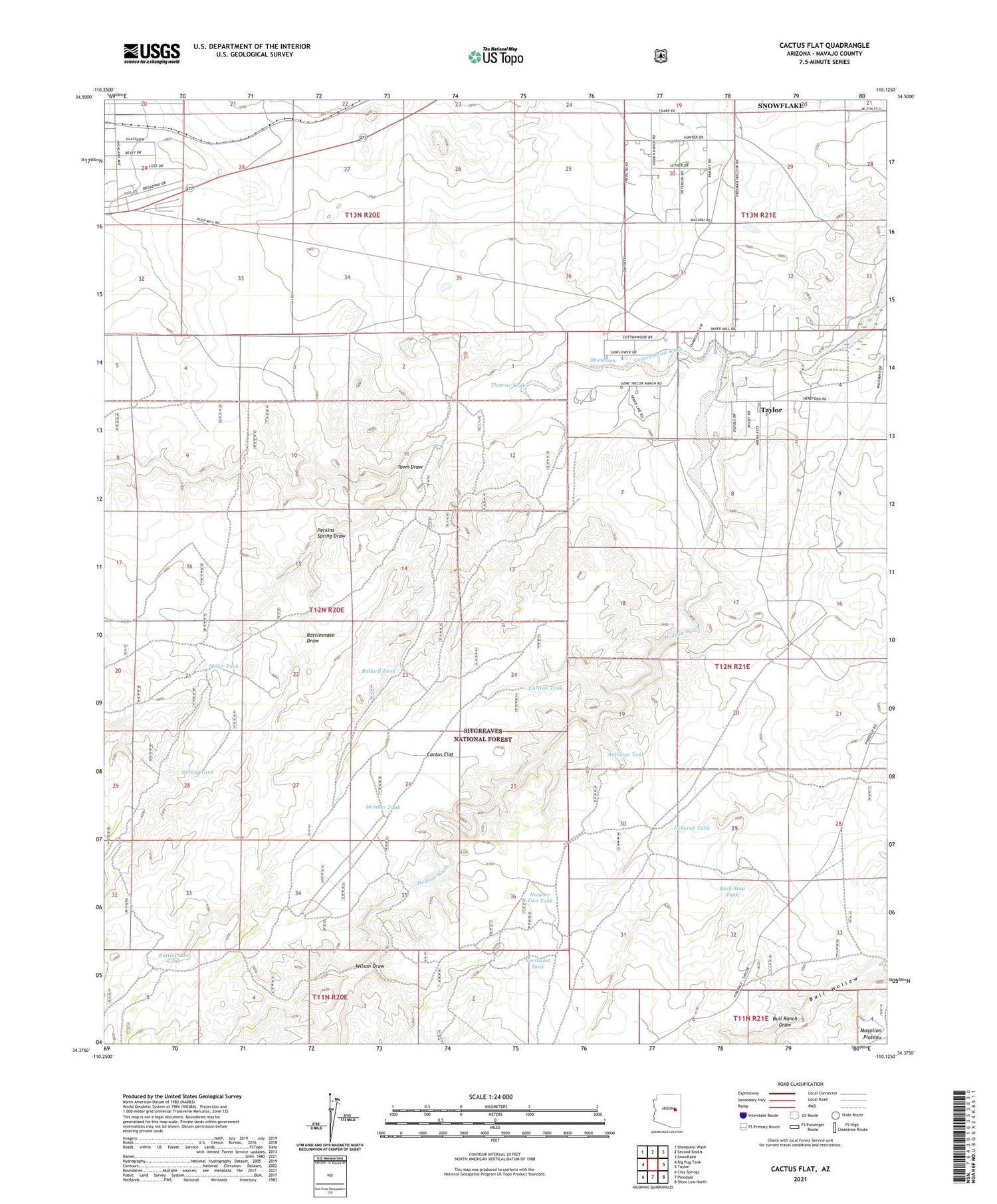
Cactus Flat Arizona US Topo Map
Couldn't load pickup availability
Also explore the Cactus Flat Forest Service Topo of this same quad for updated USFS data
2021 topographic map quadrangle Cactus Flat in the state of Arizona. Scale: 1:24000. Based on the newly updated USGS 7.5' US Topo map series, this map is in the following counties: Navajo. The map contains contour data, water features, and other items you are used to seeing on USGS maps, but also has updated roads and other features. This is the next generation of topographic maps. Printed on high-quality waterproof paper with UV fade-resistant inks.
Quads adjacent to this one:
West: Big Pug Tank
Northwest: Sheepskin Wash
North: Second Knolls
Northeast: Snowflake
East: Taylor
Southeast: Show Low North
South: Pinedale
Southwest: Clay Springs
This map covers the same area as the classic USGS quad with code o34110d2.
Contains the following named places: Antelope Tank, Back Stop Tank, Ballard Tank, Bull Ranch Draw, Cactus Flat, Cactus Flat Windmill, Carlisle Tank, Deborah Tank, Dodson Wash, Drinker Tank, East Well, Linden Windmill, Miller Tank, Mortensen Wash, Northeast Tank, Number Two Tank, Perkins Spring Draw, Rattlesnake Draw, Rattlesnake Tank, Snowflake Division, Spring Tank, Thomas Tank, Thomas Windmill, Town Draw, West Windmill, Wilson Draw


