MyTopo
Parma Arkansas US Topo Map
Couldn't load pickup availability
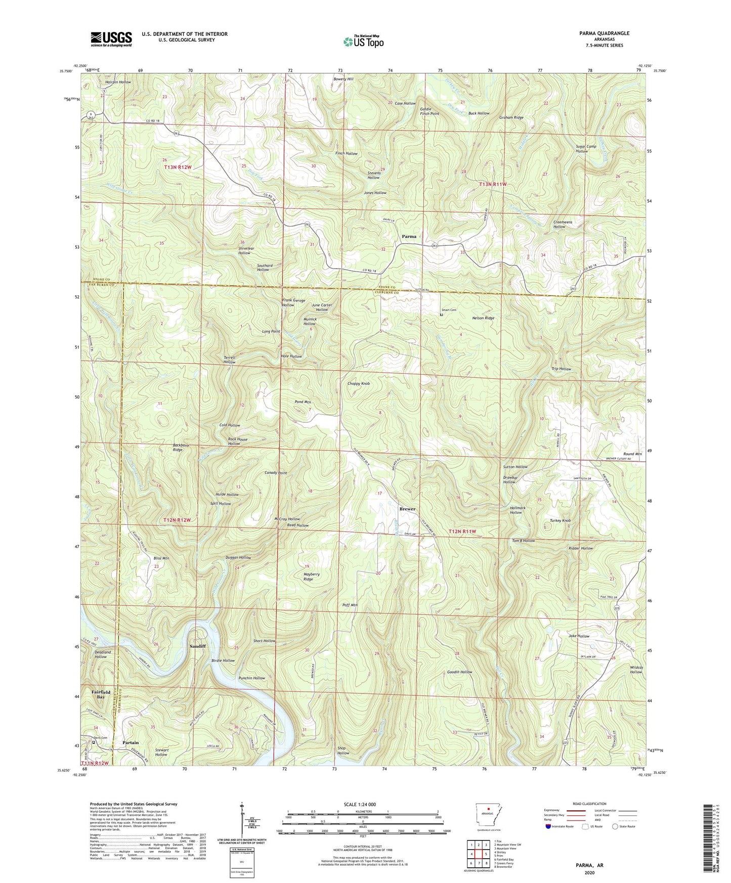
2024 topographic map quadrangle Parma in the state of Arkansas. Scale: 1:24000. Based on the newly updated USGS 7.5' US Topo map series, this map is in the following counties: Cleburne, Stone, Van Buren. The map contains contour data, water features, and other items you are used to seeing on USGS maps, but also has updated roads and other features. This is the next generation of topographic maps. Printed on high-quality waterproof paper with UV fade-resistant inks.
Quads adjacent to this one:
West: Shirley
Northwest: Fox
North: Mountain View SW
Northeast: Mountain View
East: Prim
Southeast: Brownsville
South: Greers Ferry
Southwest: Fairfield Bay
This map covers the same area as the classic USGS quad with code o35092f2.
Contains the following named places: Backbone Ridge, Birdie Hollow, Bliss Mountain, Bowery Hill, Brewer, Brush Creek, Buck Hollow, Canady Point, Case Hollow, Choppy Knob, Cold Hollow, Compton Spring Branch, Creemeens Hollow, Davis Cemetery, Deadland Hollow, Drawbar Hollow, Dry Fork, Duggan Hollow, Finch Hollow, Four Square Church, Frank Geroge Hollow, Goldie Finch Point, Graham Ridge, Gum Spring Branch, Hallmark Hollow, Hole Hollow, Hulde Hollow, Jones Hollow, June Carter Hollow, Kinderhook, Little Wild Goose Creek, Long Point, Mayberry Ridge, McCray Hollow, Middle Creek, Middle Fork Little Red River, Muinick Hollow, Nelson Ridge, Parma, Partain, Poff Mountain, Pond Mountain, Punchin Hollow, Reed Hollow, Ridder Hollow, Rock House Hollow, Round Mountain, Sandiff, Shivelear Hollow, Shop Hollow, Short Hollow, Smart Cemetery, Southard Hollow, Spill Hollow, Stevens Hollow, Sugar Camp Hollow, Sunny Slope, Sunny Slope Baptist Church, Sutton Hollow, Terrell Hollow, Tom B Hollow, Township of Poff, Township of Smart, Township of Sugar Camp, Trip Hollow, Turkey Knob, Wild Goose Creek, ZIP Code: 72044