MyTopo
Cotter SW Arkansas US Topo Map
Couldn't load pickup availability
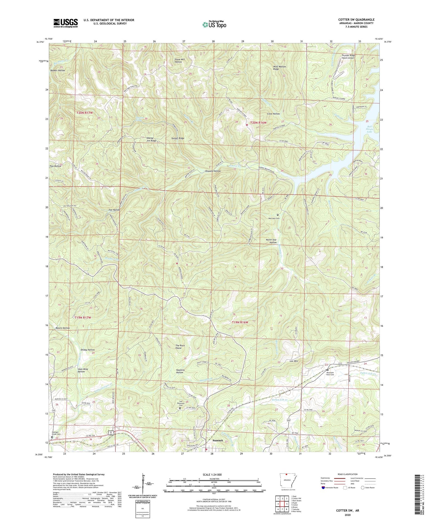
2024 topographic map quadrangle Cotter SW in the state of Arkansas. Scale: 1:24000. Based on the newly updated USGS 7.5' US Topo map series, this map is in the following counties: Marion. The map contains contour data, water features, and other items you are used to seeing on USGS maps, but also has updated roads and other features. This is the next generation of topographic maps. Printed on high-quality waterproof paper with UV fade-resistant inks.
Quads adjacent to this one:
West: Pyatt
Northwest: Peel
North: Cotter NW
Northeast: Bull Shoals
East: Cotter
Southeast: Rea Valley
South: Yellville
Southwest: Bruno
This map covers the same area as the classic USGS quad with code o36092c6.
Contains the following named places: Booker Hollow, Brushy Fork, Cedar Creek, City of Summit, Cove Hollow, Dilday Hollow, Elephant Spring, Erie Ozark Mine, Fee Hollow, Georges Creek Cemetery, Hampton Branch, Hawkins Hollow, Jimmie Creek, Johnnie Creek, KCTT-FM (Yellville), Kingdom Springs, Kingdom Springs School, Lead Drift Mine, Lean Mine Hollow, Lee Mountain, Lee Mountain Cemetery, Little Georges Creek, Lost Bell Mine, Marion County, Mitchell Creek, Moccasin Cemetery, Moccasin Creek, Monkey Hill Mine, Moore Hollow, Mountain View Cemetery, North Star Hollow, Onwata Hollow, Onwata Mine, Pine Mountain Volunteer Fire Department Substation, Sharpy Jim Ridge, Stone, Summit, Summit Fire and Rescue, Summit Station 2, Sunset Ridge, The Rock House, Thunder Ridge Ranch Airport, Township of James Creek, Township of Marion County, Township of Summit, Welcome Ridge Church, Wildcat Creek, Wolf Wallow Ridge, Wolfpen Branch, ZIP Codes: 72677, 72687