MyTopo
Canaan Arkansas US Topo Map
Couldn't load pickup availability
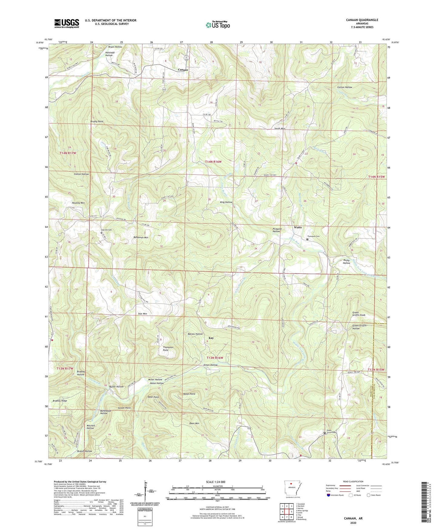
2024 topographic map quadrangle Canaan in the state of Arkansas. Scale: 1:24000. Based on the newly updated USGS 7.5' US Topo map series, this map is in the following counties: Searcy, Van Buren. The map contains contour data, water features, and other items you are used to seeing on USGS maps, but also has updated roads and other features. This is the next generation of topographic maps. Printed on high-quality waterproof paper with UV fade-resistant inks.
Quads adjacent to this one:
West: Witts Springs
Northwest: Snowball
North: Marshall
Northeast: Harriet
East: Leslie
Southeast: Botkinburg
South: Alread
Southwest: Tilly
This map covers the same area as the classic USGS quad with code o35092g6.
Contains the following named places: Ballinger Branch, Barnes Hollow, Bohannon Mountain, Bradley Hollow, Branch Hollow, Brushy Point, Bryan Hollow, Bunkhouse Hollow, Butler Hollow, Canaan, Chimes - Shady Grove Volunteer Fire Department Substation, Cotton Hollow, Crooked Branch, Dean Branch, Dean Mountain, Dean Point, Elmer Hollow, Gower Point, Green Griffin Knob, Hilltop Chapel, Holstead Hollow, Housley Mountain, Kay, King Hollow, KSNE-FM (Marshall), Little Red Creek, Mill Creek, Miller Hollow, Mitchell Hollow, Nolan Hollow, Nolan Point, Oak Hill Cemetery, Oak Hill Church, Picayune Hollow, Rambo Church, Rocky Hollow, Schoolhouse Branch, Shady Grove Cemetery, Shady Grove Church, South Mountain, South Mountain Church, South Mountain Fire Department, Star Mountain, Thompson Cemetery, Thompson Point, Township of Red River, Township of Shady Grove, Truck Wheel Branch, Watts, Welcome Home Fire Department