MyTopo
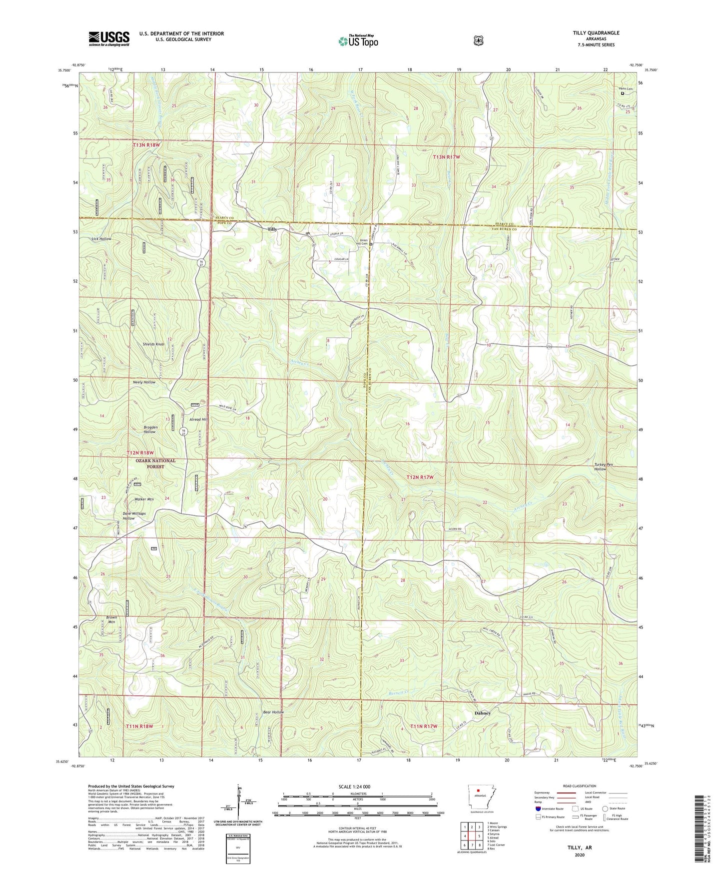
Tilly Arkansas US Topo Map
Couldn't load pickup availability
Also explore the Tilly Forest Service Topo of this same quad for updated USFS data
2024 topographic map quadrangle Tilly in the state of Arkansas. Scale: 1:24000. Based on the newly updated USGS 7.5' US Topo map series, this map is in the following counties: Pope, Van Buren, Searcy. The map contains contour data, water features, and other items you are used to seeing on USGS maps, but also has updated roads and other features. This is the next generation of topographic maps. Printed on high-quality waterproof paper with UV fade-resistant inks.
Quads adjacent to this one:
West: Smyrna
Northwest: Moore
North: Witts Springs
Northeast: Canaan
East: Alread
Southeast: Rex
South: Lost Corner
Southwest: Solo
This map covers the same area as the classic USGS quad with code o35092f7.
Contains the following named places: Alread Hill, Archer Valley School, Archey Valley Church, Bear Hollow, Brown Mountain, Burnett Creek, Cossey School, Dabney, Ella, Lick Hollow, Nogo School, Oak Ridge School, Parks Cemetery, Shields Knob, Tilly, Tilly Missionary Baptist Church, Tilly Post Office, Turkey Pen Hollow, Union Hill Cemetery, Union Hill Church, Union Hill School, Walker Mountain, Zion Hill, Zion Hill Church, Zion Hill School, ZIP Code: 72679