MyTopo
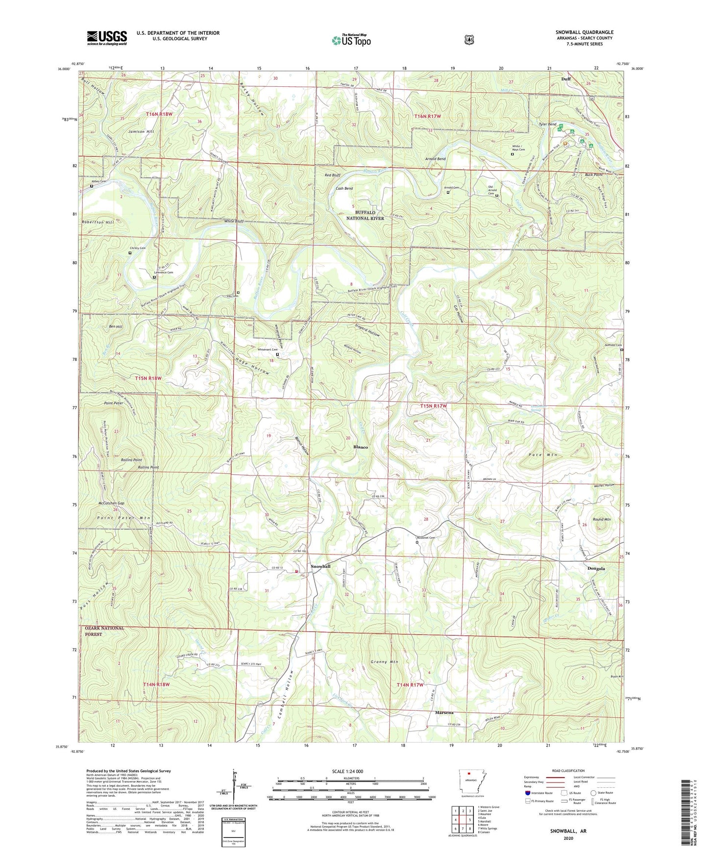
Snowball Arkansas US Topo Map
Couldn't load pickup availability
Also explore the Snowball Forest Service Topo of this same quad for updated USFS data
2024 topographic map quadrangle Snowball in the state of Arkansas. Scale: 1:24000. Based on the newly updated USGS 7.5' US Topo map series, this map is in the following counties: Searcy. The map contains contour data, water features, and other items you are used to seeing on USGS maps, but also has updated roads and other features. This is the next generation of topographic maps. Printed on high-quality waterproof paper with UV fade-resistant inks.
Quads adjacent to this one:
West: Eula
Northwest: Western Grove
North: Saint Joe
Northeast: Maumee
East: Marshall
Southeast: Canaan
South: Witts Springs
Southwest: Moore
This map covers the same area as the classic USGS quad with code o35092h7.
Contains the following named places: Abbey Cemetery, Arnold Bend, Arnold Cemetery, Ben Branch, Ben Hill, Bend Ford, Blanco, Blanco Hollow, Blanco School, Brown School, Buck Point, Bull Hollow, Buroak, Buroak School, Calf Creek, Cambell Hollow, Cash Bend, Christy Cemetery, DePriest Cemetery, Dongola, Garrett Memorial Church, Gin Hollow, Gourd Creek, Granny Creek, Granny Mountain, Hage Hollow, Jamison Creek, Jamison Hill, Lawrence Cemetery, Leadbetter Spring, Lick Fork Creek, Manes Town School, Marsena, McCutchen Gap, McDaniel Cemetery, Mill Creek, Old Arnold Cemetery, Pate Mountain, Peter Cave, Pine Bluff Church, Point Peter, Point Peter Mountain, Red Bluff, Robertson Hill, Rocky Hollow, Rollins Point, Round Mountain, Shady Grove School, Sinyard Hollow, Slay Cemetery, Slicker, Slicker School, Snowball, Snowball Baptist Church, Snowball Fire Station, Snowball Post Office, Township of Calf Creek, Township of Saint Joe, Tyler Bend, Whisenant Cemetery, Whisenant Hollow, White / Mays Cemetery, White Bluff, White Ford, White Hollow, Wildcat Hollow, Zeb