MyTopo
Alread Arkansas US Topo Map
Couldn't load pickup availability
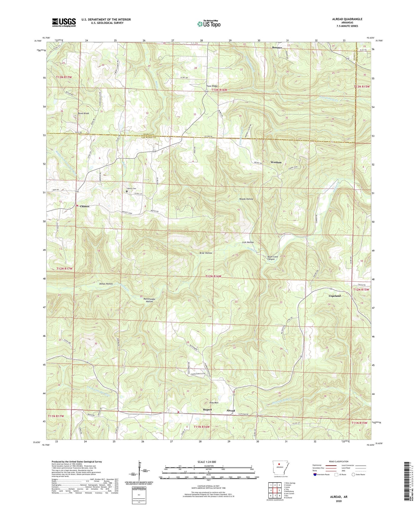
2024 topographic map quadrangle Alread in the state of Arkansas. Scale: 1:24000. Based on the newly updated USGS 7.5' US Topo map series, this map is in the following counties: Van Buren, Searcy. The map contains contour data, water features, and other items you are used to seeing on USGS maps, but also has updated roads and other features. This is the next generation of topographic maps. Printed on high-quality waterproof paper with UV fade-resistant inks.
Quads adjacent to this one:
West: Tilly
Northwest: Witts Springs
North: Canaan
Northeast: Leslie
East: Botkinburg
Southeast: Scotland
South: Rex
Southwest: Lost Corner
This map covers the same area as the classic USGS quad with code o35092f6.
Contains the following named places: Alread, Alread Church, Alread Elementary School, Alread High School, Alread Volunteer Fire Department, Alum Cave Canyon, Archey Valley, Booster, Briar Hollow, Chimes, Chimes Volunteer Fire Department, Chimes Volunteer Fire Department Ambulance, Copeland, Dollar Hollow, Liberty Cemetery, Liberty Missionary Baptist Church, Liberty School, Lick Hollow, Pine Mountain, Pleasant Grove Church, Rattlesnake Hollow, Reves Knob, Rupert, Rupert Baptist Church, Township of Archey Valley, Township of Hartsugg, Township of Wheeler, Trace Ridge, Trace Ridge Church, Woods Hollow, Woolum