MyTopo
Cecil Arkansas US Topo Map
Couldn't load pickup availability
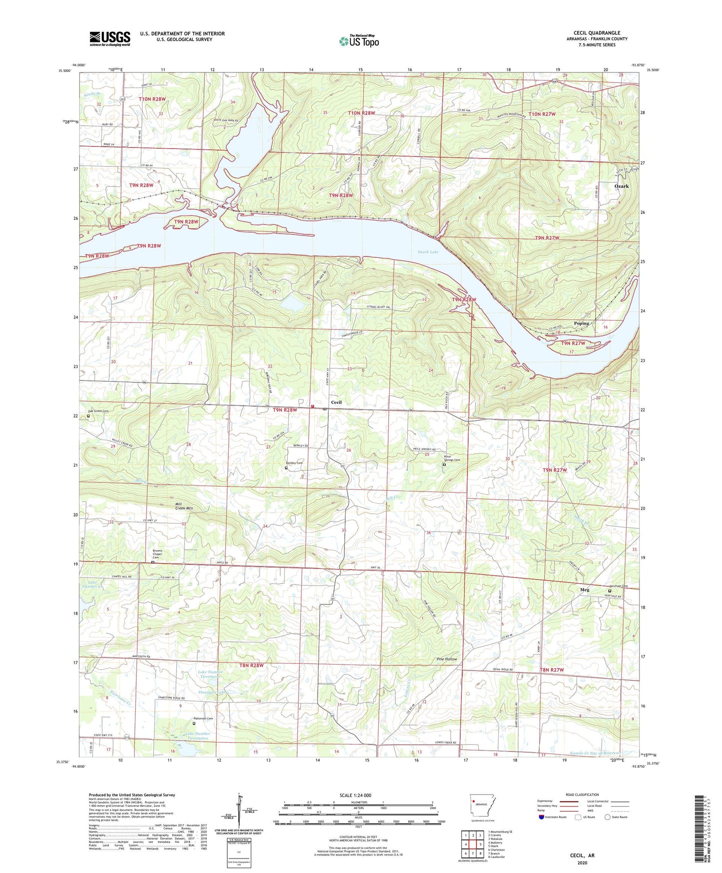
2024 topographic map quadrangle Cecil in the state of Arkansas. Scale: 1:24000. Based on the newly updated USGS 7.5' US Topo map series, this map is in the following counties: Franklin. The map contains contour data, water features, and other items you are used to seeing on USGS maps, but also has updated roads and other features. This is the next generation of topographic maps. Printed on high-quality waterproof paper with UV fade-resistant inks.
Quads adjacent to this one:
West: Mulberry
Northwest: Mountainburg SE
North: Cravens
Northeast: Watalula
East: Ozark
Southeast: Caulksville
South: Branch
Southwest: Charleston
This map covers the same area as the classic USGS quad with code o35093d8.
Contains the following named places: Bercham Cemetery, Berkley Cemetery, Browns Chapel Cemetery, Cecil, Cecil Gas Field, Cecil Post Office, Cecil Volunteer Fire Department, Citadel Bluff Park, Flanagan Lake, Flanagan Lake Dam, KDYN-FM (Ozark), Lake Number 20, Lake Number Twentyone, Lake Number Twentytwo, Lowes Creek Church, Meg, Mill Creek Mountain, North Cecil Gas Field, Oak Bend Church, Oak Grove Cemetery, Oak Grove Church, Ozark Bible Institute, Patterson Cemetery, Pine Hollow, Poping, Price Springs Cemetery, Sixmile Creek Site 18 Dam, Sixmile Creek Site 18 Reservoir, Sixmile Creek Site 21 Dam, Sixmile Creek Site 22 Dam, Sub Rosa, Township of Barham, Township of Grover, Township of Wallace, White Oak Creek, White Oak Park, ZIP Code: 72930