MyTopo
Cherokee City Arkansas US Topo Map
Couldn't load pickup availability
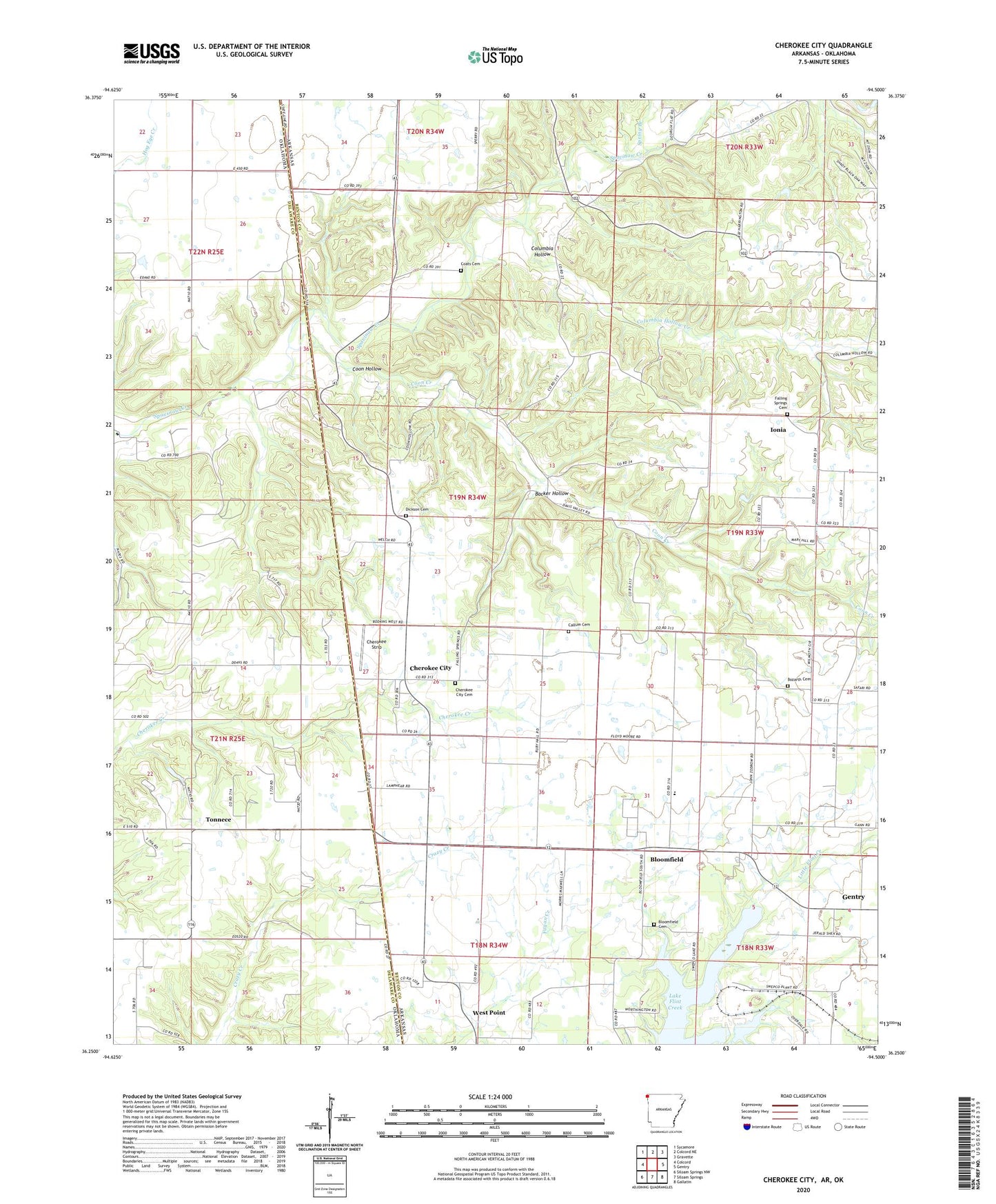
2024 topographic map quadrangle Cherokee City in the states of Arkansas, Oklahoma. Scale: 1:24000. Based on the newly updated USGS 7.5' US Topo map series, this map is in the following counties: Benton, Delaware. The map contains contour data, water features, and other items you are used to seeing on USGS maps, but also has updated roads and other features. This is the next generation of topographic maps. Printed on high-quality waterproof paper with UV fade-resistant inks.
Quads adjacent to this one:
West: Colcord
Northwest: Sycamore
North: Colcord NE
Northeast: Gravette
East: Gentry
Southeast: Gallatin
South: Siloam Springs
Southwest: Siloam Springs NW
Contains the following named places: Backer Hollow, Bloomfield, Bloomfield Cemetery, Bloomfield School, Bozarth, Bozarth Baptist Church, Bozarth Cemetery, Callum Cemetery, Cherokee City, Cherokee City Baptist Church, Cherokee City Cemetery, Cherokee City Census Designated Place, Cherokee City School, Cherokee Strip, Church of God in Christ, Coats Cemetery, Coats School, Columbia Hollow, Columbia Hollow Creek, Coon Creek, Coon Hollow, Decatur Branch, Dickson Cemetery, Eldorado Springs, Falling Springs, Falling Springs Cemetery, Falling Springs Community Church, Falling Springs School, Ionia, Keiths Ford, Lake Flint Creek, Mount Zion Church, Mount Zion School, Pactolus, Round Prairie, Spring Branch, Spring Creek Farm, Tonnece, Township of Cherokee, Township of Eldorado, Township of Round Prairie, West Point, West Point School, Word School, ZIP Code: 72747