MyTopo
Colcord Oklahoma US Topo Map
Couldn't load pickup availability
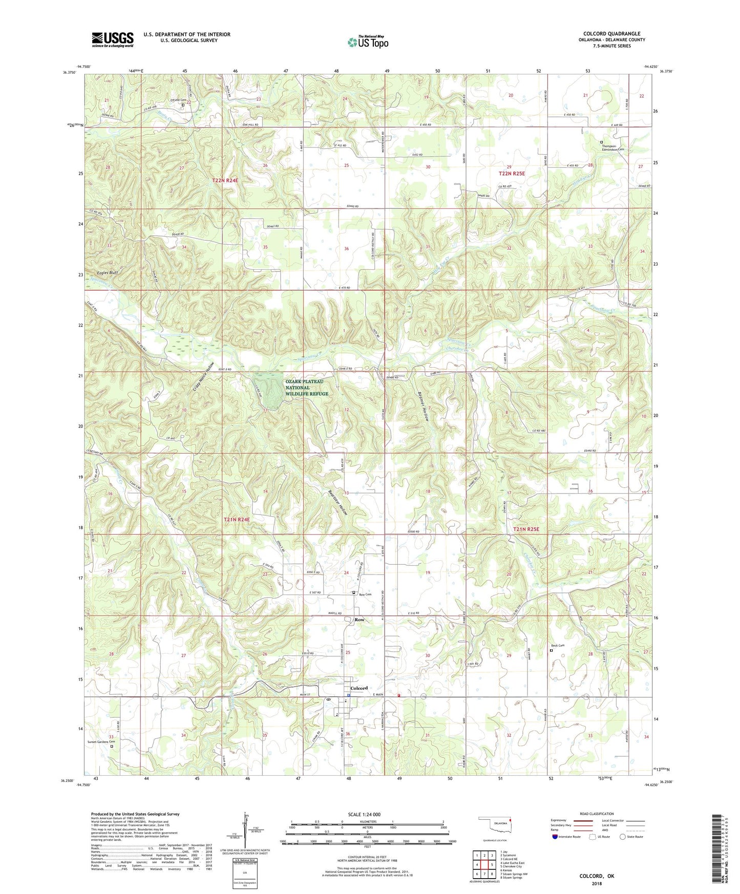
2022 topographic map quadrangle Colcord in the state of Oklahoma. Scale: 1:24000. Based on the newly updated USGS 7.5' US Topo map series, this map is in the following counties: Delaware. The map contains contour data, water features, and other items you are used to seeing on USGS maps, but also has updated roads and other features. This is the next generation of topographic maps. Printed on high-quality waterproof paper with UV fade-resistant inks.
Quads adjacent to this one:
West: Lake Eucha East
Northwest: Jay
North: Sycamore
Northeast: Colcord NE
East: Cherokee City
Southeast: Siloam Springs
South: Siloam Springs NW
Southwest: Kansas
This map covers the same area as the classic USGS quad with code o36094c6.
Contains the following named places: Beamer Hollow, Beartoter Hollow, Beck Cemetery, Bethel Church, Cherokee Creek, Cloud Creek, Cloud Creek Church, Colcord, Colcord Elementary School, Colcord Fire Department, Colcord High School, Colcord Police Department, Colcord Post Office, Crazy Nance Hollow, Eagles Bluff, Hog Eye Creek, Piney Cemetery, Piney Church, Row, Row Cemetery, Sunset Gardens Cemetery, Taylor, Thompson-Edmondson Cemetery, Town of Colcord, ZIP Code: 74338